About Us

Showing posts with label Cochise County. Show all posts

Tuesday, December 9, 2014

Goodbye Sierra Vista, or the Best of Southeast Arizona

The Monday before Thanksgiving, my boss called up and offered me a promotion. The only catch was that it meant leaving Sierra Vista. We had a great two years in Arizona. When we originally accepted the position here we knew that we wouldn't be here forever, so we tried our best to get out and explore and enjoy the area as much as we could. We'll miss a lot about southeast Arizona, but we're looking forward to seeing and exploring new places as well. That said, we sat down and decided to make a Best of Southeast Arizona post to highlight some of our favorite things we saw or did here. Cochise County has a slogan of “Where the Old West comes alive!” and as we've thought over our experiences here, it's true. So here it is- the best of Southeast Arizona!

Best Prehistoric Site: The MurraySprings Mammoth Kill Site.

There are several mammoth kill sites in the San Pedro Valley, ranging from the privately held Naco site, to the Lehner Mammoth Kill Site, noted by a small plaque, to this one. The Murray Springs site has a short trail with numerous interpretive signs along the way to help visitors understand why/how the mammoths were killed, how the site was preserved, and how the site was excavated. It's worth a stop. Unfortunately, there aren't any of the artifacts found on display at the site.

Best Spanish Historical Site: Tie. El Presidio Santa Cruz de Terrenate and Tumacacori

The Spaniards were in Arizona way before any English speaking Americans. There are towns and missions with Spanish heritage in several spots, Tucson being the most notable, and San Xavier del Bac being the most recognizable. We had a hard time deciding between two of the lesser known sites though. Tumacacori was a Spanish mission founded in the 1600's that is now part of the National Park system. It's easily accessible and well worth visiting. Each time we visited, we left saying that we should come back again soon. El Presidio isn't well known, but it's still fascinating to visit a spot where an Irish Mercenary founded a fortress for the King of Spain, in 1776, the same year the Declaration of Independence was signed.

There are several sites in southeast Arizona from near Tombstone, to along the San Pedro River, to elsewhere. But undoubtedly, the best rock art is the Garden Canyon Pictographs. They're located on Ft Huachuca, up Garden Canyon, a beautiful canyon with a perennial stream lined with sycamores, walnuts, and other native plants. It's the one spot in the United States where potatoes have been found growing wild. The pictographs are well marked, but every time I've been up there they're a little further then I remember them being. Two wheel drive will get you there, but you'll be glad if you have a little extra clearance. If you don't see them, drive a little further and you'll find them.

Best Mormon History site: The Battle of the Bulls

There are several markers along the trail where the Mormon Battalion went through on their longest infantry march in recorded history- over 2000 miles from Ft Leavenworth, Kansas to San Diego, California. It's a small marker, but it's still amazing to think of how a small march helped shape the settlement of our country in the decades to follow. Our favorite is the one at the San Pedro River between Sierra Vista and Tombstone.   


Didn't know that Arizona had some Civil War sites? Neither did I until I read about the Confederate soldiers buried at Dragoon Springs. There were a few small Confederate and Union forces in the west during the Civil War, with none in any significant battles. The Battle of Dragoon Springs was actually fought between Confederates and Apaches. Visit the ruins of the Dragoon Springs Stage Station to visit the graves of the fallen Confederates and learn more.

Best Ghost Town: Camp Rucker.

This was a close race, with Sunnyside a close second. We have had a great time finding and exploring ghost towns, mostly in Cochise County. It seems like this is an area of the west where booms and busts were pretty common as miners and others went from one lode to the next, looking for their own payday. It's still a common occurrence here, as people shuffle in and out of Ft Huachuca, the largest generator of employment in Cochise County.
Camp Rucker is our top ghost town choice, simply because there's still a lot of buildings standing that are in surprisingly good condition. It's easily accessible by passenger cars up Rucker Canyon in the Chiricahua Mountains. We loved wandering the building ruins and stopping at various signposts to read about the inhabitants and how it started out as an Army supply camp before it became a cattle ranch and then was donated to the Forest Service. It's an amazing place.

Best Backpacking Spot: Aravaipa Canyon

Ok, I've got to admit- this was pretty much the only backpacking trip we did here, but anytime you can go backpacking with a few kids under the age of 5 and everyone have a great experience, you know you're onto someplace special. The kids had a great time playing and walking through the water, I enjoyed the beautiful scenery and the slot canyon up Deer Creek, and my wife fulfilled a lifelong dream when we saw a mother bear and two cubs. It's a little remote, so if you're at the east end, it's worth taking the short detour up Turkey Creek to find the indian ruin. You might just find the best primitive campsite (non-backpacking) in Arizona up Turkey Creek.

Southeast Arizona is a nirvana for birders. Its got two sites that birders from all over come to visit- the San Pedro Riparian Area and Ramsey Canyon. One lucky birder spotted 14 different varieties of hummingbirds on one day here. Others come and patiently sit, hoping to spot an Elegant Trogan, a tropical cousin of the Quetzal bird sacred to the Mayans, up Ramsey Canyon, one of the only spots in the United States where the bird can be found. But since we're not die-hard birders, and we have young children, we picked a spot that's suitable for, and accessible to just about everybody. During the warmer months there's hummingbird banding at the San Pedro House nearly every week. They get numerous species flying through, Black-chinned being the most common species. Once the hummers are examined, weighed, and banded, lucky members of the audience get to be a launchpad when they are released back into the wild. Be sure to show up about 30 minutes early for the best chances at getting a low number to participate!


Think of a desert. Any desert. Now draw a picture of it. What do you see? Does it look like someplace Wile-E-Coyote and the Roadrunner would live? Or someplace you might spot the Three Amigos? Does it have gigantic cacti with arms pointing emphatically skyward, with a roadrunner or gila monsters? Odds are, you're thinking of the Sonoran Desert. There's a museum for it. Go and visit- and plan on spending all day long. We thoroughly enjoyed what the kids called the “half zoo- half museum”.

Best National Park/Monument: Chiricahua National Monument

Our kids begged to go to the Chiricahuas all of the time. Terrific scenery, no crowds, and a surprising variety of activities. Plan to take a weekend at Chiricahua National Monument- you'll be glad you did.

I was tempted to put Wupatki NationalMonument, but my wife said this was all about the lower right corner of the state, so here's a shoutout to Wupatki as another place to consider in addition to the Grand Canyon for you northern Arizona visitors.

Best Hot Spring: Hot Well Dunes

Man- this is a toughie! I mean, how can you go wrong with a hot spring? As I write this, I'm hundreds of miles away from any natural source of hot water, and it's below freezing outside. A nice long soak sure sounds amazing right now. Roper Lake State Park has a nice soak, but it's a high traffic area, that's why I'm putting the Hot Well Dunes as the soak of choice right now. But seriously, you can't go wrong with either one.

Best historic town- non-ghost town style: Tombstone or Bisbee

Where we lived in Sierra Vista is a newcomer to Cochise County as far as towns go. We scoured the town looking for nice architecture and concluded pretty rapidly that you're not going to find it in Sierra Vista. It's an army town that essentially started to grow in the 1950's. So, we'd occasionally go out to Tombstone or Bisbee to enjoy a sense of place somewhere else. We didn't find it in Sierra Vista. Even though we enjoyed the architectural details elsewhere, we still found Sierra Vista the best place to live, especially with kids. Tombstone is a little too crusty and Bisbee is a little too free spirited. But they are fun for a short visit.

Best Cave: Kartchner Caverns

We visited several caves in Cochise County. Coronado Cave is well publicized, and others are not as well advertised. But by far and away, the best cave was Kartchner Cavern. Now I will add that it is pricey. I also prefer primitive caves to developed caves. But Kartchner Caverns is definitely worth visiting. It's wet, humid, and highly decorated. You're not going to find pictures of it as they don't allow you to take pictures. Trust me- it's worth the visit.

Best Hike: Too many to choose!

Wow this one is difficult! I listed several to my wife- Council Rocks, Carr Peak, Charleston, Kings Canyon, Fort Bowie, Sugarloaf Fire Lookout, Kingfisher Pond, RamseyCanyon, and several more. We couldn't decide on which one was best. I'll just say there's a lot of great hiking in the area. Get out and explore and let me know which trail you like best!

Best Fishing Hole: Officers Club Pond

Ok, I've got a couple of disclaimers right up front. I'm spoiled and lazy. Most of my life has been within 5 minutes of great fishing. You ask around town and people will tell you to go to Parker Canyon Lake or Patagonia Lake. Well, I'm lazy- and both of those are about an hour drive away from Sierra Vista. So driving two hours round trip to go fishing for ten minutes is not an appealing use of time. I'd rather drive for 5 minutes there , fish for 2 hours, and drive 5 minutes back home. The problem is options. You don't have them if you're a fisherman in Sierra Vista. But if you need a fix, the Officers Club Pond on Ft. Huachuca can help you get by.

Best Event: Tie between Cavefest and the Electric Light Parade
There are several events in Sierra Vista and the surrounding area that we went to and enjoyed.  The Christmas Light Parade is a huge event and one of our favorites.  We ended up missing it this year because we moved away, but would have been there otherwise.  There are always farmers markets, or car shows, or art in the park type events going on at Veterans Memorial Park. We also enjoyed finding a few smaller events such as the Cochise & Western Model Railroad Open House or the Star Parties at Patterson Observatory.  Cavefest is a growing event and was tons of fun.  It was an absolute blast last year. 
We had a great time living in Sierra Vista. Looking back, it's amazing how much history is woven throughout Cochise County. We visited and explored the area pretty well, but still didn't see it all. We hope you enjoy it as much as we did!

Saturday, October 25, 2014

The best of summer- Carr Creek

One of the kids favorite places to go in the summer is to Carr Creek.  Much of the year it's dry, but once the monsoons start, the creek has water in it through the fall.  We'll drive up Carr Canyon Road, then park at the first turnoff past the Forest Service Boundary, then walk down to the creek and let the kids play for a while.  There are several trails that branch off from the parking area, most notably the Perimeter Trail.  Down at the creek, the kids have a blast wading in the water, throwing rocks, tromping up and down the creek, and just about anything else you do when you're a kid.  Sometimes we'll bring a picnic with us.  We watch the kids play, but sometimes we go for a wade too.  It's a refreshing break in the shade of the cottonwood and oak trees.  It's nice that it's close enough that we can go after work during the week, or on a Saturday if we don't have anything else happening.  If you're a little adventurous, the Carr Canyon Ranch is just up the trail a little ways.
Nearest City: Hereford, AZ
Location: N° W°
Time Needed:
Difficulty:
Kid Friendly:
Additional Info:

Saturday, October 18, 2014

The Carr Canyon Waterfall

Back in mid-September, we had the fallout from Hurricane Odile make its way north and through Arizona.  It was a fantastic addition to our water year- one of the best in recent memory in Sierra Vista.  I think we got around 13 inches of water between July 4 and the end of September.  One afternoon, I stepped outside from work and saw that the Carr Canyon waterfall was flowing pretty good, so decided to go and take a drive when I got off of work.  Unfortunately the road was closed because the creek was too high, so this picture was the closest I could get, and the picture doesn't do the waterfall justice.  The falls are visible from most of Sierra Vista, and most of the year are just a dark stain on a cliff south of town- dry marks from when water flows, or a wet smudge from the trickle that is there a few months of the year.  During monsoon season though, the falls can get flowing pretty good.   We weren't the only ones who wanted to go see the falls, because several other cars pulled up, saw the road closed by the raging stream, and turned around. 
On the way home, the Dragoon Mountains off in the distance looked almost like you'd see in a painting.  Once again, the picture just doesn't quite do it.  But, it was fun getting out for a drive after dinner.

Nearest City: Sierra Vista, AZ
Location: off of Carr Canyon Road
Time Needed: varies
Difficulty: varies
Kid Friendly:
Additional Info:

Millville Ghost Town and Petroglyphs

The Millville Petroglyphs and Ghost Town is another spot that I've visited a few times, but never bothered to blog about, probably because I didn't bring my camera the first few times. What good is a blogpost if it doesn't have pictures?  Anyway, in mid-late September we went for a morning hike out to Millville.  The trailhead is located on the north side of Charleston Road, about 1/4 mile east of the San Pedro River.  
We had wanted to visit earlier in the year, but the gates were locked and some signs indicated that they were searching the area for unexploded ordnance from back when the army had used Charleston, located just across the river, as a practice area for street fighting back during World War 2.  Anyway, I noticed a headline or press release from the BLM detailing that the sites were open again, and put visiting back on my list, even though it took us a while to make it over.
We went for our hike and stopped to see the petroglyphs first.  There are two identified sites along the trail, the first one has these bear footprints and several others on boulders just east of the trail.  This location would have been more or less right in the middle of Millville back in its heyday, so it's pretty great that they're still there.
The second location is another 1/4 mile north and is several boulders on the side of the hill, a stones throw from the San Pedro River.  The trail stops just south of a small gully, but I scrambled down it, then up the other side and climbed around and looked at the boulders up close. 
Who knows what the scribbles mean?!  It's something that's been lost since the Apaches were pushed from the area.   The hillside is steep and has mesquites, cacti, and other spined and poky desert plants, so I didn't do an extensive and thorough reconnaissance to find all of the petroglyphs.
Back at the end of the trail, there are a few pipes that are set up go direct your site to where the petroglyphs are. 
We hiked back down the trail to go see the ruins of Millville. 
Some of the rock walls are visible from the Charleston Road, but most of them are only visible when you get out and hike.  With a name like Millville, it's not hard to guess why the town was here.  Millville existed solely to mill the ores mined in Tombstone.  Tombstone didn't have the water needed to power the stamp mills, so they would freight the ore to Millville for processing.  The arrangement worked great for Millville until the miners in Tombstone struck water.  After that, it wasn't too long until the mills were dismantled, and shipped to Tombstone for reassembly there, much closer to the ore.   Today there's just several walls and building foundations remaining, along with old cans and broken glass and pottery.  A few interpretive signs explain more about the ruins if you visit. 
I had to throw in one last picture of the Huachuca Mountains in the background, with the cottonwoods lining the San Pedro River in the foreground.  It was a beautiful morning for a hike!

Nearest City: Sierra Vista, AZ or Tombstone, AZ
Location: Charleston Road, 1/4 mile east of the San Pedro River
Time Needed: 2 hours
Difficulty: easy/moderate
Kid Friendly: yes
Additional Info:

Bisbee, AZ

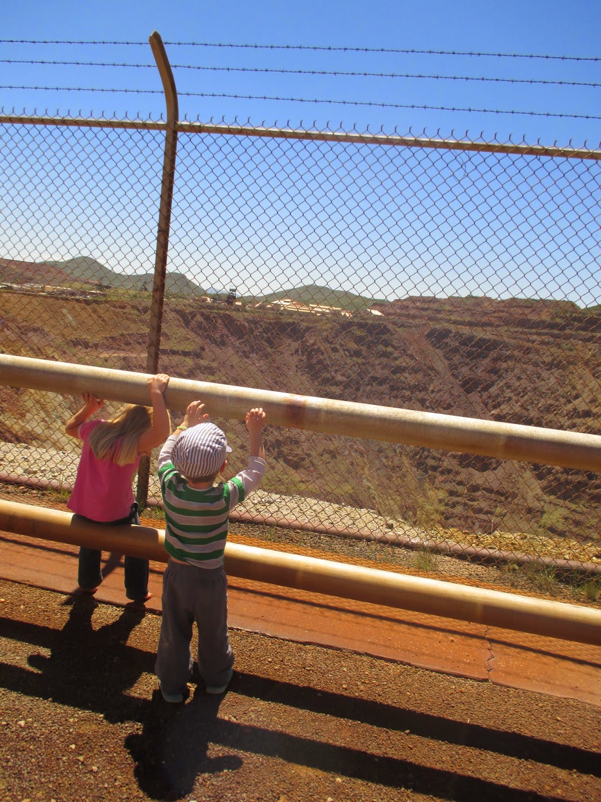
Occasionally we go out to Bisbee.  It's a weird little town, built on the side of a canyon 5 miles from Mexico.  If you guessed mining town, you nailed it.  Bisbee was founded after a rich copper deposit was found, which was then worked and became the Queen Mine.  Southeast of downtown Bisbee is the Lavender Pit, an open pit mine that was developed once the high-grade ores played out.  The pit and Queen Mine are no longer mined for ore, but you can stop and book a tour and they'll take some of your money and use it to help the place stay open.  Last year, there was talk of shutting down the tour.   We like to stop at the overlook, get out of the car, and look at the big hole in the ground. 
Old town Bisbee is the second most famous town in the county, coming in just after Tombstone.  It certainly got the appealing architecture that is hard to find elsewhere in the area.  Once the mines shut down, most of the residents boarded up the houses and moved away.  Like elsewhere, an artist found out about it and now Bisbee is full of artists, liberals, and other Bohemians.   Some of them are a little too weird for me, so if we go we stick to daylight hours only.  It's a unique little community.  Every fall they have a big race event called the "Bisbee 1000" where racers seek to ascend or descend all of the public staircases in town.  The profit from the race is pumped back into the community and used exclusively to help preserve the stairs of Bisbee and fight against the relentless pull of time and gravity.
A few miles west of Bisbee is this small Catholic shrine just off of the north side of the highway.  There's a few of them in the area,  and since we hadn't stopped before, we said "why not" and stopped for 3 minutes. 
One last thing to see in the area is the Mule Pass Tunnel- one of the only highway tunnels in Arizona.  It's not that long, but it cuts through the bedrock of Mule Pass at over 5,500 feet elevation.  Snowplows park on the west side of the pass- nearly the only place in Cochise County where snowplows are needed, although they are only needed sparingly.

Nearest City: Bisbee, AZ
Location: Bisbee, AZ
Time Needed: Varies
Difficulty: Easy
Kid Friendly: Varies
Additional Info:

Saturday, October 4, 2014

Shut out of the Slaughter Ranch

After visiting Chiricahua National Monument, we planned on swinging down through Douglas and going to the Slaughter Ranch / San Bernardino National Wildlife Refuge.  The first part went great and we had a good few days at Chiricahua.  We also saw that there was some not-so-great in our planning.  On our way to the Slaughter Ranch, there's a marker noting that the Mormon Battalion passed through here in 1846, one of several markers in the area.  It just said that they camped nearby on December 26, 1846 along the way of their longest infantry march in history. 
We pulled up to the gate to the Slaughter Ranch, and saw that it was closed.  It's closed every Monday, and only open the last part of the week.  So much for great planning!  I'd wanted to see the ranch, so we'll see if we make it back out.  "Texas" John Slaughter was a prominent rancher in Cochise County, who made peace with the Indians when he settled what became his ranch (which included land in Mexico, as well as the US).  He also was the one asked to make peace in the county after the Earp/Clanton Feud in Tombstone had it's climax at the OK Corral in 1881.  He seems like a pretty upstanding guy and it would have been fun to see the ranch and learn more about him and the history of Cochise County.  I'd heard that he hired a Mormon polygamist to work on his ranch and the polygamist had built a cabin straddling the US/Mexican border, so he had one wife in the US, the other in Mexico, but since we didn't get to go there, I guess that's just hearsay.
Oh yes- the border.  Yeah- that's it in that picture just above.  Not much there is there!  Just a few jersey barriers, and maybe a string of barb wire.  There's a fairly large contingent of Border Patrol agents on the 15 mile drive out from Douglas to help keep the border secure, but just the same it is a little weird to know that it's pretty porous despite what the politicians in Washington DC say.
Nearest City: Douglas, AZ
Location: 15 miles east of Douglas, AZ
Time Needed:
Difficulty:
Kid Friendly:
Additional Info: Slaughter Ranch Website

Camping at Chiricahua National Monument

We had a great time camping at Chiricahua National Monument over the Labor Day weekend.  We arrived late on Friday and found that half of the campsites were closed to camping.  We didn't know this, but found out later, that about half of the campsites in the Bonita Creek Campground are closed during monsoon season (roughly July 4 to mid-September) to limit flash flood danger.  When we originally planned our trip, my wife saw that camping at Chiricahua National Monument was free over the summer this year while the park superintendent evaluated the fee structure.  Basically, the park gets more visitors with National Park Passes then visitors that pay as they enter, so they're deciding what to do.  You can read the press release here. 
The only spot left was the handicapped spot, so we took it since we were the last ones in and it becomes fair game once all of the other sites are filled.  After a late dinner and setting up the tent in the dark we piled in to go to sleep.  Unfortunately we had a few kids in the 8-12 age range right next to us that didn't know that their outside voices should go down with the sun too.  Yeah, this is why I hate campgrounds.  The next day the park opened up a few more sites since the weather forecast was clear, so we moved over to one of the other sites.  In the campground area, we enjoyed the walk down to the Silver Spur Meadow.  The flowers along the way were beautiful.

There are two old chimneys near the meadow that are all that remain of an old Civilian Conservation Corps (CCC) camp from the 1930's.  We checked out the chimneys, and wandered around.  We also saw a small buck nearby.  Others had been a little more lucky and had spotted some coatimundi and bears, but we didn't see either.  It's still a great spot as any to spot them in the park, but they're not spied very frequently.  Our kids also had a blast playing in Bonita Creek.  We spent a good part of an afternoon just wandering the creekbed and splashing in the small pools. 

Nearest City: Dos Cabezas, AZ
Location: Bonita Creek Campground at Chiricahua National Monument
Time Needed: Varies
Difficulty: Easy
Kid Friendly: Yes
Additional Info:

Back to the Chiricahuas

Over Labor Day we went to the Chiricahuas to visit Chiricahua National Monument once more.  Our oldest kept asking to go, so when we had the long weekend it made for a great destination about 2 hours from Sierra Vista.  We arrived a little late on Friday night and snared the last campsite available in the campground.  On Saturday morning we woke up, then after breakfast headed to the visitor center and arranged a ride with the shuttle to drop us off at the top.
This was out third visit to the Chiricahuas and we wanted to do something different from our last visits when we had hiked to the Sugarloaf Fire Lookout Tower, the Faraway Ranch, and the Grotto. We strung a few trails together and left from the Echo Canyon Parking lot and hiked down the canyon to the Visitor Center.  The trails we took were the Echo Canyon Trail (1.6 miles), the Upper Rhyolite Canyon Trail (1.1 miles) , and the Lower Rhyolite Canyon Trail (1.5 miles) for a total distance of about 4.2 miles. 
We hiked to the Echo Canyon Grotto, then played there in the shade for 10-15 minutes before hiking on.  Another 1/4 to 1/2 mile down the trail was "Wall Street", a spot where the trail goes through several rocks that rise abruptly along each side of the trail.  It got narrow enough that I was able to put myself in the gap and chimney up off of the trail.  Almost slot canyon like! 
Our next fun discovery was some pokeberries growing alongside the trail.  We didn't know what they were, but the spear covered in blue and green berries sure was pretty.  We didn't eat them.  Eating something you can't positively identify is never a good idea.  When we showed the picture to a ranger at the visitor center to ask about them, they told us that they are pokeberries and are poisonous. 
Before long we were in Echo Park, a small forested meadow down in the middle of the formations.  There's a small stream that proved ideal spot to take off our shoes and wade.  We took a snack break as well.  I think the stream in Echo Park was the kids' favorite part of the hike!
Shortly before the trail intersection with the Upper Rhyolite Canyon Trail, you have a beautiful view of the formations from below.  Actually, the first 1/3 of the hike (the Echo Canyon Trail) was the best part of the hike.  We then branched off onto the Upper Rhyolite Canyon Trail. 
I was surprised how little use this part of the trail got.  There were several spots that just didn't seem like they ever see much traffic.  We got down to the streambed and had a few spots that had some pretty nifty stonework at the (mostly dry) creek crossing. 
The rest of the hike was all a downhill descent through Rhyolite Canyon.  It went pretty quickly- especially since we motivated the younger hikers with gummy bears, and counting the number of lizards along the way. We finally made it to the visitor center about 4 - 4 1/2 hours after we left.  It was a great hike! 

Nearest City: Dos Cabezas, AZ
Location: N° W°
Time Needed: 4 1/2 hours
Difficulty: moderate
Kid Friendly: Yes, with the caveat that the distance is the determining factor
 Additional Info: Chiricahua National Monument

Wednesday, September 17, 2014

Confederates vs Indians at Dragoon Springs Station

On Labor Day Weekend we headed east to the Chiricahua Mountains for a getaway.  On the way we had one important stop to make at Dragoon Springs.  I like to think that I'm pretty good at digging up unique and random sites that are worth visiting, so when I heard about Dragoon Springs I just had to visit it.  I was just surprised though that it took me a year and a half to learn about it.  We turned off of I-10 at the Dragoon Exit, then drove to the small town of Dragoon before turning off to drive a few miles on dirt roads to find the Dragoon Springs Stage Station. 
Along the way we saw a few roadrunners.  It's beautiful out here in the foothills of the Dragoon Mountains. 
We found our turnoff, then parking area, and a short time later we were at the ruins of the Dragoon Springs Stage Station.   The ruins themselves are worth a visit just because it's always fun to think about what traveling in the old west was really like.  I personally think they way the depict it in movies is actually better than it was in real life.  It would be a tough drive over roads that are just barely better than trails, then camping or staying at stage stations that were not much more than a room and a corral for the horses or mules.  But, the stage station was not strictly what we came to visit.
Just north of the stage station are several graves.  Not just any graves, but the graves of Confederate Soldiers from the Civil War.  I was somewhat incredulous when I heard about them at first, but sure enough, they're there with Confederate flags and grave markers to boot!  How'd they get here?  In 1862 a band of Confederates had a run in with Apache Warriors when the Apaches stole much of their stock.  The Indians got the best of round 1 and took most of the Confederate's horses and killed 4 of the Confederates.  It's become a small footnote in history as it wasn't a significant engagement of the Civil War.  What's fascinating though it that it is one of Arizona's Civil War sites and the furthest west casualties of the Confederate States of America during the Civil War.  It's also one of the few skirmishes where Confederates and Indians fought.  Round 2 went to the Confederates when they recovered their livestock and killed several Apaches a short time later. 
Here's a sign at the site giving more detail to the history.  It's a unique location that's well worth visiting. 

Nearest City: Dragoon, AZ
Location: Take the road immediately south of the train tracks in "downtown" Dragoon and head west.  The dirt road will curve to the south.  Turn east on the side road when you see a sign for Jordan Canyon and the Stage Station.  Drive 1 mile and park at the sign, then take a short stroll to the northeast to the stage station and graves.
Time Needed: 1 hour
Difficulty: easy.  The most difficult part is the drive as the road is better with a little clearance on your vehicle.
Kid Friendly: Yes
Additional Info:

Saturday, July 26, 2014

Star Parties at Patterson Observatory

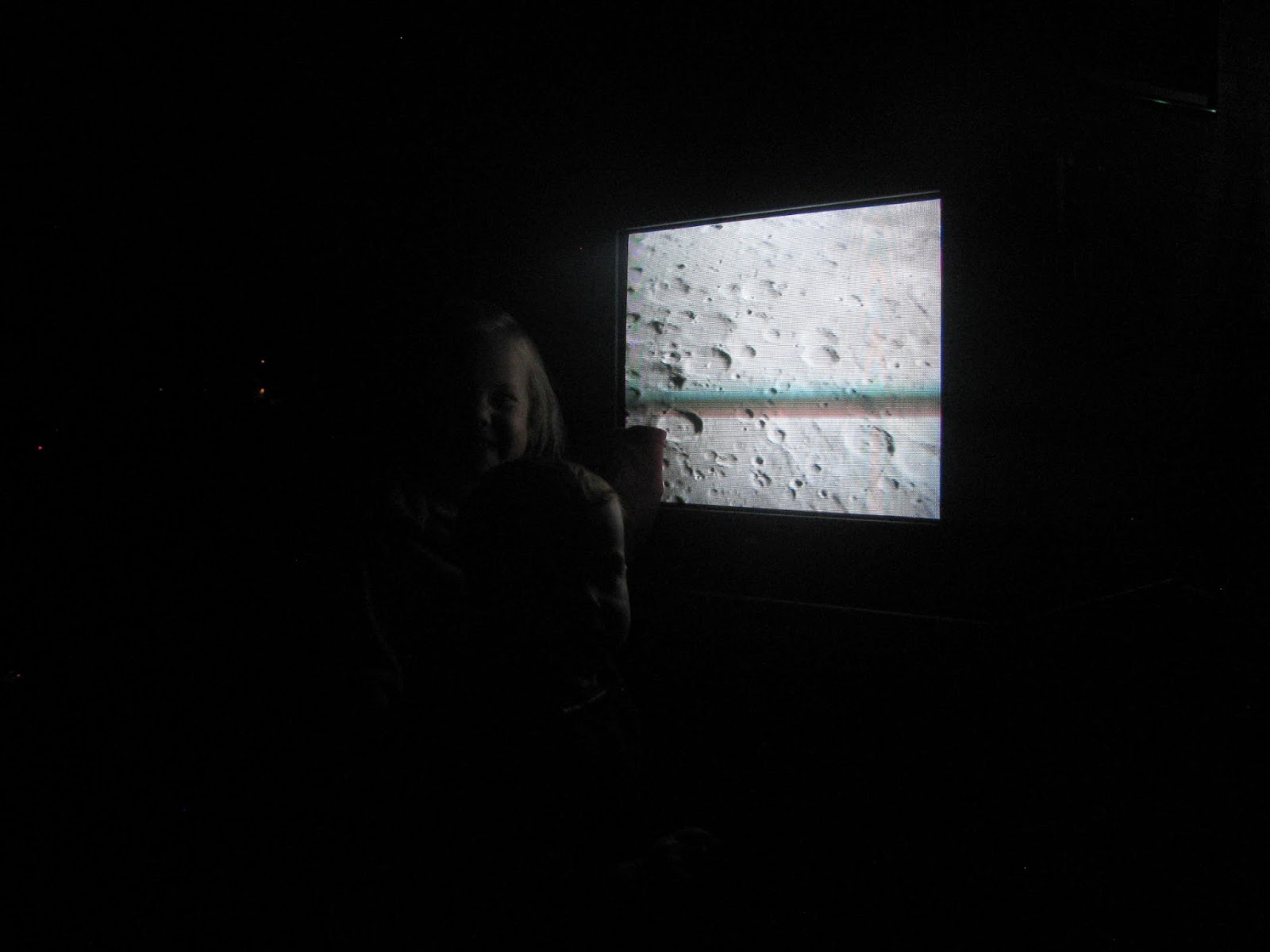
The Huachuca Astronomy Club has star parties regularly at Patterson Observatory on the Cochise College Campus.  We wanted to visit them for a while before we were finally able to make it happen.  The star parties generally start about dusk, depending on the weather.  Several of the ones we wanted to make it out to were cancelled due to overcast skies.  We were able to see the craters on the moon, look through several telescopes, and even look through the large telescope at the observatory.  The telescope is programmed to be aimed by a computer, which makes seeing several of the stars and objects easier to find.  I saw a two colored double star when I peeked through the eyepiece.  If you've got a free evening when they're holding an event, stop by and see what's happening!  Several of the club members have discovered other planets, distant stars, and the like.  You're welcome to come out and join them!

Nearest City: Sierra Vista, AZ
Location: Cochise College Campus, College Drive, Sierra Vista
Time Needed: varies
Difficulty: easy
Kid Friendly:
Additional Info: Huachuca Astronomy Club

The Cochise and Western Model Train Club Open House

A couple times every year the local model railroading club has open houses.   We like to stop by and see what the Cochise and Western Model Railroad Club is doing.  It's always fun to step inside their little clubhouse and observe the changes to the layout they've done since our last visit.  They have a lot of fun doing it! 
They have two main rooms, each with a different scale model railroad.  They have the tracks and trains set up, along with the scenery that the trains pass by on the way through.  Small towns, farms, train trestles, rivers, and many other sites are in place.  The IRS office in one of the towns is burning down.  Rafters are being rescued from a waterfall.  You can look for an amorous couple stepping out from some bushes.  There's lots to see and the humor is found in the details here.
Outside, there is a larger train set that runs around on bigger tracks.  This one seems to be a favorite of the kids.   There are always club members around to answer questions and to help you have a good time.  The kids loved it when one of the club members let them blow the train whistle.
Our favorite scale building outside was "The Poverty Depository for Old Unwanted Parents".  The club meets weekly, and if you're around and see cars outside, they welcome visitors to stop in and take a look around.  You're always welcomed to join the club as well.

Nearest City: Sierra Vista, AZ
Location: 680 Fort Avenue, Sierra Vista, AZ
Time Needed: varies
Difficulty: easy
Kid Friendly: yes
Additional Info: Cochise & Western Railroad Club

Ramsey Canyon Nature Walk

We've been to Ramsey Canyon several times.  It's a great afternoon getaway in the summer months, but really it's nice anytime.  We like it on weekends in the summer though because they have "bring a kid, get in free" weekends.  Otherwise, it's a few dollars per person charged by the Nature Conservancy to go up Ramsey Canyon.  Ramsey Canyon, along with the San Pedro River is one of the world famous birdwatching spots here in Cochise County.  The record for most hummingbirds spotted in one day was set here a few years back when somebody identified 14 or 15 different species. 
In addition to the birdwatching, there's a nice hiking trail up and old road, and several cabins that are along the way.  The cabins are closed off, and at least one of them is home to a bat colony in the summer. 
The trail loops and goes by another cabin as well.  It's pleasant along the creek, with the water splashing in the shade of the sycamores and oak trees.  We absolutely love the sycamore trees here in the Huachuca Mountain canyons.  They are so pretty!
One spot on the trail is constantly wet due to a small seep.  The butterflies flutter around the spot quite heavily.  They'll even land on you to get some of the salt and minerals from your skin.  We held still and this large butterfly couldn't get enough of us!  The kids absolutely loved the butterflies! 
Toward the top of the canyon there are a few small frog ponds, used to raise endangered Chiricahua Leopard Frogs.  We spotted a few while we were there.  The kids wanted to go chase them, but since the are is roped off, we thought it best to leave the frogs alone. 

Ramsey Canyon is a great place to visit.  It's located at the end of Ramsey Canyon Road, southwest of Sierra Vista. 

Nearest City: Sierra Vista / Hereford, AZ
Location: west end of Ramsey Canyon Road
Time Needed: several hours
Difficulty: easy to moderate
Kid Friendly: yes
Additional Info: Nature Conservancy Webpage for Ramsey Canyon

The Lavender Pit and the Copper Queen Mine

Cochise County is an interesting place.  It's largest city, Sierra Vista, is probably the only the 4th best known location in the county, trailing Tombstone, Bisbee, and Ft. Huachuca.  We've talked to a number of people, including those from Arizona who don't know where Sierra Vista is.  But inevitably they've heard of Tombstone and Bisbee. 
We've gone to Bisbee several times and it's an "interesting" place.  It definitely has better architecture than Sierra Vista does.  But they artistic element there can be less then kid friendly if you want to teach your children morality. 
On the southeast side of Bisbee is the Lavender Pit.  There's a viewing area that's right off of the highway where you can pull off and get out and take a look.  I highly recommend it. The Phelps-Dodge Company, which is largely responsible for the growth of Bisbee, dug the Lavender pit from the 1950's to the 1970's to extract low-grade copper ore which was unprofitable to develop any other way.  The nearby Copper Queen Mine was run for many years extracting the high-grade ore, but when that was exhausted, the Lavender Pit (named after Horace Lavender) rebirthed life into the town.  The mining days of Bisbee are now largely past and now there is a lot of reclamation of the land once used for mining.  South of town you can see large hills that have been graded and re-seeded to restore the area from a mining dump to desert hillside once again.

Nearest City: Bisbee, AZ
Location: N° W°
Time Needed: 20 minutes
Difficulty: Easy
Kid Friendly: with supervision
Additional Info: Wikipedia Article on the Lavender Pit

Thursday, July 24, 2014

Officers Club Pond, the closest fishing to Sierra Vista

For most of my life I've been a spoiled and lazy fisherman.  I grew up 1/2 mile from the Weber River in Utah and spent the best parts of my teenage years running up and down its banks, or more appropriately, wading up and down and through it's riffles and runs.   When we lived in Fort Collins, Colorado, I had the Cache la Poudre River and numerous small community ponds nearby.  Then we moved to Kaysville, Utah and had the Kaysville Ponds nearby whenever I wanted to get away for a quick fishing trip.  Then we moved to Sierra Vista.  It was pretty much a death blow to my fishing life.  Most of the time when I'd ask around about fishing opportunities, people would tell me to go to Parker Canyon Lake or Patagonia Lake.  Umm, no.  Is there anything closer?  Not that I'm against driving to go fishing, but the truth of the matter is I'd rather be fishing then driving to go fishing.  I finally found a workable solution in the Officers Club Pond on Fort Huachuca.
I have to admit, it's not much to look at.  But the important part is that is has fish in it.  I've caught mostly bluegills and green sunfish, and they're not huge by any means.  There are quite a few mosquito fish in there as well (I've caught a few of them), and I think I've seen a bass or two swimming.  The problem with the pond is that there are too many fish in there.  Because there are so many fish, there aren't any "big" fish.  The biggest fish I've caught is about 5 inches long.   So, if you go, have fun and be glad that there's a spot to go fishing close to Sierra Vista!  Please don't keep any of the bass- throw them back in to help control the smaller fish. 
This green sunfish is just big enough to be catchable, but just small enough to be pretty hard to make a meal out of unless you're a heron.  I've had a time or two where the master fisherman was lurking nearby and would perk up as soon as I hooked something.  I'd reel the fish in, then toss them on the bank and the heron would come and gobble them up.  I figured reducing the fish population slightly would be a good thing.  The heron certainly enjoyed doing his part!

Nearest City: Ft Huachuca, AZ
Location: N° W°
Time Needed: varies
Difficulty: easy
Kid Friendly: yes
Additional Info: