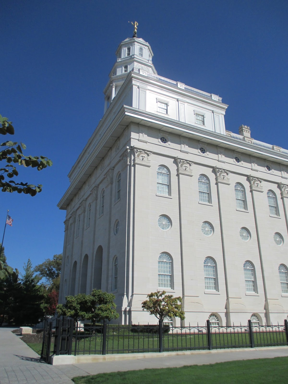
We had a good visit to Nauvoo this fall. We made a point to visit several of the buildings that we didn't see on our January visit. We visited the Lands and Records office and learned where some of our ancestors had lived here in Nauvoo. We stopped by the Nauvoo Temple. It was a beautiful trip and a great time to visit.
One morning we drove up the road, I think it was Parley Street, from where we were camping in Nauvoo State Park to visit the Old Nauvoo Burial Ground.
Across from Brigham Young's house there were several chestnut trees, and the missionaries gave us permission to pick some up and bring them home. You could tell they were real chestnuts because the husk was prickly. Poisonous false chestnuts do not have the prickly husk.
Another thing we really liked was the persimmon trees behind the Pendleton Schoolhouse. The ripe and wrinkled persimmons were delicious! I accidentally picked one that wasn't quite ripe, and it was anything but good. We had a great time on our visit. On Monday morning we picked up camp, toured two more houses, then headed home.
Nearest City: Nauvoo, IL
Location: N° W°
Time Needed: varies
Difficulty: easy
Kid Friendly: yes
Additional Info:
Our random, yet highly entertaining, romp through the highly visited and less explored parts of life. Comments with additional information are also welcomed, as are questions looking for more information. If you like my blog or it was useful to you, please comment!
Showing posts with label Free. Show all posts
Thursday, November 26, 2015
Saturday, November 14, 2015
Finding Geodes at Wildcat Springs Park, Hamiliton, IL
We took a short trip to Western Illinois over Columbus Day. One of the things we really wanted to do was find some Keokuk geodes. The area surrounding the tri-state area where Illinois, Missouri, and Iowa come together is famous for geodes, generally called Keokuk geodes. I little research showed that there are several places to search for them, including some geode quarries.
We decided to go easy and look at the Wildcat Springs Park in Hamilton, Illinois. All we did was go to the park, then head for the stream bottoms or erosion gullies and start looking. In not much time at all we had several geodes in hand, and in less then a half hour of easy looking we ended up with two gallons of geodes. I told the kids to look for "fossil potatoes", since the geodes are roundish like potatoes and hard like rocks or fossils.
We took them out of the streambed and sat down at a covered pavilion and split several of them. Some of them were duds, but some were full of beautiful crystals. We took a while and split about half of our bucket, then brought the rest of them home with us to split later.
If you're looking for a great free spot near Keokuk to find geodes, Wildcat Springs Park in Hamilton is definitely a spot you can find success.
Nearest City: Hamilton, IL
Location: N° W°
Time Needed: varies
Difficulty: easy
Kid Friendly: yes
Additional Info:
Sunday, September 27, 2015
Tallgrass Prairie National Preserve
We left Chase County Fishing Lake, stopped in the cute little town of Cottonwood Falls, then continued up the Flint Hills Scenic Byway to Tallgrass Prairie. The heart of the location is the old ranch, with headquarters on site. They have hikes and a ranger-driven bus ride as options that you can do. We missed the bus tour because of a discrepancy between the time posted on the website and times posted at the visitor center.
We went on a short hike out among the prairie grasses. The NPS only owns 35 acres of the preserve, with the Nature Conservancy owning the difference. I heard 10,000 acres as a number, but I'm not sure how accurate that is. Lets just say it's a lot of land and wide open sky out here.
The Flint Hills are prime grazing land. The shallow soil isn't good for farming, which led to much of the prairie grass not being plowed under and replanted in corn or soybeans like much of eastern Kansas is.
Lots of grass out here. If you miss the bus tour like we did, your only option is to explore on foot. They do have a pasture with a buffalo herd that the bus tour drives through the middle of (the pasture, not necessarily the herd). The bus fills up fast, at least the weekend we were here. We were surprised how many people were out here. Like anywhere else, call ahead for your best options.
Nearest City: Strong City,KS
Location: 2 miles north of Strong City
Time Needed: varies
Difficulty: easy
Kid Friendly:
Additional Info:
Thursday, September 24, 2015
Winter Quarters Visitor Center and Pioneer Cemetery
While we were in Omaha, we also visited the Winter Quarters visitor center. There's a lot of information at the center! We learned all about pioneers crossing Iowa after they were forced by mob violence to leave Nauvoo, Illinios, preparations for their continued trek to Utah, and what made them unique when compared to other emigrant groups. They were organized. Rather then remain bunched together, they made about 200 settlements in the Winter Quarters vicinity to decrease their impact on the area. They planted crops, established ferries, and did all they could to make it easier for the groups that followed them. The Mormon Trail Center gave a great overview into many facets of their lives, including transportation methods of wagon, handcart, ships, and railroads.
Across the street is the Winter Quarters pioneer cemetery and Winter Quarters Temple. Most of the people buried in the cemetery were babies and children. I have a relative buried there. It's a place that encourages introspection and quiet reverence. I am grateful for the sacrifices that were made by so many who have gone before.
Nearest City: Florence, NE
Location: 3215 State Street, Omaha, NE
Time Needed: 90 minutes
Difficulty: easy
Kid Friendly: yes
Additional Info:Mormon Trail Center Website
The Kanesville Tabernacle
While we were in Omaha, we drove across the river to Council Bluffs to visit the Kanesville Tabernacle. The tour was pretty cool. The original tabernacle was built in 1847 out of green cottonwood logs. Because the logs were green, the walls warped and the building was demolished within a few years of being built. In 1997, the replica was built on the site out of cottonwood logs by a historical society in Council Bluffs to celebrate the 150th anniversary of the Mormon's arrival in Utah. It was then donated to the Church.
The tabernacle has a small Mormon Battalion exhibit, since Council Bluffs was where the Mormon volunteers came from before reporting to Ft. Leavenworth to begin their epic march.
Two notable events happened at the Kanesville Tabernacle. The first one was Brigham Young being sustained as 2nd Prophet and President of the Church of Jesus Christ of Latter-day Saints in December 1847. It changed my perspective of Mormon history a little bit, since I had always assumed that Brother Brigham had led the Saints west to Utah, then stayed there in Salt Lake City, except for when he went to St George for the winter. Nope. He led them to Utah, then quickly turned around and went back to Iowa.
The second notable event was it was where Oliver Cowdry, one of the Three Witnesses of the Book of Mormon came to a church meeting after being separated from the church for a number of years and began the process of rejoining the church.
Nearest City: Council Bluffs, Iowa
Location: 222 E Broadway, Council Bluffs, IA
Time Needed: 45 minutes
Difficulty: easy
Kid Friendly: yes
Additional Info: Kanesville Tabernacle Website
The Federal Reserve Money Museum
I had to work one Saturday, so my boss told me to take a day off to make up for it. Done and done. It wasn't hard to decide what to do with the free day. We went to KCMO to visit the Money Museum, since it is only open on weekdays. We parked in the visitor parking lot, then went inside. Nice security guards ask if you have knives, guns, bombs, or any thing of that nature. We told them no, except for my pocket knife. They let me keep it, but sent us all through the metal detectors anyway. They said I looked like an honest guy, so I guess I can trust them. Trust but verify. So, after they verified by running my drivers license, they let us all in to the museum. They really know how to roll out the red carpet and make ordinary folks feel welcome.
Once inside, we saw lots of information about the Federal Reserve. But really there are four exhibits that are what the money museum is all about. The first is the Truman Coin Collection. It shows coins minted during the reign of each president of the USA. The older coins were definitely the coolest. They don't use gold or silver anymore, like they used to. In fact, our government doesn't even trust its own currency. Don't believe me? Go ahead and look on your tax form when you fill out your taxes before April 15th. It says to not send cash.
The next one of the awesome exhibits is the gold bar. The day we visited, it was worth nearly a half- million dollars.
The last two awesome exhibits are at the back of the museum. Ever wanted to see what a million dollars cash looks like? You can see it at the Money Museum! It's a whole lot of paper! The final awesome exhibit is the counting/sorting/warehousing of some of the money that goes through the Kansas City Federal Reserve Bank. There were huge bags and bins full of money. Some of $1s, $5s, $10s, $20s and bags of coins. Then a computerized/robotized/lazer-guided automated forklift system that brought bins in and out of the ware-safe. The forklifts were Huey, Dewey, and Louie. I kept looking for the Mr. McDuck one, but never saw it.
On the way out we picked up a bag of cash. Approximately $167 of shredded bills stuffed into a bag that fits into the palm of your hand. Interesting and informative.
Nearest City: Kansas City, MO
Location: 1 Memorial Drive, Kansas City, MO
Time Needed: 1-2 hours
Difficulty: easy, except for the airport-like screening
Kid Friendly:
Additional Info: Kansas City Fed Money Museum
Once inside, we saw lots of information about the Federal Reserve. But really there are four exhibits that are what the money museum is all about. The first is the Truman Coin Collection. It shows coins minted during the reign of each president of the USA. The older coins were definitely the coolest. They don't use gold or silver anymore, like they used to. In fact, our government doesn't even trust its own currency. Don't believe me? Go ahead and look on your tax form when you fill out your taxes before April 15th. It says to not send cash.
The next one of the awesome exhibits is the gold bar. The day we visited, it was worth nearly a half- million dollars.
The last two awesome exhibits are at the back of the museum. Ever wanted to see what a million dollars cash looks like? You can see it at the Money Museum! It's a whole lot of paper! The final awesome exhibit is the counting/sorting/warehousing of some of the money that goes through the Kansas City Federal Reserve Bank. There were huge bags and bins full of money. Some of $1s, $5s, $10s, $20s and bags of coins. Then a computerized/robotized/lazer-guided automated forklift system that brought bins in and out of the ware-safe. The forklifts were Huey, Dewey, and Louie. I kept looking for the Mr. McDuck one, but never saw it.
On the way out we picked up a bag of cash. Approximately $167 of shredded bills stuffed into a bag that fits into the palm of your hand. Interesting and informative.
Nearest City: Kansas City, MO
Location: 1 Memorial Drive, Kansas City, MO
Time Needed: 1-2 hours
Difficulty: easy, except for the airport-like screening
Kid Friendly:
Additional Info: Kansas City Fed Money Museum
Columbia, MO Splashpad at Stephens Lake
In mid-July I had some business to attend to out in Columbia, Missouri. I brought my family along since they would enjoy going. We quickly finished our business then went to Stephens Lake Park to play at the splashpad. Stephens Lake Park is a beautiful park, with walking/running trails, playgrounds, pavilions for events, and a lake for fishing.
The splashpad is on the west side of the lake. Water fountains shoot jets and streams of water into the air, and kids have a fantastic time playing in them. Our kids were timid at first, but before long were having a wet and giggling good time. They ran through the streams, jumped through them, and even stood on top of a few of them.
Right next to the splashpad is a swim beach that is also quite popular. The sandy beach entry area is also cordoned off to restrict fishing. There's nothing worse for a swimmer then getting hooked by a fisherman! Stephens Lake Park is definitely a place that we would visit a lot if we lived in Columbia.
Nearest City: Columbia, MO
Location: NE corner of Old 63 N and East Broadway
Time Needed: varies
Difficulty: easy
Kid Friendly: yes
Additional Info: Columbia Parks and Recreation
Tuesday, September 22, 2015
The Bayfield Fish Hatchery
The Bayfield Fish Hatchery. In Bayfield. Lots of tourists make for a great educational and informational opportunity for the Wisconsin Division of Natural Resources. Right? Wrong. The morning we stopped by, the hatchery never opened in spite of the signs on the door saying that it should have opened at 8. We walked up and around some of the ponds, and saw a few ducks and a few fish, not the abundant number we were expecting. Our visit was a disappointment. Maybe yours will be better.
Nearest City: Bayfield, WI
Location: 83875 Hwy 13, Bayfield, WI 54814
Time Needed: 10 minutes for us, including unloading/reloading kids from/back into the car
Difficulty:
Kid Friendly: possibly, if they are open
Additional Info: Les Vogt Bayfield Fish Hatchery
Nearest City: Bayfield, WI
Location: 83875 Hwy 13, Bayfield, WI 54814
Time Needed: 10 minutes for us, including unloading/reloading kids from/back into the car
Difficulty:
Kid Friendly: possibly, if they are open
Additional Info: Les Vogt Bayfield Fish Hatchery
Lake Superior: Maslowski Beach
We finally made it to Lake Superior. The kids were so excited to be there that they refused to be restrained to car seats, so we stopped at Maslowski Beach in Ashland so they could play in the sand. It's been over 12 years since I was in Ashland, but since I was there for a few months over the winter, I never took the chance to walk along the beach. The kids had a great time finding driftwood, seagull feathers, mussel shells, and other treasures intermingled in the sand. They made sand castles, dug a few holes, and waded in the water up to their knees. Lake Superior. Now that we made it, we could finally slow down for a while and relax in the north woods.
We brought our water bottles over to the small artesian spring located there on the beach. Regrettably, the State of Wisconsin had a posting indicating that they were planning on shutting it down unless funds were raised to bring the well casing up higher to avoid all possible chance of contamination. The water was cold and delicious. I hope they've been able to keep the well uncapped.
The west end of the park had a small wooden cabin to commemorate the first traders in the area, way back in 1659. Interestingly enough, the traders had a hand in the establishment of the Hudson Bay Company, which became famous for its fur traders.
Nearest City: Ashland, WI
Location: west end of town
Time Needed: varies
Difficulty: easy
Kid Friendly: yes
Additional Info:
St Croix National Scenic Riverway
We visited the St Croix National Scenic Riverway twice on our trip, and it's a beautiful river. I would have loved to get out and spend a couple days canoeing and fishing. Our first stop was at the Namekagon Visitor Center in Northern Wisconsin. We enjoyed learning a little bit about the river that forms most of the border between Minnesota and Wisconsin. The rangers were very informative about boating and fishing regulations, as well as knowing that seeing bears along the river is much more common then wolf sightings are. Much of this area was logged back in the lumber baron heyday, and logs are still fished out of the river occasionally with the end mark of the various mill that had cut the tree and sent it down the river before it sank. Actually, is at least one lumber reclamation company on Lake Superior strictly dedicated to finding and retrieving the old-growth logs.
Up north the river is a beautiful little river, flowing past tree-lined banks, with sandbars and occasional islands. Because the river is so long, the standard NPS brochure doesn't have enough information on it to really be that useful beyond being an overview, so they have smaller river maps which break the river down into 7 or 8 segments. I picked up the smaller maps as well.
A little later in the trip the smaller maps came in greatly handy. In addition to showing distances and river hazards, the map also shows launches & take outs and camp sites. We were somewhere between Duluth and the Twin Cities and wanted to stop for the night before we got there. I pulled out the maps and found a primitive campsite nearby on the Minnesota side of the river.
We set up camp and had a great view of the river, here much wider and slower. The kids thought it looked like a big lake, but when I showed them that the water was gently flowing they thought it was the biggest river ever.
Nearest City:
Location: varies
Time Needed: varies
Difficulty: varies
Kid Friendly: yes
Additional Info: St. Croix NSR Maps
Monday, September 21, 2015
Pewits Nest, A Wisconsin Slot Canyon
I'm a fan of slot canyons, wherever they may be, so when I planned our trip to Wisconsin, I put Pewits Nest on the list. We arrived on a Monday evening and took the last spot in the parking lot. The parking area is big enough for only about a dozen cars, and judging from how full it was on an off time, and from all of the "No Parking" signs along the road, it's a popular place to visit on evenings and summer weekends. I'm glad we visited early in the week and avoided the zoo that it must be on weekends. We parked, then walked not even a quarter mile south to Skillet Creek. Just before the creek, the trail starts to branch and braid, so we picked one and shortly thereafter were dipping our toes in the water at the end of the gorge.
The slot canyon doesn't get too narrow, but does have several waterfalls in it, with amazing swimming pools throughout. A few adventurous souls walk out along narrow ledges above one of the pools before cliff jumping into the water below, even though it is prohibited and you could get ticketed for doing so.
We walked played in the pool below last waterfall, then walked along the top of the gorge up to the beginning of the narrows. We climbed down, then played and splashed in Skillet Creek and walked along the top of some of the waterfalls. It's a beautiful spot! We splashed and played and had a great time until we started getting hungry. We should have brought a picnic with us, but went in to Baraboo for dinner.
Nearest City: Baraboo, WI
Location: From the intersection of U.S. Highway 12 and County W in southwest Baraboo, go west and south on W 1.5 miles to a small parking area south of the road.
Time Needed: varies
Difficulty: easy
Kid Friendly: varies
Additional Info: Pewits Nest Natural Area Website
Labels:
Free,
hiking,
Midwest,
Slot Canyons,
Waterfalls,
Wisconsin
Effigy Mounds: The Sny Magill Unit
Somewhere at Effigy Mounds, I saw something about a detached unit with more mounds, so I asked about it. They said that I was probably wondering about the Sny Magill unit, which has the largest concentration of mounds. Yup- that's it! They had a paper with an outline of the mounds at the Sny Magill unit, as well as directions on how to get there. I was interested, so we carved out some time to seek it out.
The Sny Magill unit has over 100 mounds, all located close to each other. It's on the flood plain of the Mississippi River, about 10 miles south of the main section of the park. There are mostly conical mounds, but also bird and bear mounds. This page of the NPS website has a little bit about it. I was wondering who this Sny Magill guy was, and if he had donated the land to the NPS or why there was the separate unit to the park. It turns out that Sny is another word for slough, and Magill was a Scottish indian trader who lived in the area. So even though his name was Donald, Sny was not his nickname. Sny Magill, Magill's Slough, same difference! There's a creek with trout in it, as well as access to the river all named after the old trader.
We parked at the boat launch/ river access, crossed through a gate, and came to the first of the mounds in a couple hundred yards. The area is mowed down, but it goes quite a ways off to the north. We didn't stay long because in late June the mosquitoes were pretty bad. It's definitely worth a visit though if you like places that are a little untrammeled and quiet.
Nearest City: McGregor, Iowa
Location: South of McGregor on County Road X56 a couple of miles. When the road crosses a small creek (Sny Magill Creek), turn east and park at the parking lot to the boat launch. Go through the gate to the north.
Time Needed: 30+ minutes
Difficulty: easy, finding it is the hardest part
Kid Friendly: meh
Additional Info:
Wednesday, July 29, 2015
Making Marbles and the Moon Marble Company
My wife and the kids took another adventure without me. This time they went to the Moon Marble Company to watch a marble making demonstration. They had a great time both watching the demonstration, and picking out some marbles to purchase afterward.
Nearest City: Bonner Springs, KS
Location: 600 E Front Street, Bonner Springs, KS 66012
Time Needed: 1 hour
Difficulty:easy
Kid Friendly: yes
Additional Info:Moon Marble Company
Nearest City: Bonner Springs, KS
Location: 600 E Front Street, Bonner Springs, KS 66012
Time Needed: 1 hour
Difficulty:easy
Kid Friendly: yes
Additional Info:Moon Marble Company
Tuesday, July 28, 2015
The Baby Goats at Deanna Rose Farmstead
My wife took the kids to the Deanna Rose Farmstead in Overland Park, Kansas one day when I was working. Deanna Rose is free admission during the week, but has a small admission fee on weekends. It's a city park owned by the city of Overland Park. It's well known throughout the Kansas City metro area though.
When I got home that night, I was told all about the park. There were goats they got to feed milk from bottles. And they fed the goats. The baby goats were so cute when they fed them. It was $1.00 for a bottle of milk, and money well spent. And seriously, how often do you get to feed baby goats? Once they were done telling me about the goats, the kids told me about some gardens, green tractors that they got to pedal, a fishing pond "but we didn't go fishing because you had to pay, and we don't have to pay when we go with you dad!", and lots of other stuff- including feeding baby goats. I think one of these days I'll end up going down to Deanna Rose myself. Baby goats are hungry creatures you know!
Nearest City: Overland Park, KS
Location: 13800 Switzer Road, Overland Park, KS
Time Needed: varies
Difficulty: easy
Kid Friendly: yes
Additional Info: Deanna Rose Children's Farmstead
Monday, July 27, 2015
The Weston Bluffs Trail at Weston Bend State Park
In Mid-May we had a free Saturday morning. Some friends had told us about a fantastic trail at Weston Bend State Park that was good for hiking as well as kids on bikes, so we headed over to Weston. Our friends planned on meeting us if they could break away as well. We drove through downtown Weston and parked on Market Street about a block east of the lower end of Main Street. It's a weird trailhead, but parking is limited right where the trail begins. We unloaded the kids' bikes and headed south on Welt Street. After a block or two, the road turned into a nice paved trail sandwiched between the bluffs of Weston Bend State Park on the east, and the Missouri River on the west.
We had a great time racing down the trail. The kids would slow down as they rode up small inclines, then raced down again on the other side. We went for about a mile/mile and a half until the paved trail intersected with a service road from the main part of Weston Bend State Park. Shortly after that, the pavement gave way to dirt, and since it had rained earlier in the day, we opted to turn around rather then bike in the mud.
Along the way we saw two toads, countless snails, and lots of cicadas. One of our little bikers was determined to rescue every snail he could and picked them off of the trail and threw them into the bushes. We finally had to set a limit on the number of snails he could remove, or we'd never have made it back. Lewis and Clark went through here a couple hundred years ago, and there is the occasional sign along the way that gives you an opportunity to stop and read a little about the local history.
It was a great little trail. We even had a few trains go by on the tracks just below the trail. Each time the kids stopped their bikes and ran over to the edge to see if they could count the cars on the train. Don't let the confusing signage at the trailhead discourage you. This trail is a local favorite. I guarantee you'll see others out on it.
Nearest City: Weston, MO
Location: Park at Market St & Welt Street. Head south & slightly east on Welt.
Time Needed: 2 hours
Difficulty: easy
Kid Friendly: yes
Additional Info: Platte County Parks Department Includes a trail map.
Sunday, July 26, 2015
Weekend trip to Adam-ondi-ahman
In mid-May we took an overnight trip to Adam-ondi-ahman. Friday after work, we drove up to the Holmes Bend Access near Gallatin, Missouri. Missouri has a fantastic network of conservation areas, some of which have primitive camping areas. We put this one to use, since it seemed to be the closest camping area to Adam-ondi-ahman. As I was pitching our tent and getting camp set up, one of the kids found a night crawler. He ran around excited about the big worm until it started crawling up his sleeve, at which point he panicked. We carefully extracted the worm from his sleeve and he was more than willing to let it go crawl back with its family. After I finished preparing our campsite, we walked over to a nearby marshy pond to look for frogs. We saw a few but didn't catch any. We then walked down the dirt road to look at the river access. While we were walking back, there started to be small flashes of light in the bushes and undergrowth. Fireflies! It was finally warm enough for them to come out! We watched the fireflies as they flickered in the darkening twilight then crawled in our tent to sleep.
In the morning, we went to Adam-ondi-ahman, a Mormon history site nearby.
It's a quiet mixture of fields and woodlands. It's a spot where "Three years before he died, Adam called his righteous posterity into this valley and bestowed on them his last blessing (D&C 107:53–56). In 1838 Adam-ondi-Ahman was the location of a settlement of between 500 and 1,000 Latter-day Saints. The Saints abandoned this settlement when they were expelled from Missouri. Before Christ’s Second Coming in glory, Adam and his righteous posterity, which includes Saints of all dispensations, will again assemble in this valley to meet with the Savior (Dan. 7:9–10, 13–14; D&C 27; 107:53–57; 116)."
We went for a short walk and drove around the area as well. There's really not much to see other than a few overlooks and a spot or two to get out and walk.
Nearest City: Jameson, MO
Location: Along Highway 13 between Jameson and Gallatin
Time Needed: 1 hour
Difficulty: easy
Kid Friendly:
Additional Info:
Saturday, July 25, 2015
The Independence Visitor Center, Temple Lot, and Community of Christ Temple
| Independence Temple Lot portion owned by the Community of Christ (Temple Lot) |
| The Temple of the Community of Christ |
We stopped by the Community of Christ temple and quietly walked through it. Its design was inspired by the conch shell. The building functions as an administrative building, visitor center, museum, and temple. Every day they have a Prayer for Peace at 1:00. I found an interesting contrast between the Community of Christ Temple and those of The Church of Jesus Christ of Latter-day Saints. If you have some time in Kansas City, stop by the Kansas City Missouri Temple and walk around the grounds. I feel at peace there.
Nearest City: Independence, MO
Location: 937 W. Walnut Street, Independence, MO 64050
Time Needed: 1-3 hours
Difficulty: easy
Kid Friendly: yes
Additional Info:
Subscribe to:
Posts (Atom)