About Us

Showing posts with label Ghost Towns. Show all posts

Friday, April 17, 2015

Weekend Trip to Indian Cave State Park

In early/mid April we took a weekend camping trip to Indian Cave State Park in Nebraska.  Why Indian Cave?  Why not!  I enjoyed the trip, but was slightly underwhelmed by it.  First off, there is no cave.  Secondly, I didn't see any Indians either.  But, there were some petroglyphs, so that made the visit worthwhile.  The alcove is located on the south end of the park, just off of the Missouri River.  We parked our car, wandered down to the river, then crossed the road and climbed the boardwalk to the alcove.  Most of the pictures you see will make you believe that you hike down to see the petroglyphs.  Not so!  You start at the bottom, then hike up. 

Here's one of the petroglyphs.  There are several that are readily visible, although they are surrounded by graffiti that's been inscribed more recently.  I could pick out 8-10 pretty easily, although a sign said there were 15 petroglyphs in the alcove.  One of the pictographs is a half fish/half man but it isn't visible from the boardwalk.  I would have liked to see it, but I can understand why they don't point it out just the same.  Most of the petroglyphs, like the one pictured above, were of buffalo. 
We also visited the ghost town of St. Deroin there in the park.  There are several buildings, but since we visited in the off season, there were only two we could walk around at- the old schoolhouse, and a store.  They give broom making demonstrations at the store in the warmer months, but since we visited too early in the year, we just peeked in the windows. 
Some of the roads were pretty interesting.  I jokingly referred to this one as a Nebraska slot canyon.  It was incised so deeply into the hillside that the surrounding oak trees could have fallen over and still left room to drive underneath.  The park is 5 square miles along the Missouri River and has some beautiful views and a vast network of trails. 
One of the better viewpoints looked eastward into Missouri and over the river.  When Lewis and Clark were through here the river was 1 1/2 miles further east than it is today.  We enjoyed reading the signs and talked about how Lewis and Clark passed going both up the river and down the river.  The kids asked why it took so long for them to go up the river, but so short when they went down the river, so I had them walk from one side of a platform to the other with me pushing them in opposition, then walk back with me pushing them faster and faster.  I then compared it to the river pushing against you when you go up it, but pushing you faster when you go with it. 

Overall we had a great weekend camping trip.  I think my impression of Indian Cave State Park would have been more favorable if more stops were open when we visited.  But, since half of the ghost town was closed, as well as the museum, it doesn't get my ringing endorsement.  Maybe you'll enjoy it more if you visit in summer.  I probably would have. 

Nearest City: Shubert, Nebraska
Location: 65296 720 Rd, Shubert, NE 68437
Time Needed: Varies
Difficulty: Easy-moderate
Kid Friendly: yes
Additional Info: Indian Cave State Park website

Saturday, October 18, 2014

Millville Ghost Town and Petroglyphs

The Millville Petroglyphs and Ghost Town is another spot that I've visited a few times, but never bothered to blog about, probably because I didn't bring my camera the first few times. What good is a blogpost if it doesn't have pictures?  Anyway, in mid-late September we went for a morning hike out to Millville.  The trailhead is located on the north side of Charleston Road, about 1/4 mile east of the San Pedro River.  
We had wanted to visit earlier in the year, but the gates were locked and some signs indicated that they were searching the area for unexploded ordnance from back when the army had used Charleston, located just across the river, as a practice area for street fighting back during World War 2.  Anyway, I noticed a headline or press release from the BLM detailing that the sites were open again, and put visiting back on my list, even though it took us a while to make it over.
We went for our hike and stopped to see the petroglyphs first.  There are two identified sites along the trail, the first one has these bear footprints and several others on boulders just east of the trail.  This location would have been more or less right in the middle of Millville back in its heyday, so it's pretty great that they're still there.
The second location is another 1/4 mile north and is several boulders on the side of the hill, a stones throw from the San Pedro River.  The trail stops just south of a small gully, but I scrambled down it, then up the other side and climbed around and looked at the boulders up close. 
Who knows what the scribbles mean?!  It's something that's been lost since the Apaches were pushed from the area.   The hillside is steep and has mesquites, cacti, and other spined and poky desert plants, so I didn't do an extensive and thorough reconnaissance to find all of the petroglyphs.
Back at the end of the trail, there are a few pipes that are set up go direct your site to where the petroglyphs are. 
We hiked back down the trail to go see the ruins of Millville. 
Some of the rock walls are visible from the Charleston Road, but most of them are only visible when you get out and hike.  With a name like Millville, it's not hard to guess why the town was here.  Millville existed solely to mill the ores mined in Tombstone.  Tombstone didn't have the water needed to power the stamp mills, so they would freight the ore to Millville for processing.  The arrangement worked great for Millville until the miners in Tombstone struck water.  After that, it wasn't too long until the mills were dismantled, and shipped to Tombstone for reassembly there, much closer to the ore.   Today there's just several walls and building foundations remaining, along with old cans and broken glass and pottery.  A few interpretive signs explain more about the ruins if you visit. 
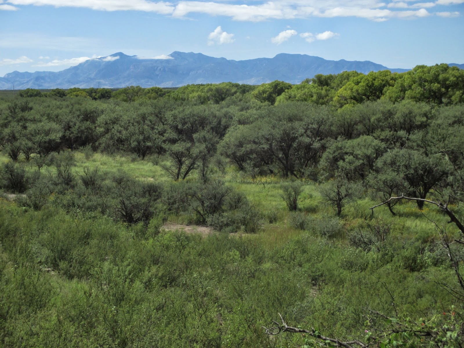
I had to throw in one last picture of the Huachuca Mountains in the background, with the cottonwoods lining the San Pedro River in the foreground.  It was a beautiful morning for a hike!

Nearest City: Sierra Vista, AZ or Tombstone, AZ
Location: Charleston Road, 1/4 mile east of the San Pedro River
Time Needed: 2 hours
Difficulty: easy/moderate
Kid Friendly: yes
Additional Info:

Wednesday, September 17, 2014

Confederates vs Indians at Dragoon Springs Station

On Labor Day Weekend we headed east to the Chiricahua Mountains for a getaway.  On the way we had one important stop to make at Dragoon Springs.  I like to think that I'm pretty good at digging up unique and random sites that are worth visiting, so when I heard about Dragoon Springs I just had to visit it.  I was just surprised though that it took me a year and a half to learn about it.  We turned off of I-10 at the Dragoon Exit, then drove to the small town of Dragoon before turning off to drive a few miles on dirt roads to find the Dragoon Springs Stage Station. 
Along the way we saw a few roadrunners.  It's beautiful out here in the foothills of the Dragoon Mountains. 
We found our turnoff, then parking area, and a short time later we were at the ruins of the Dragoon Springs Stage Station.   The ruins themselves are worth a visit just because it's always fun to think about what traveling in the old west was really like.  I personally think they way the depict it in movies is actually better than it was in real life.  It would be a tough drive over roads that are just barely better than trails, then camping or staying at stage stations that were not much more than a room and a corral for the horses or mules.  But, the stage station was not strictly what we came to visit.
Just north of the stage station are several graves.  Not just any graves, but the graves of Confederate Soldiers from the Civil War.  I was somewhat incredulous when I heard about them at first, but sure enough, they're there with Confederate flags and grave markers to boot!  How'd they get here?  In 1862 a band of Confederates had a run in with Apache Warriors when the Apaches stole much of their stock.  The Indians got the best of round 1 and took most of the Confederate's horses and killed 4 of the Confederates.  It's become a small footnote in history as it wasn't a significant engagement of the Civil War.  What's fascinating though it that it is one of Arizona's Civil War sites and the furthest west casualties of the Confederate States of America during the Civil War.  It's also one of the few skirmishes where Confederates and Indians fought.  Round 2 went to the Confederates when they recovered their livestock and killed several Apaches a short time later. 
Here's a sign at the site giving more detail to the history.  It's a unique location that's well worth visiting. 

Nearest City: Dragoon, AZ
Location: Take the road immediately south of the train tracks in "downtown" Dragoon and head west.  The dirt road will curve to the south.  Turn east on the side road when you see a sign for Jordan Canyon and the Stage Station.  Drive 1 mile and park at the sign, then take a short stroll to the northeast to the stage station and graves.
Time Needed: 1 hour
Difficulty: easy.  The most difficult part is the drive as the road is better with a little clearance on your vehicle.
Kid Friendly: Yes
Additional Info:

Saturday, July 26, 2014

Ramsey Canyon Nature Walk

We've been to Ramsey Canyon several times.  It's a great afternoon getaway in the summer months, but really it's nice anytime.  We like it on weekends in the summer though because they have "bring a kid, get in free" weekends.  Otherwise, it's a few dollars per person charged by the Nature Conservancy to go up Ramsey Canyon.  Ramsey Canyon, along with the San Pedro River is one of the world famous birdwatching spots here in Cochise County.  The record for most hummingbirds spotted in one day was set here a few years back when somebody identified 14 or 15 different species. 
In addition to the birdwatching, there's a nice hiking trail up and old road, and several cabins that are along the way.  The cabins are closed off, and at least one of them is home to a bat colony in the summer. 
The trail loops and goes by another cabin as well.  It's pleasant along the creek, with the water splashing in the shade of the sycamores and oak trees.  We absolutely love the sycamore trees here in the Huachuca Mountain canyons.  They are so pretty!
One spot on the trail is constantly wet due to a small seep.  The butterflies flutter around the spot quite heavily.  They'll even land on you to get some of the salt and minerals from your skin.  We held still and this large butterfly couldn't get enough of us!  The kids absolutely loved the butterflies! 
Toward the top of the canyon there are a few small frog ponds, used to raise endangered Chiricahua Leopard Frogs.  We spotted a few while we were there.  The kids wanted to go chase them, but since the are is roped off, we thought it best to leave the frogs alone. 

Ramsey Canyon is a great place to visit.  It's located at the end of Ramsey Canyon Road, southwest of Sierra Vista. 

Nearest City: Sierra Vista / Hereford, AZ
Location: west end of Ramsey Canyon Road
Time Needed: several hours
Difficulty: easy to moderate
Kid Friendly: yes
Additional Info: Nature Conservancy Webpage for Ramsey Canyon

Wednesday, July 2, 2014

Brown Canyon Ranch


 I was looking through pictures and realized that I haven't blogged about Brown Canyon Ranch even though we've been there several times.  Brown Canyon Ranch is located southwest of Sierra Vista, adjacent to Fort Huachuca.  It's a popular place for family pictures, hiking, biking and picnicking.  We like visiting there. 
Brown Canyon Ranch is one of the original ranches in the area, that has been converted into a community park of sorts.  Instead of playgrounds though, it's great for recreation and nature lovers.  The old homestead is still there and has been converted into a small museum.

We like walking through the inside, then exiting onto the porch to sit and talk.
Outside near the parking area is the ruin of an old barn.  The roof is gone and much of the walls have fallen, but there's still part of it standing. 
There are numerous agaves, often called century plants, in the area right along the foothills of the Huachuca Mountains.  It's a pretty area and it's close enough to Sierra Vista that it makes a quick getaway in the evening. 

Somewhere around town we picked up a flyer for Brown Canyon Ranch that was published by the Friends of Brown Canyon Ranch.  Whoever wrote it would have you believe that you can be cured from cancer just by walking on the grounds.  I've typed it out and included it below for your enjoyment. 

As you enter the grounds of Brown Canyon Ranch, you are stepping back over one hundred years into history.  It's the way it's been for decades.  Entering the property, an overwhelming sense of peace and tranquility will grab you.
 
You may start your unique journey by touring the Ranch House.  As you drift from one room to the next in amazement, it will be easy for you to visualize life so long ago, as you'll have numerous visual aids throughout the house to assist you. 
 
Personnel will aslo be on campus to answer any questions you may have.
 
With your appetite now calling, it's time to settle in the shade under one of the massive trees that circle the Upper Pond.  As you spread your picnic goodies out on one of the tables, you may meet one of the many friendly visitors that could be hiking, running, riding a horse, or cruising on a mountain bike.  With no motorized vehicles allowed on the premises, the quiet is almost haunting.
 
After your meal, it could be time to explore the pond in greater detail. 
 
Using a pair of binoculars or a spotting scope, the diverse wildlife fills one view after another.
 
With the feeling of total reverence that permeates the air, don't be surprised if the wildlife lands so close to you, you will put your optical aid aside to truly capture the moment for a memory that will last a lifetime.
 
Become increasingly at one with the sights, sounds, and smells of your pristine surroundings.  You may meet a passerby who tells you about the last annual Open House when the Cavalry marched down the West Trail and proudly strode by the Ranch House where dozens of displays and activites where in full swing as visitors from everywhere were celebrating the family wholesomeness that embodies the ranch.
 
If there is anything more spectacular than the ranch in the daytime, it is the ranch at night.  Int he blackest of skies, with owls calling and coyotes yelling, you will witnes the cosmos as never before.  The Milky Way will be blazing overhead as it winds its way through one deep space object after another. 
 
As Brown Canyon Ranch rests in an oasis of beauty, it has it all.  If you have an interest in any aspect of nature, history, recreation, family togetherness, or peacefulness it is here waiting for you. 
 
You may har of the Western Heritage Program where 4th and 5th graders from virtually all of the elementary schools in the area venture to the ranch on field trips to expand their young horizons.
 
After viewing in wonderment the ancient windmill still in working condition, the corral area where mighty horses were once kept, and various relics on display, you decide to take a ahort easy walk to the second pond, also loaded with wildlife.
 
Facing mountians to the west, there is a bench where you can sit and relax, reflect, and finish renewing your spirit.
 
As you move throughout the ranch, you may occasionally notice large groups of footprints. This could've been the site of a recent wedding, a reception, an anniversary, an educational school visit, a family reunion, a club or organization gathering, or friends meeting to catch up on old times.
 
Of the few signs posted on the property, what is that one on the wooden railed fence that has an illustration of a frog on it?  Why does it say "Sensitive Habitat Boundary"?  The most rewarding endeavor at the ranch is the ongoing preservation of the wild population of the very much endangered Chiricahua Leopard Frog.  Looking carefully on the surface of the pond for a small patch of bright lime green, you hopefully can spot one soaking up the sunshine.
 
As another brilliant ethereal sunset marks the end of they day, you will reflect back on everything you experienced. 
 
From the magical history, to the staggering beauty everywhere, to Nature's many life forms, to the hiking trails so full of opportunity, to the many warm and friendly people, you will leave the pristine setting with a sense  of awe that promises to stay with you.  And as you look back at the ranch from the top of the road, there is an unmistaken lure.  A lure that becons you to return soon.
 
This beautiful site is kept open to you by The Friends of Brown Canyon Ranch and the Coronado National Forest, Sierra Vista Ranger District.

Nearest City: Sierra Vista, AZ
Location: Take Ramsey Canyon Road heading west, then follow the signs to Brown Canyon Ranch
Time Needed: 30 minutes to several hours
Difficulty: easy
Kid Friendly: yes
Additional Info: Friends of Brown Canyon Ranch

Saturday, April 19, 2014

The Empire Ranch at Las Cienegas National Conservation Area


In March we needed another camping trip.  While driving to or from Sonoita I'd noticed a sign saying Las Cienegas National Conservation area off to the north side of the road and was pretty intrigued by it.  After looking on the Las Cienegas National Conservation Area Website, we were certain that camping was allowed, so we loaded up and off we went.  We found ourselves at the Road Canyon Primitive Camping area and had the place to ourselves.  The amazing thing about southeast Arizona is the complete lack of competition for good camping areas when it's nice out.  There are a few places like Pinery Canyon in the Chiricahuas, or the west face of the Dragoon Mountains that pretty much always have people camping there, but outside of that you can find a great place to camp pretty easily and as likely as not have the place to yourselves.  If this was Utah or Colorado, there would have been other campers, but as it was, we enjoyed a nice quiet evening listening to the coyotes yapping outside our tent. 
In the morning after breakfast, we drove north to look for the Empire Ranch.  On the way we stopped by Cottonwood Pond.  In warmer weather there's a population of Chiricahua Leopard Frogs that call the pond home, but it must have been to early in the spring for them to be out of hibernation.  We walked around the pond then loaded back up to continue toward the Empire Ranch.  Along the way we passed a large number of trucks and trailers hauling mesquite off to be processed into furniture, firewood, and who knows what else.  The BLM is trying to clear the area of the mesquite to restore it to a grassland area for the pronghorn antelope. 
Finally we found the Empire Ranch Headquarters.  Almost the entirety of Las Cienegas used to be part of the Empire Ranch.  The ranch was a cattle ranch up until a few years ago when it stopped running cattle.  Now it's just an old ranch with a small museum. We enjoyed walking through and wandering around the ranch and learning about life as a cowboy in the late 1800's and early 1900's.
This breezeway was the original entrance to the corral.  To keep Indians and wild animals away, the only way to get to the corral was to go through the breezeway, past the windows of the two ranch owners located on either side.  One of the more interesting stories we read was about a cattle drive from the Empire Ranch to California.  The railroad was in place, but jacked up their prices and the ranch owners didn't want to pay the outlandish prices, so they gathered up the cattle and the boys and rode the dusty trail to California with 900 cows.  The ultimate result of the drive, in addition to being a success for the ranch, was the railroad dropped it's price for freighting the cows by the time the next herd was ready to go. 
We took a nature walk down into the Empire Gulch and saw these frog raising pens.  They were all empty because the BLM had released the Chiricahua Leopard Frogs raised here in other locations to help keep them off of the endangered species list. 
We really enjoyed the Empire Ranch and Las Cienegas.  There's a conservation organization set up to preserve the Empire Ranch called the Empire Ranch Foundation.  I really like the west side of the Whetstone Mountains and the grasslands down this way.  It's amazing how varied the landscape is here in the area.  There are other things to see that we didn't get to,  but the Empire Ranch Headquarters is the main attraction here.  I heard that somewhere out this way is a cabin that the BLM or Forest Service used to rent out to overnight guests, but the drug cartels pretty much monopolized the place, so the BLM/Forest Service stopped renting the place out.  It would be fun to go track it down, along with another cabin or two out here.  There also were a few John Wayne westerns shot here on the ranch.  I need to find out what ones they were and try to recognize the locations in the film and match the site today. There's always more out there to see and do!

Nearest City: Sonoita, AZ
Location: N° W°
Time Needed: a few hours to all day
Difficulty: Easy
Kid Friendly: yes
Additional Info:

Monday, April 14, 2014

The Ruins at Carr Canyon Ranch


On the way back from camping up Carr Canyon, we stopped for a short 1/3 mile hike to the Carr Canyon Ranch Ruins.  They're also known as the Carr House, but the Carr Canyon Ranch is a little more appropriately named in my mind. The Brown Canyon Ranch further to the north is better preserved and a popular spot for photography, but I really liked the old ruins here. 
The ruins are at the mouth of Carr Canyon, and take a hike to get to them.  It's an easy hike, with the most difficult part being crossing the stream which is flowing most of the year.  Here in Southern Arizona, the oak trees shed their leaves in the spring, which is why the tree above has leaves that are changing colors.  The ruins climb up the hill and wrap across the hillside.  This was once an impressive building, but now is just ruins. 
Several of the rooms still have all four walls, but no doors, windows, or roof.  Unfortunately a few not-classy people have also found the ruins and tagged up a little of it.  The spray paint graffiti isn't all over the place yet, so there still is a nice happy feeling to most of the area. 
We wandered around, peeking into this room and that room.  The old chimney and fireplace are overgrown with climbing plants, making a nearly tree-like feature in the middle of the ruins. 
We took about an hour wandering the area, checking out the flowering orchard, or remnants of the orchard behind the house, reading a historic plaque placed there as an Eagle Scout Project, and finding old stone fences and other features in the area from when the house was lived in.  The Carr Canyon Ranch is a great little find.  Not many people know about it, so get out and explore it!  If you live in Sierra Vista you'll be glad that you did. 

Nearest City: Sierra Vista, AZ
Location: Park at the parking lot at the mouth of Carr Canyon, cross the creek, and take the trail to the southwest.  You'll be there in 1/3 mile.
Time Needed: 1.5 hours
Difficulty: easy
Kid Friendly: yes
Additional Info:

The Reef Townsite Trail

In late March we took a camping trip up Carr Canyon a little southwest of Sierra Vista.  There are two Forest Service campgrounds up there and a few primitive sites as well.  We wanted to just go camping, but thought it would be fun also to try and find the Reef Townsite trail.  Back in October we were up there during the government shutdown, and the signs warning people that bad things would happen if they passed the markers left us straddling the line of do we stay or do we go.  We ultimately ended up wandering the creekbed looking for and finding several quartz crystals, but I still had the unquenched desire to explore the Reef Townsite.  Since the road up Carr Canyon is closed generally from December to mid-March to keep it from being torn up as the weather gets bad, March ended up being a great time to get up there.  The nights were still cool, but it was early enough to keep the crowds away.  We found a primitive site, but there were a few people in the campground too.  After breakfast in the morning, we drove over to the Sawmill Springs Trailhead across from the Reef Townsite Campground and parked, then wandered down through the campground looking for the trail.  We found it at the end of the campground next to Site 13.
The Reef Townsite Trail loops its way across the hillside, with several signs along the way explaining what used to be at the Reef Townsite.  This sign was one of my favorites, as it has a map of some of the original mining claims on it. 
I always like finding old cart rails when I'm in the mountains.  Most of the old tracks have been torn up and either used at other mines, or scrapped for money, so finding a rail brings a smile to my face every time.  I see it as a sign of luck.  One time I found a rail at an old mine, I saw a rubber boa constrictor nearby.  I'd always wanted to see one and finally did.  Another time, at another mine that was a few miles back in from the nearest road we also found a cave.  Good things happen when I find cart rails. 
This time was no exception.  We looked around in a promising place and found an old mine.  This one had been gated, but the bars have pretty big spacing.  I didn't go in, but these ones would only keep out an extremely large person.   We continued on, the trail being about 3/4 of a mile long.  Nearby, the ruins of a cyanide process plant were weathering away on the hillside.  Several other prospects and the foundation holes of buildings that once stood could be found if you knew what to look for. 
We ended up back at the Reef Townsite Campground, and to be honest with you, most of the artifacts that we found were just scattered on the ground in and around the campsite.  Shards of old purple glass, mining spikes, more broken glass and pottery, and other small reminders cover the area.  There's not much left of where the town once was, but it was fun to go walk through the history of what it had been. 

Nearest City: Sierra Vista, AZ
Location: Reef Townsite, the top of Carr Canyon Road.
Time Needed: 1.5 hours
Difficulty: Easy/Moderate
Kid Friendly: yes
Additional Info:

Wednesday, December 18, 2013

Mogollon, New Mexico

Sometimes the unplanned adventure or detour leads to amazing places.  Mogollon was one of those unplanned treasures that we found when on our New Mexico trip.  We'd come back to visit the Catwalk Trail, but it was too late to go hiking, and after we'd set up camp we looked at the map and decided to see what was at Mogollon. 
Mogollon is an old mining town that is essentially a ghost town now.  There are a few old time residents and a few newcomers who've spent quite a bit of money fixing up some of the old miners shacks.  It's a paved road up from Glenwood to get here, but it's narrow, curvy, and quite steep in some spots.  The signs say not to drive it after dark, and it's easy to see why.  Nevertheless, it's a great place that is entirely worth visiting. 
There are lots of buildings still standing, although quite a few others have fallen down and are being reclaimed by the forest.  Here's the old General Store.
An old gas station, complete with pumps is a bit further up the canyon. 
We took the road to the cemetery to get this picture looking down on Main Street.  It's amazing how much is still here! 
We also saw numerous old mines in the area.  Some were posted, others like this one were not.  We spent less than an hour at Mogollon, but I really wish I'd had more time here.  There's lots to see, and even more if one would get out of the car. 

Nearest City: Mogollon, New Mexico
Location: N° W°
Time Needed:
Difficulty:
Kid Friendly:
Additional Info: