We took a short trip to Western Illinois over Columbus Day. One of the things we really wanted to do was find some Keokuk geodes. The area surrounding the tri-state area where Illinois, Missouri, and Iowa come together is famous for geodes, generally called Keokuk geodes. I little research showed that there are several places to search for them, including some geode quarries.
We decided to go easy and look at the Wildcat Springs Park in Hamilton, Illinois. All we did was go to the park, then head for the stream bottoms or erosion gullies and start looking. In not much time at all we had several geodes in hand, and in less then a half hour of easy looking we ended up with two gallons of geodes. I told the kids to look for "fossil potatoes", since the geodes are roundish like potatoes and hard like rocks or fossils.
We took them out of the streambed and sat down at a covered pavilion and split several of them. Some of them were duds, but some were full of beautiful crystals. We took a while and split about half of our bucket, then brought the rest of them home with us to split later.
If you're looking for a great free spot near Keokuk to find geodes, Wildcat Springs Park in Hamilton is definitely a spot you can find success.
Nearest City: Hamilton, IL
Location: N° W°
Time Needed: varies
Difficulty: easy
Kid Friendly: yes
Additional Info:
Our random, yet highly entertaining, romp through the highly visited and less explored parts of life. Comments with additional information are also welcomed, as are questions looking for more information. If you like my blog or it was useful to you, please comment!
Showing posts with label Rockhounding. Show all posts
Saturday, November 14, 2015
Tuesday, February 24, 2015
Five Mile Creek Waterfall
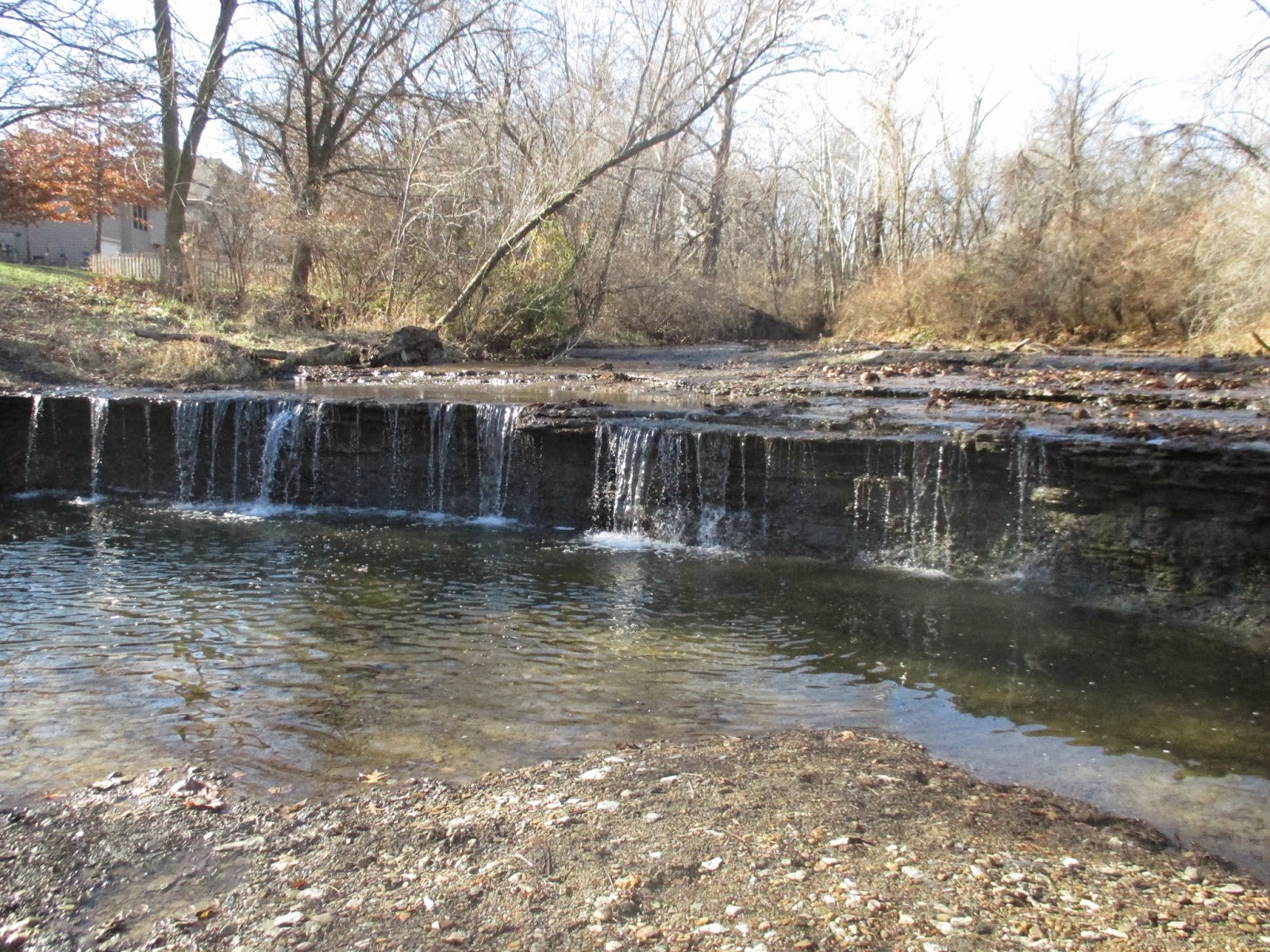
We've discovered a delightful little waterfall on Five Mile Creek in Leavenworth. It's just south of the walking path at 10th Avenue Park. The water cascades over a rock ledge that stretches completely across the creek and drops about 4 feet. We've stopped by several times and always detour from the path to throw a few rocks into the pool at the bottom or just look at the falling water. It's been cold since we moved here, so we haven't wanted to play in the water yet, but I'm sure it's a great place to splash and play at in the summer. We've had a few stretches of single-digit temperatures this winter and the waterfall has frozen over , forming a wall of icicles from the frozen water. The last time we stopped by we found a few fossil shells in the rocks. The waterfall is always fun to see. Another nice thing about the 10th Avenue Park is the walking trail is a great place for the kids to ride their bikes. There aren't consistent sidewalks here in Kansas. Some places have them, other places don't, and it's really hit or miss to find a good solid walking route that kids can ride bikes at. When we found the 10th Avenue Park, it was a great day for the kids and grownups in our house.
Nearest City: Leavenworth, KS
Location: Gatewood Street and 10th Avenue
Time Needed: varies
Difficulty: easy
Kid Friendly: yes- with supervision around water
Additional Info:
Nearest City: Leavenworth, KS
Location: Gatewood Street and 10th Avenue
Time Needed: varies
Difficulty: easy
Kid Friendly: yes- with supervision around water
Additional Info:
Saturday, January 24, 2015
All alone at the Marais Des Cygnes Massacre Site
The site is located a few miles east of Highway 69, about an hour south of Kansas City. It's only about 1/4 mile from Missouri, which plays a factor in the story of the Marais Des Cygnes Massacre. It's relatively undeveloped for being a State Historic Site, with a few picnic tables, an old historic "cabin" that's apparently always closed, and a short driving tour with signs to read telling about the massacre. There are numerous pecan trees, but all of the pecans we cracked open had been eaten by bugs. A few blackberry bushes pop up along abandoned stone fences. It's literally a place that you'll most likely have to yourself if you visit.
The Marais Des Cygnes Massacre was part of the "Bleeding Kansas" struggle prior to the Civil War. Bleeding Kansas was essentially a political struggle from 1854-1861, centered primarily on whether Kansas would permit or oppose slavery. The tendency was to oppose it, but citizens of pro-slavery Missouri did their best rail against anyone against slavery, and sometimes the efforts fell to violence.
The Marais Des Cygnes Massacre was one of the last large violent outbreaks of the Bleeding Kansas era. On May 19, 1858, a group of 30 or so men from Missouri crossed the border into then Kansas Territory and rounded up 11 unarmed men and turned back east. Most of them knew the leader of the group, Charles Hamilton, personally. Hamilton and his ruffians led them into a small hollow, then opened fire. Five of the men were killed, five were injured, and another escaped physical harm by playing dead. The only man who was prosecuted for the crime was caught and hanged in 1863.
We wandered the area for a while. There's a prominent spot in the ravine where a plaque or statue must have once been attached, but now it's just an empty cement monument base. We turned to walk back to the car, but got sidetracked with one of the stone fences. There's lots of limestone in the area, and several fences have been constructed of the stone.
We noticed several fossils in the stones- this a small fossilized piece of crinoid stem. It's an interesting spot. We spent probably 45 minutes at the site, reading the signs, wandering under the trees, and swinging on a small rope swing dangling from one of the oaks. It would be a great spot for a picnic!
Nearest City: Lacygne, KS
Location: North of Kansas Hwy 52, 1/4 mile east of the Missouri state line
Time Needed: 30-45 min
Difficulty: easy
Kid Friendly: yes, but not that entertaining to them
Additional Info: Kansas Historical Society Webpage
Labels:
Free,
Historic Site,
Kansas,
Midwest,
Rockhounding,
Wild Berries
Saturday, July 19, 2014
Illegal Aliens on the Vanished Trail up Garden Canyon
At the top of Garden Canyon on Ft. Huachuca, there used to be a Boy Scout Cabin, but it burned down and was removed. We drove up Garden Canyon and found the site of the old Boy Scout Cabin, then noticed a small trail called the Vanished Trail just south of where it was. The sign said the trail was 1 mile long, so we decided to hike the Vanished Trail.
Along the way we found fossils! Crinoid stems were pretty abundant in some areas of the limestone. We spent a while looking for fossils and actually found a scorpion under one of the rocks we turned over. Be careful if you go looking! Don't put your fingers where you can't see what's lurking!
This dead moth caught my eye as well. It's red head and bluish sheen on it's wings and body made it a pretty insect.
The best fossil we found was this small spiral. The trail winds and splits several spots, so if you're not careful you will find that the Vanished Trail is appropriately named.
We also enjoyed all of the agaves. Some spots along the trail literally had dozens of agaves in a small area. It's the most dense collection of agaves I've ever seen.
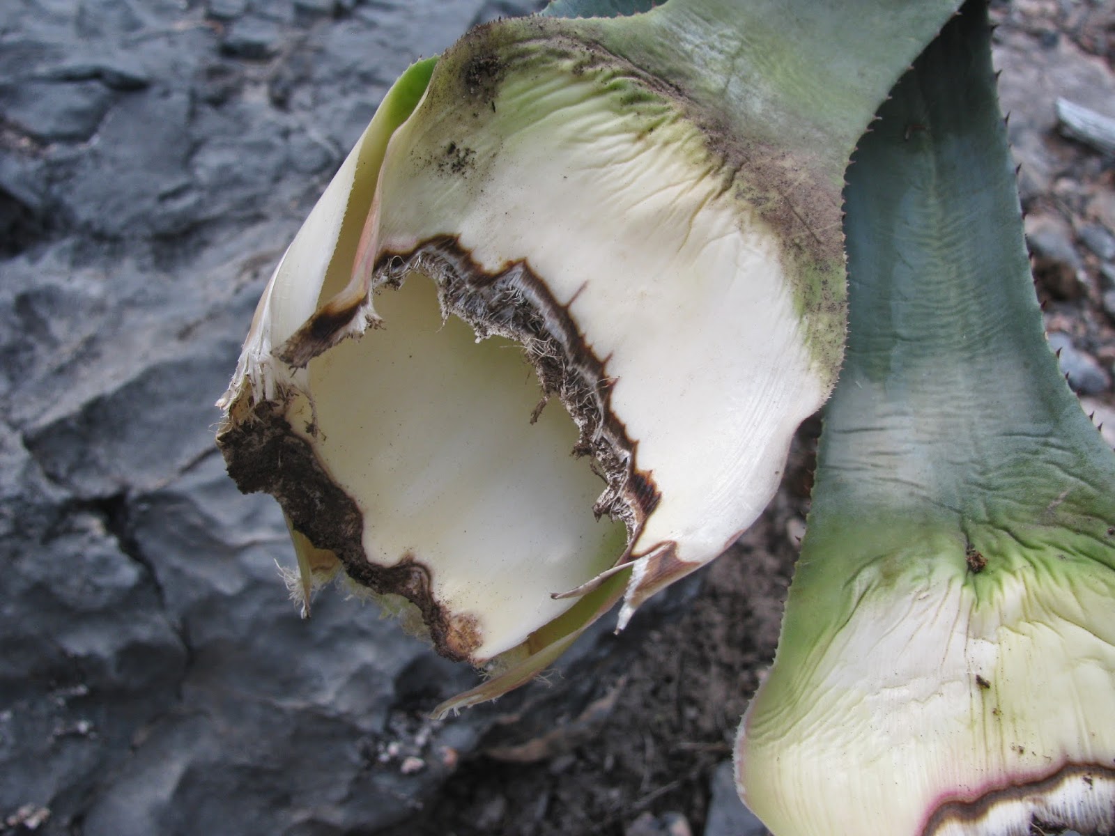
At the top, we dropped down to a dry streambed where the trail disappeared. Maybe it just goes to the streambed, but anyway, we lost the trail at the streambed, but that was ok. The streambed would have water in it with nice pools during monsoon season between July 4 and Labor Day. We gave the kids a snack and took a short break. While we were on the break and I went looking for the trail I found a few water bottles with labels printed in Spanish and then even something more crazy. I found an agave that had been torn apart and eaten like one eats an artichoke! You could see the teeth marks and everything on the base of the leaves! The agave kind of freaked my wife out a little bit, so we packed up and headed back down to go home. When you're in the Huachuca Mountains, even on Fort Huachuca, be alert for illegal aliens. They definitely go through here!
Nearest City: Sierra Vista, AZ
Location: Top of Garden Canyon
Time Needed: 2 hours
Difficulty: moderately easy, some route finding
Kid Friendly: yes
Additional Info:
Tuesday, July 1, 2014
Finding Quartz Crystals Near the Reef Townsite
The weekend before Fathers Day we went camping with friends up Carr Canyon to the Reef Townsite Campground. We had a great time camping and took some time to look for quartz crystals as well. The last time we were here looking for crystals was during the government shutdown of 2013. We found a few small crystals, but not much else. This time we had a lot more success. There's a streambed that runs along the east side of the campground, in and around the streambed is where we looked for the crystals.
On the east side of the streambed there are abundant piles of white quartz. You can see many pieces that have the crystalline shape, but finding the crystals is the hardest. If you look where others have been digging, you're in generally the right spot. Now you just need to find one! Often when I'm rockhounding, the most difficult fossil or mineral specimen to find is the first one, and after that it's easier to find others. We found several pretty decent crystals without looking terribly hard. I'd be interested in looking further south in the area of the old mines that are southeast from the campground, but I haven't looked up there. Heading up to the top of Carr Canyon is definitely a good escape from the summer heat down in the valley. If you're looking for something to do, take a drive and see what you can find!
Nearest City: Sierra Vista, AZ
Location: Drive up Carr Canyon Road to the Reef Townsite. If you don't want to pay for a site, park across the street in the Sawmill Spring Parking Area. Look on the east side of the creek near the campground.
Time Needed: varies
Difficulty: varies
Kid Friendly: yes
Additional Info:
Sunday, April 6, 2014
Looking for Desert Roses near St. David
I've been slow about updating my blog over the past few months. Hopefully I can catch up on all of the places we've been and the things we've done. Christmas Day we went rockhounding. Southern Arizona is beautiful in late December, and with no extended family close by we wanted to do something with our own little family. We decided to go and look for desert roses near St. David, so we packed up, drove out past Tombstone, and turned north to go to St. David. St. David was named after David Patton, an early apostle of the Church of Jesus Christ of Latter Day Saints (Mormon Church). A large number of the church members came through Southern Arizona as members of the Mormon Battalion during the Mexican War in 1846, and later came back to settle the area. St. David is still a small town, so we passed through it quickly as we looked for the turnoff on Apache Powder Road.
We turned onto Apache Powder, then took several other turns onto other dirt roads, following the directions outlined in an Arizona Rockhounding book we checked out at the library. Most of the drive was passable in a passenger car, but when we got about 1/2 mile away from our destination we were glad to have the added clearance our Subaru offers. A wash with a steep hill on the otherside were quickly navigated, but it would have been impossible for a smaller vehicle. We arrived at the collecting area and saw endless sparkles glistening on the ground in the afternoon sun. We first thought it was broken glass, but after getting out of the car we saw that it was selenite crystals. Selenite is a form of gypsum, so I like to think of it as crystallized sheetrock. The desert roses are clumps of the selenite, forming a ball with fins. They aren't as easy to find as they used to be as the area has been publicized for a long time and has been well-visited. We dug in the dirt, chiseled in the nearby bluffs, and scoured the desert looking for roses, but with no success.
As we wandered through the white-thorn acacia and mesquite, hoping to find an overlooked desert rose or two, I noticed an impaled beetle on a branch on one of the bushes. Apparently a bird had found beetle, impaled it on the stick, then forgotten to come back and eat it.
Even though we didn't find any desert roses, we enjoyed the hunt and took a few pieces of selenite home to look at. As a reminder, if you do look for desert roses nearby, please be careful as there have been fatalities due to rockhounding in unstable nearby locations.
Nearest City: Location: St David, AZ
N° W°
Time Needed: a few hours
Difficulty: Easy-moderate
Kid Friendly: Yes- with supervision, and not in all areas.
Additional Info:
Friday, January 24, 2014
Visiting the Unvisited Prehistoric Trackways National Monument
While I was planning our quick trip out to Las Cruces, I stumbled upon something that mentioned Prehistoric Trackways National Monument. Hmm. I'd never heard of Prehistoric Trackways National Monument, so I pulled up NPS.gov and it didn't show up on the map. Interesting. Further searching did pull up a website on the BLM server for Prehistoric Trackways National Monument. The NPS website does mention it on a National Fossil Day page leaves me to believe that the monument is managed by the Bureau of Land Management instead of the National Park Service. Regardless of who manages it, it sounded like a place right up my alley. Unique, interesting, worth visiting, not lots of people, and throw in a little hiking to boot. I bookmarked it for a visit.
We dragged in to Las Cruces about 7:30 at night and swung by the local KOA to check on accommodations there. They wanted $30 and change just for us to pitch our tent for the night. No thanks! I might be crazy, but I'm not that crazy. We punched in the coordinates to the monument to see what we could find there. Sure enough, there were a few primitive sites on the side of a dirt road, but it sure beats shelling out $30 just for a campsite. And it had the added bonus of being closer to where we wanted to explore. We pitched the tent, set up our bedding and crashed out. We weren't even bothered by the half dozen travel trailers from Texas down the road that were watching a football game on the side of one of their rigs.
The next morning, we got up, ate a quick breakfast, then set off to find the rumored dinosaur footprints. The trail led straight up the mountain, over the top, and down the other side. A short way down the far side of the mountain, the trail dropped to the west into a drainage, then downstream a hundred yards or so to the quarry. It was well signed, so we had no problem finding the site.
Apparently a local Las Cruces resident named Jerry MacDonald was out looking for dinosaurs and discovered the trackway site in 1987. He didn't know it at the time, but what he'd found was the best and most complete trackway site in the world. They're technically not dinosaur footprints since they are Paleozoic, but to a 4 year old a pre-dinosaur is the same thing as a dinosaur. Our kids thought they were pretty cool and wondered how they got there. The tracks aren't big, the biggest ones we saw were about the size of a small dog footprint, and numerous being mouse-sized footprints.
There's also a rock with some plant imprints in it.
We also found several marine fossils in the rocks and limestone along the way. Remember- no collecting either the fossils or the tracks! Only take pictures! This is definitely the most unknown and least visited national monument I've ever been to. It's minutes from a city of 100,000 people, but yet it's off of a dirt road with no visitor center, no restrooms, and only a few interpretive signs. It makes more sense if you understand that the purpose of national monuments is to protect and preserve, while the purpose of national parks is to expose to the masses.
Nearest City: Las Cruces, NM
Location: N° W°
Time Needed: 3+ hours
Difficulty: Moderate
Kid Friendly: So-so. If they can get to the end of the hike they'd like it, but the hike is several miles round trip
Additional Info:
We dragged in to Las Cruces about 7:30 at night and swung by the local KOA to check on accommodations there. They wanted $30 and change just for us to pitch our tent for the night. No thanks! I might be crazy, but I'm not that crazy. We punched in the coordinates to the monument to see what we could find there. Sure enough, there were a few primitive sites on the side of a dirt road, but it sure beats shelling out $30 just for a campsite. And it had the added bonus of being closer to where we wanted to explore. We pitched the tent, set up our bedding and crashed out. We weren't even bothered by the half dozen travel trailers from Texas down the road that were watching a football game on the side of one of their rigs.
The next morning, we got up, ate a quick breakfast, then set off to find the rumored dinosaur footprints. The trail led straight up the mountain, over the top, and down the other side. A short way down the far side of the mountain, the trail dropped to the west into a drainage, then downstream a hundred yards or so to the quarry. It was well signed, so we had no problem finding the site.
Apparently a local Las Cruces resident named Jerry MacDonald was out looking for dinosaurs and discovered the trackway site in 1987. He didn't know it at the time, but what he'd found was the best and most complete trackway site in the world. They're technically not dinosaur footprints since they are Paleozoic, but to a 4 year old a pre-dinosaur is the same thing as a dinosaur. Our kids thought they were pretty cool and wondered how they got there. The tracks aren't big, the biggest ones we saw were about the size of a small dog footprint, and numerous being mouse-sized footprints.
There's also a rock with some plant imprints in it.
This is probably the most defined print I found. One of the unique things about the site is it contains the imprints and trace fossils of both land and sea creatures. I wasn't quite sure what the sea creature tracks looked like, so I didn't find any. Many of the tracks are now in Albuquerque at the museum at the University of New Mexico. I'm sure they are in better shape and more defined than the ones we saw in the wild were.
Here's a picture of the quarry. Not much other than a bare spot in the hillside, but it's the little things that count here! We also found several marine fossils in the rocks and limestone along the way. Remember- no collecting either the fossils or the tracks! Only take pictures! This is definitely the most unknown and least visited national monument I've ever been to. It's minutes from a city of 100,000 people, but yet it's off of a dirt road with no visitor center, no restrooms, and only a few interpretive signs. It makes more sense if you understand that the purpose of national monuments is to protect and preserve, while the purpose of national parks is to expose to the masses.
Nearest City: Las Cruces, NM
Location: N° W°
Time Needed: 3+ hours
Difficulty: Moderate
Kid Friendly: So-so. If they can get to the end of the hike they'd like it, but the hike is several miles round trip
Additional Info:
Saturday, December 21, 2013
Digging Around at Rockhound State Park
While on our New Mexico trip, we stopped at Rockhound State Park near Deming. We had read about it and thought that it sounded fun to go see, and dig up some cool rocks. We arrived, toured the small visitor center, then set out to see what we could find. I can't say I was that impressed with Rockhound State Park. The best areas have already been picked over for years, leaving behind areas that take some serious digging to get to anything good. Your best bet might be looking around one of several rockshops in the area.
We climbed a hillside, found several small and lower quality rocks and pieces, and basically had the whole place to ourselves. If you're looking for a place to take the kids, I can't recommend Rockhound State Park. But if you are in the area, driving to the Spring Canyon State Park (better described as a sub area of Rockhound), a few miles south of the main park you will have the chance (slim, but still a chance) to see a wild ibex, which were released into the Florida Mountains, which are similar to their native range in Southwest Asia. We didn't see any.
Nearest City: Deming, New Mexico
Location: N° W°
Time Needed: A lot or not much. There's not much in between though.
Difficulty: Varies
Kid Friendly: Not like we had hoped.
Additional Info:
Monday, December 2, 2013
Courtland Ghost Town
We had a camping trip over Veterans Day and took a stop by Courtland the first night. We didn't have anywhere in particular to go, so we ended up camping near an old mine, with the aim to do more exploring in the morning. After breakfast, we wandered around and looked at some of the foundations of the mine buildings, climbed on the dumps, then packed up to go see more of the ghost town. Our first stop was at the Courtland Cemetery. It's small and there are no signs directing you to the lonely spot out in the desert. It's a small cemetery, with many of the graves only marked by a pile of rocks.
We then went to see some of the buildings. The Courtland Jail is probably the most famous structure of the town, so we went to see it first. Unfortunately, some low-lifes and druggies had found the place first and had spray painted the place with drug references and other materiel that isn't needful to repost. Back when Courtland was more of a town and less of a ghost, the jail was used more to calm down rowdies and sober up drunks then it was used for anything else.
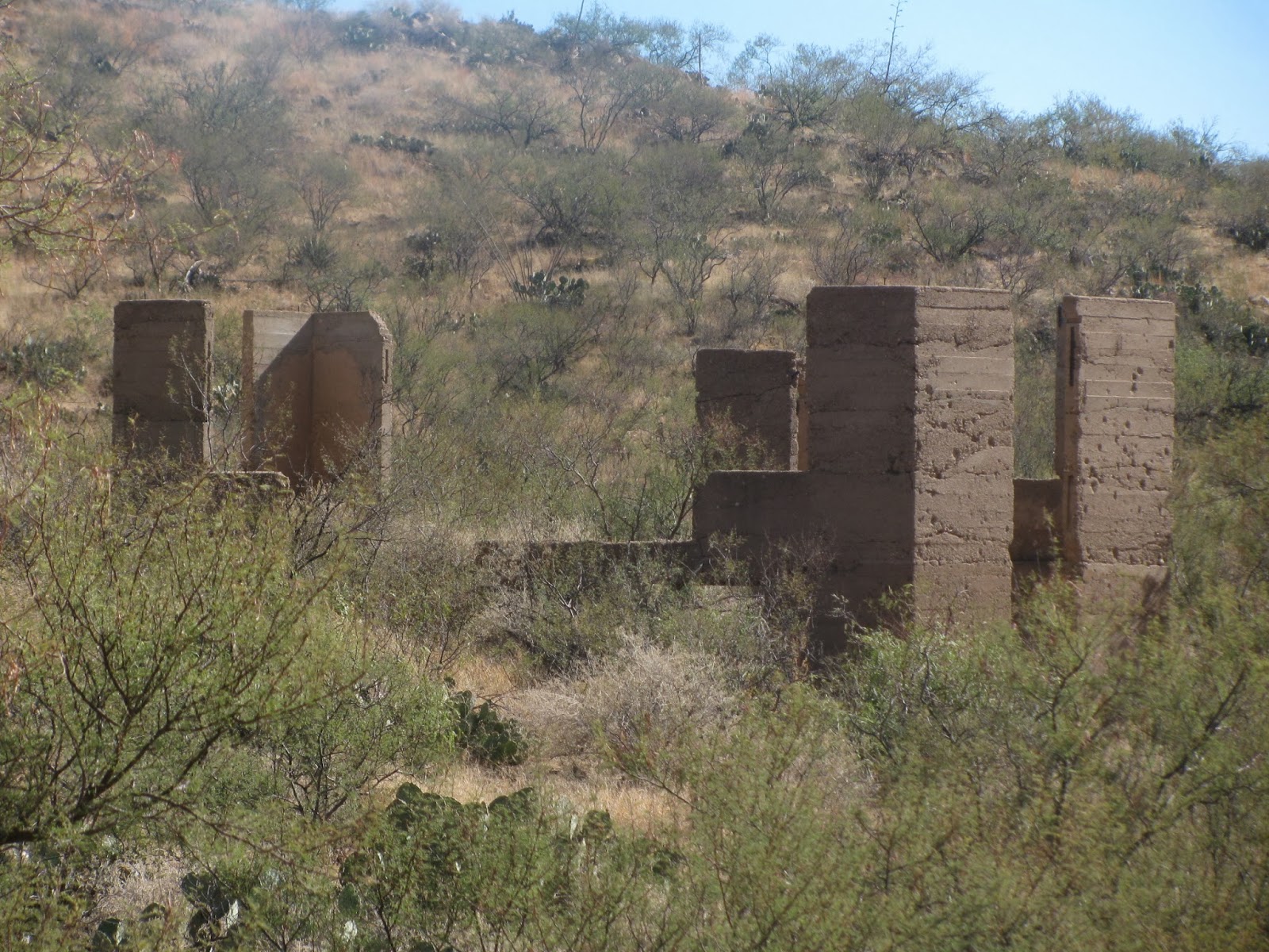
There are several other old buildings still there that the desert hasn't reclaimed yet. Most of them are only walls or foundations though.
Courtland is a place that would be good to visit if you're not in a hurry. We didn't spend as much time as we could have, and I'm sure there is a lot to see hidden in the brush and the desert growth. Take some time and hike around and see what you find! In addition to silver, maybe you could find some turquoise in one of the nearby mine dumps!
The only treasure we found was near the jail. As we wandered around on the hillside out back we found some fossil bearing limestone with some crinoid stem pieces and other fossils in it.
Nearest City: Courtland, AZ
Location: Ghost Town Trail N° W°
Time Needed: Varies
Difficulty: Varies
Kid Friendly:
Additional Info:
Monday, September 2, 2013
Sunnyside Ghost Town and the Eureka Mine
I read a book about hiking the Huachuca Mountains that mentioned the Eureka Mine and that it had lots of malachite and azurite laying around, so I added it to my list of things to do in Sierra Vista. A short time later, my wife sent me a link about the Sunnyside Ghost Town, which is nearby. We decided to make it happen. One Saturday we didn't have much to do, we loaded up and drove to the west side of the Huachuca Mountains, past Parker Canyon Lake, and up Sunnyside Canyon.
The road was generally pretty good, but higher clearance is best in a spot or two. The map said to take the road to the left when they forked, and that it would loop down to Sunnyside from above. We wanted to hike to the mine first, so we took that route, drove to a spot I had marked on my GPS that looked like the place to begin for the hike, then got out to go do it. We ran into a few Boarder Patrol agents, talked with them briefly, then continued on our hike up Eureka Canyon, a smaller side canyon to Sunnyside Canyon.
The hike wasn't bad at all, it was along what once must have been a road that has been closed. There were a few steep spots, but most of it was pretty gradual elevation gain. Along the way we enjoyed the views and the wildlife. A baby horny toad was definitely a fun find. The picture is above at the top. Once at the mine, the GPS said we had gone 1.65 miles- so a decent little hike, but not too long. Almost from the moment we arrived we noticed lots of green rocks laying around. Some had bits of blue in them too. We set down our packs, then spent the next half hour scrambing all over the hillside trying to find the best pieces. The mine has been blown, so it is no longer open. We found more rocks then we could carry, sorted through them, then loaded the best pieces up to bring home.
Here is the view from the mine dump. It's a beautiful spot. We lugged the booty down the trail to the car, then drove down to Sunnyside.
Sunnyside was founded to be a utopian community in the late 1800's/early 1900's. It has since been abandoned and is in a state of suspended decay. There are several buildings still standing as well as the crumbling remains from some that have fallen.
I can't recommend going in the buildings. They are best to be enjoyed from the outside. While we were wandering around, a bat flew out of one of them, circled around a few times, then flew back in to roost. All the more reason not to go inside. Bats are so amazing and eat tons of bugs. Leave them alone!
We wandered the area looking for other buildings or structures that may be hidden in the trees. We found some outhouses, barns, and miscellaneous structures. We also found the fruit orchard. It's just west of the main town area and looks like it would be quite nice if it was just trimmed and maintained! The kids were tired, so we took a few last pictures, splashed in the creek for a little while, then loaded up to drive home. It was a fantastic day.
Nearest City: Elgin, AZ
Location: N° W°
Time Needed: 1/2 a day+
Difficulty: Easy/moderate
Kid Friendly: Yes- with supervision
Additional Info:
Labels:
Arizona,
Cochise County,
Free,
Ghost Towns,
hiking,
Mines,
Rockhounding,
Scenic Drive
Friday, September 7, 2012
Digging for Trilobites at Spence Gulch
Over Labor Day we had another trip to Bear Lake. Since I've been on somewhat of a fossil kick lately, I dragged everyone up to Spence Gulch in Idaho. Ok- dragged isn't quite realistic. Everybody was interested and volunteered to come. We drove north from Garden City for about half an hour, turned off on the Lanark Road, then turned west again on Mill Farm Road. When we got to Dutch (Danish?) Flat we turned north on Road 939. A little way down the road we parked, then hiked down the drainage looking for a huge cutbank. Bingo.
After a short hike, we found the huge outcropping of Spence Shale. This shale bed contains a high concentration of fossils and was first identified here in Spence Gulch.
The biggest challenge I found at Spence Gulch was the rock quality is very poor. There are lots of fractures and getting out large pieces to split is tough to do. It's a tough balance- it's easy to find and get to, it has fairly abundant and interesting fossils, but the rock quality isn't very good. We dug, splitted, and looked for trilobites for probably about 2 hours and came home with some pretty cool looking ones. I need to brush up on my trilobite identification- all I know is these ones have spiny bodies and look cool.
Here's one of the trilobites we found. The spiny body is really cool.
This one is a different species.
We also found countless fossils like this one. We wondered if they were leaves, or what. It's a hyolith, an extinct mollusk with a cone-shaped shell. They're pretty common at some sites like this one.
Here's a few more pictures of some of the trilobites. It was interesting how you could spend 10 minutes splitting a chunk of shale and not find any complete fossils, but then be working on extracting another piece and have a great looking one fall out of the rubble.
Nearest City: Liberty, ID
Location: N° W°
Time Needed:
Difficulty:
Kid Friendly:
Additional Info:
Subscribe to:
Posts (Atom)