While we were in Wisconsin, we stopped one morning at Kwik-Trip for gas and breakfast. I had to introduce one of the finer (or funner) things Wisconsin has to offer to them- milk in a bag, Of course when you say it though, you have to put in a little bit of the upper Midwest accent, so it sounds more like "milk in a beyg". Don't be confused though when you've paid for your items that the clerk behind the counter asks if you wanna beg for them. The polite thing to say in that situation is "yes, plastic will be fine." Of course your initial gut response may be more like "What do you mean? I already paid for them and now I need to beg for them too?" Good times! Wisconsin rocks!
We had our chocolate milk and donuts and kept driving north. Oh, and the milk in a bag is delicious. It's also a little cheaper than milk in a carton.
Our random, yet highly entertaining, romp through the highly visited and less explored parts of life. Comments with additional information are also welcomed, as are questions looking for more information. If you like my blog or it was useful to you, please comment!
Showing posts with label Random. Show all posts
Tuesday, September 22, 2015
Tuesday, July 28, 2015
Hooray for Mulberries!
In late May and early June we had a great time picking mulberries. Here in Kansas, they're just about everywhere. They're in the city, staining the sidewalk purple, or along the back alley ignored by virtually everyone. They're in the country too, most commonly along fence lines and dirt roads.
Most people don't know that they're edible. They're ripe when they're almost black and quite frankly, you could spread out a tarp under a tree and shake it and they'd fall off and make picking easier for you. They look kindof like blackberries or raspberries, but instead of growing in a bramble, they grow on trees. The berries also have a small green stem, while raspberries and black berries do not. The stem is edible. We picked quite a few. Mostly we picked them here and there and ate every berry we picked almost as soon as it was in hand. One Saturday we did find a tree that was heavily laden, so we spread out some sheets underneath it and did give it a good shake. We ended up with enough berries to go home and make some jam, as well as a pie or two and bag a few bags for our freezer. That was a good day. What do mulberries taste like? They're sweet but without any tartness. They taste somewhat like a blackberry or a raspberry if you subtracted the tartness or tang. They're not quite as good, but they're delicious nonetheless. One of the best parts about them is the fruit ripens over a several week window, so you can go back several times to pick them. I think that's part of why they're not really available in stores. One of our favorite things to do with mulberries other then eat them raw, is to bake them into a pie with cherries to make a cherry-mulberry pie. Sometimes pie cherries can be too tart, so the mulberries counter the tartness to result in a delicious pie. Next year go ahead and pick them. You've seen that tree staining the sidewalk way too many times. You'll be glad you did.
Incidentally, mulberry trees were imported to North America to provide food for silk moths. I've never seen a silkworm on a mulberry tree though.
Also there's a nursery rhyme about a mulberries. All around the mulberry bush the monkey chased the weasel. The monkey thought it was all in fun POP! goes the weasel. Consequently, I tease my kids when we pick mulberries that I'm looking for a monkey and a weasel.
Friday, July 24, 2015
The Peel Ferry, a Free Boat Ride in Arkansas
While doing some preliminary research on our trip to Arkansas, I found a tasty little spot we had to experience for ourselves. In Northern Arkansas on Bull Shoals Lake, there is a ferry. A free ferry. Yes please! We cut our visit to the Buffalo National River a tad bit short so we could make it to the ferry before it did its last run for the day. The road between the Tyler Bend visitor center and the Peel ferry was just about as crooked as could be. The bends this way and that way got to be rather taxing, and we were fortunate that nobody got car sick. A time or two I had to slow way down though or I'm sure bad things would have happened.
Finally, after a bajillion bends and turns, we reached the end of the road. Beyond the ferry dock was the blue open water of Bull Shoals Lake. A sign told us to put the car in park and wait for the ferry, so we did. The Peel Ferry is the last free ferry in the Arkansas State Highway system. It's somewhat out in the boonies, and the decision had been made at one point or another to keep the ferry instead of build a bridge. I guess for the (limited) amount of traffic the highway gets, it's more economical to operate a ferry then it is to build and maintain a bridge. This Arkansas Highways article does a great job of telling more about the ferry. We just watched it as it came closer and closer, until it was our turn for a ride.
We drove on to the ferry, put the car in park, and after they'd left the dock we were free to get out and wander around for the 20 minute ride. We looked over the edge, talked with one of the ferry operators, and asked him a few questions. He patiently listened to the kids questions and answered them at a level they would understand. Then it was my turn for my only question. Before we knew it, it was time to get back in the car and continue on into Missouri. If you're wondering what my question was, I'll tell you the answer. No, they can't fish while they are working.
Nearest City: Peel, AR
Location: Highway 125 by Peel, Arkansas
Time Needed: 20 minutes to cross
Difficulty: easy
Kid Friendly: yes
Additional Info: Arkansas.com page on the Peel Ferry
An Evening Along the River in Little Rock
| The Little Rock Skyline from the Clinton Presidential Park Bridge |
We followed Rock Street north to the river, paid $5 for parking, then walked along the Arkansas River Trail a short distance to the Witt Stephens Jr Central Arkansas Nature Center. The Nature Center was a good stop. We learned about a lot of different things in Arkansas, including that alligators are native to parts of the state.
There were lots of displays, including some live fish and reptiles. I thought this albino gar was really awesome. We enjoyed the nature center for about 30 minutes or so until they had to close. They're open almost every day of the year and close about 5 pm. It's worth a visit if you're ever in downtown Little Rock.
We decided to spend a little more time and strolled on the Arkansas River Trail to the Presidential Park Wetlands, a short distance east of the nature center. The wetlands trail had a boardwalk over some wetlands along the Arkansas River. We saw fish, turtles, a snake, and ducks. The kids kept trying to out do each other on the animals they spotted.
Just up the hill from the wetlands is the Clinton Presidential Library. We walked up to it, but the large animatronic dinosaurs out front were a quite intimidating to the kids. We were there a little too late in the evening to go inside.
We concluded that since we'd walked a little ways down the river trail, it would be great to make the rest of the loop as a way to tire the kids out before we drove north. We crossed the Clinton Presidential Park Bridge, turned west on the north bank of the river, then took the Junction Bridge back to our car. It was a great little loop, but and we succeeded in wearing the kids out. The loop has some fantastic views of the Arkansas River and the Little Rock skyline. There were a number of people walking, jogging, or biking- clearly it's a popular urban trail.
On the Junction Bridge, we were able to look down at a submarine, part of the Arkansas Inland Maritime Museum. It was closed for the night, but was fun to look down on a submarine in a river. It might be a fun stop too if we're ever back in Little Rock
Nearest City: Little Rock, AR
Location: 602 President Clinton Avenue, Little Rock, AR 72201
Time Needed: varies
Difficulty: easy- moderate
Kid Friendly: yes
Additional Info:
Monday, May 25, 2015
Lawrence Community Orchard in the Spring
A few months ago I found a passing reference to the Lawrence Community Orchard. Intrigued, I looked it up to see what it was. Then I decided that I should go visit it. I was intending to visit in the fall when most of the fruit is ripe, but a short trip to Lawrence gave me an earlier opportunity to visit it then I had planned on. The Lawrence Fruit Tree Project is located in a residential neighborhood, just off of Garfield Street, east of Delaware Street. It's a dead-end street because of the greenway/walking trail at the east end of the street, adjacent to the orchard.
The little park has a lot of fruit trees and some garden spaces that are open to the public to walk through, as well as pick the ripe fruit. I'm not sure their policy on taking fruit home, but I'm pretty sure the intent is to allow people to pick and eat whatever they'd like to while on the premises, but to limit opportunists who strip everything off of the trees so that others can't use it. It sounds like an intriguing idea. When I stopped by in mid-April, it was a rainy day and the ground was pretty well saturated. I didn't stay for long, but long enough to see that there are numerous varieties of trees as well as some smaller plants and vines.
I plan on going back to visit this fall. Probably the biggest reason may be to try and sample several different varieties of apples. I'd like have a few fruit trees, but I want to figure out what kind of apple I like best before I plant the tree. The Lawrence Community Orchard seems like a great place to stop and try a few.
Nearest City: Lawrence, KS
Location: Garfield Street, east of Delaware Street, Lawrence, Kansas
Time Needed: Varies
Difficulty: easy
Kid Friendly: yes
Additional Info: Lawrence Fruit Tree Project Website
Friday, April 17, 2015
Wild Onions in Kansas
One of the first plants to appear in the spring in eastern Kansas are wild onions. They are literally everywhere! We saw a few, pulled on the ends and smelled the onion smell. It was enough to send us online to look for answers. Sure enough- they were wild onions! Some people find them to be unwanted weeds growing through their lawn. I thought them unique enough that I got out a shovel and started digging some up. I made a pile of the onions, then brought them inside and washed the dirt off of them.
Before I decided what to cook with the onions, I made sure that they really were onions. There are some wild plants that look similar to onions that can be very poisonous. Fortunately, there's an easy way to tell the difference. Wild onions smell like onions. Poisonous look-alikes don't. I smelled each plant- yup, all onions.
You can use wild onions just like you would use normal onions, only the bulbs are small- just like green onions. I took my pile of onions, chopped them and made French onion dip. Yum- it was delicious.
What do wild onions taste like? They taste substantially like normal onions, but with an ever so slight different taste to them. I compare the difference in taste to much like different varieties of apples taste the same generally but with slight differences. Will I dig them again to eat some more? I'm not afraid to. I might. I guess it comes down to convenience. It is a lot more convenient to use a nice big bulbed cultivated onion then it is to spend an hour digging up and processing wild onions.
Saturday, February 28, 2015
Marceline Missouri: Walt Disney's Hometown
| Marceline, Missouri |
| Walt Disney's Childhood Home |
| Sign outside Walt Disney's Boyhood Home |
| Walt Disney's Dreaming Tree |
| The Disney Barn |
| Inside the Walt Disney Barn (replica) in Marceline, MO |
Nearest City: Marceline, Missouri
Location: West Broadway, Marceline, MO
Time Needed: 30-60 minutes. No need to rush here!
Difficulty: easy
Kid Friendly: yes
Additional Info: Walt Disney Hometown Museum
Wednesday, February 25, 2015
Lincoln in Leavenworth
A few weeks ago we went for a walk through downtown Leavenworth. Downtown Leavenworth to me indicated a town that's come down from its peak but not quite sure how to proceed into tomorrow. It's trying to decide whether to take the long slope into decay or make some hard decisions needed to help it prosper. There's a lot of history here since it's the oldest city in Kansas, but it also doesn't have much of economy if you discount the military base and the prisons.
On a building corner we found a plaque that said it was the site of Abraham Lincoln's first speech leading to his campaign for President of the United States of America. The plaque reads: "Campaigning for the Presidency of the United States, Abraham Lincoln crossed the Missouri River from St. Joseph to Elwood, Kansas Territory, on December 1, 1859. From there, he was driven is a horse-drawn buggy to Leavenworth.
On December 3, 1859, he spoke in Stockton Hall, then occupying this site. This speech was his first major political address that led to his nomination and subsequent election as President of the United States. Here Lincoln first proclaimed the principles incorporated in his famous speech at Cooper Institute, New York the following February.
Lincoln left Leavenworth December 7, 1859 and returned to his home in Springfield, Illinois."
The plaque left me wondering about the speech he gave here, so I found that it's included in the Collected Works of Abraham Lincoln, Volume 3. A transcript of it can be found here. In summary, his speech was about slavery and how the middle-ground status quo was unacceptable. Either slavery is wrong, or it is not wrong, and that conviction should be extended throughout the nation. He said that if slavery is wrong, it should be done away with. If it is not wrong, then it should be extended. But the current standing was untenable. He then encouraged the listeners to be involved and to vote and that it was their duty and obligation to do so.
Nearest City: Leavenworth, KS
Location: SW corner of intersection at 4th Avenue and Delaware Street
Time Needed: 10 min
Difficulty:
Kid Friendly:
Additional Info:
Saturday, February 21, 2015
The Lakeside Nature Center and Red Fox Trail
It seems like I'm always behind when it comes to blogging. We visited the Lakeside Nature Center back in December, and I'm only getting around to blogging about it now. We had a free Saturday, so went over to the Lakeside Nature Center. We'd heard that it was a place that rehabbed injured wild animals and was a fun stop for kids. So, we loaded everybody up and went over to Swope Park to see what was there.
Swope Park is a huge natural area on the east side of Kansas City that has the zoo, a golf course, numerous hiking trails, some fishing ponds, and lots more. It's also home to the Lakeside Nature Center. We found our way there (Swope Park is BIG!), then went inside. There were a few animals there to see, but really not as many as I expected. Most of them had been hit by cars, or injured in some other way and were unable to fend for themselves in the wild. The opossums were a favorite of the kids. They also had mice, turtles, fish, snakes, squirrels, and a few other animals inside, with some large cages out back for eagles, hawks and owls. We enjoyed looking at all of the animals, then looking at them some more. After about half an hour, the kids saw a coloring table and went over to color pictures.
I wanted to go for a hike, so after the kids finished their pictures, we dropped the pictures off in the car, then went out to hike the Red Fox Trail, located just outside the Lakeside Nature Center. There are maps available at the center, and the trail is well-signed for the most part and easy to follow.
WOW- Midwest hardwood forests. This was basically my first hike in the Kansas City area after moving from Arizona. It's definitely nothing like Arizona here! I like it! The trees were everywhere. I'm sure it will be crazy how green it ends up when the summer gets here. The many kinds of fungus we saw growing were really neat too. The kids had fun at first, but then wanted to be carried. We found a great alternative when we found a "choo-choo train stick". They all grabbed ahold of it, then marched down the trail as part of the choo-choo train. We had a few small disagreements along the way about who got to be the engine, but the problems all worked themselves out with a little parental intervention.
The best part of the hike though would definitely be swinging on the vines. I think they are wild grape plants, and they shoot runners that climb up to the top branches of the trees. Near one of the trail junctions, someone had cut the vine off at the base, freeing it to make a "rope swing" out of the vine. I guess that would make it a vine swing! We spent a lot of time just swinging back and forth like Tarzan. Finally after our hands and arms were all gripped out, we stopped swinging and continued hiking. We definitely had a good time!
Nearest City: Kansas City, Missouri
Location: 4701 E. Gregory Blvd. Kansas City, MO
Time Needed: 30-45 minutes for the nature center, 30-60 minutes for the hike
Difficulty: Easy
Kid Friendly: yes
Additional Info: The Lakeside Nature Center
Saturday, January 3, 2015
Dorothy's House- Liberal, Kansas
It's been a crazy month since I've blogged last. The short version is I got a promotion and my work moved me to the Midwest. Even though we did a lot of driving to get here, that didn't mean we skipped every opportunity to stretch our legs along the way. We just skipped most of them. Dorothy's House in Liberal, Kansas was one of the few places that we did stop. Now you're probably wondering two or three things by now: 1. How did they get that thing back from Oz? (they didn't- it's fake) 2. Wouldn't it have suffered major structural damage when the tornado dropped it? (it would have, but it's fake) and 3. Why Liberal, Kansas and is this some sort of a political statement? (keep reading, it's not).
The truth of the matter is that ever since MGM released the film in 1939, "Somewhere Over the Rainbow" has become the unofficial state song of Kansas- much like the good citizens of West Virginia adopted John Denver's 1971 hit "Take me Home Country Roads". Even though Dorothy Gale refers to her beloved Kansas several times in the movie, the most famous being "Toto, I've a feeling we're not in Kansas anymore", she never does come out and say which town in Kansas was home.
In 1981, the citizens of Liberal decided that Liberal was as good a place for Dorothy to be from as anywhere else in Kansas, so they preemptively claimed her as a citizen. They even got the governor of Kansas to declare that Dorothy was from Liberal.
An old farm house from a few miles outside of the city limits was located and determined to look close enough to the prop used in the movie, so they hauled it in to town to set up a museum and a place for fans of the movie to stop and spend their money. The house was built in 1907, and was not actually used in the movie. The house in the movie was built on a set in Hollywood and nothing remains of it.
There's a museum on site and for a small admission fee, you can follow a blue-checked gingham dress wearing Dorothy look-alike tour guide around, complete with ruby slippers, and learn more about the movie and the farmhouse. Our kids had way too much energy to burn, so we opted to just follow the yellow-brick path instead. They had a great time running around the grounds, playing on the playground, and looking at the replicas of the Lion, Scarecrow, and Tinman. The Tinman was created by a shop class at the local high school. My wife enjoyed the lion drinking fountain and the memories it brought back from her youth of the similar one at the Hogle Zoo in Salt Lake City, Utah.
Liberal, Kansas got its name from one of the first citizens of the area and his generosity with his well water. He allowed travelers to have all they wanted. Imagine some dusty cowboy, with a the spillage of a long drink of cool water dribbling down his face- "That's mighty liberal of you pardner." You get the idea. Liberal's main drag is Pancake Boulevard- Dorothy's house is located just a block north of it. Pancakes you say. I'm not sure if that first old farmer was liberal with his pancakes or not. But Liberal does have a Pancake Day celebration. So whether the street gathered its name from the celebration, or from the fact that it is flat as a pancake in western Kansas, I can't say, but if you find out let me know!
Nearest City: Liberal, Kansas
Location: 567 East Cedar Street, Liberal, KS 67901
Time Needed: 15 min to 1 hour
Difficulty: easy
Kid Friendly: yes
Additional Info: www.dorothyshouse.com
Tuesday, November 25, 2014
Martha's Garden Date Farm in Yuma
While in Yuma, we stopped by Martha's Gardens Date Farm. It's located about ten miles east or so from the heart of Yuma, off of a few minor roads. There are several signs to help direct you the right way so it's not terribly difficult to find. The date farm is pretty cool as you pull into it you're greeted with a palm tree forest. Actually it's a palm tree orchard. At last count, there were about 80 acres of date palms, with more being planted yearly.
We got some of their famous date shakes, which were well enjoyed by the kids. They did their best to lick up every last drop out of their cups. I thought they tasted pretty good too- the best comparison I've come up with is a brown sugary/caramel flavor. We bought a box of dates to bring home with us to use in baking.
They offer tours if they can get more then ten people to sign up for them ahead of time. There weren't enough people when we were there to do a tour. It was still neat to see the part of the date farm that we could, including a few trees with bunches of dates still growing on them. If you're in Yuma and looking for something to do, make the drive out to Martha's Gardens!
Nearest City: Yuma, AZ
Location: N° W°
Time Needed: 30 min
Difficulty: easy
Kid Friendly: yes. It's a popular spot for snowbirds too.
Additional Info: Tours are $10/person
Friday, October 31, 2014
Playing in Oak Creek
We enjoyed the beautiful creek. The kids decided that it was wet enough to go play in the water. I found it a little bit chilly when I was wading, but they went up to their waists and had a grand time. I would have preferred to have my fishing pole to chase a few trout in the catch & release section. The kids played up and down the creek for quite a while, then suddenly, disaster struck. #2 fell in. He slipped or was pulled, and fell flat on his face, resulting in a complete drenching. That ended that! We fished him out, stripped him down, and helped him cheer up, even though he was now telling us that "I'm a coldie." All good things come to an end, so we packed up and climbed up to the car.
We were almost at the top of the stairs when we spotted a snake crawling from one side to the other. I looked at it's head and markings and relaxed when I knew it was only a gopher snake. We watched it crawl across the trail and pointed out how it's ribs move as it pushes itself forward. It was a great way to get everyone focused on something other then themselves. #2 falling in the creek was enough to convince us that going to Slide Rock as we had planned was not the best way to go. The water was just too cold now that it was fall to be able to really have a great time there. We loaded up and decided to head back to camp.
Now one thing about Sedona and Oak Creek Canyon- nobody tells you that exiting the canyon and dropping right onto the crowded tourist area of Old Town Sedona makes for a traffic nightmare. I'm telling you now- it does. The traffic backs up for a really long distance, especially in the afternoon when most people are trying to exit the canyon. We took it easy and even though it felt like we were stuck in traffic for an hour, we finally made it out of the canyon.
Nearest City: Sedona, AZ
Location: N° W°
Time Needed: varies
Difficulty: easy
Kid Friendly: yes
Additional Info:
Saturday, October 25, 2014
The Sedona Model Airplane Club
| Hot Air Balloon at Sunrise over Sedona |
Back over Columbus Day, we took a trip up to Sedona. My wife needed to get out of the Sonoran Desert, she didn't put it that way, but that's all it was. She said "I just need to get out of Arizona- New Mexico, Nevada, California- I don't care where we go, I just need to leave Arizona." So we started to weigh our options and destination possibilities. I didn't want to go particularly far since it was a short holiday weekend, so as we discussed possible destinations, nothing really meshed with both of us until we mentioned Sedona as a possibility.
Back in May we had our Northern Arizona Trip (see the Northern Arizona label for much of what we did), but the Slide Fire just west of Oak Creek Canyon started after we left, and the resulting blaze closed the canyon and Highway 89A to everyone but the firemen, and forcing us to re-arrange our trip and discover new things to see and do. It was a serendipitous closure for us because we found some really great spots, but we wanted to come back up and see what we missed. We left Sierra Vista on Friday after work and drove for 5 hours, arriving in the vicinity after dark. We took a few dirt roads and found a great little campsite where we hurridly set up camp then crashed for the night.
We woke up on Saturday morning to a beautiful bluebird day. A few balloons were visible off in the distance- the hot air balloonists were up before we were to take advantage of the cool morning. Just about the time we started cooking breakfast, we heard a low whine overhead, then looked up to see a model airplane. As I cooked our breakfast burritos, a few other airplanes joined in the fun. The kids were enthralled and insisted that we go and find out all about them. We had ended up camping just to the north of the Central Arizona Modelers airport for their model airplanes. So we packed up for the day and headed out- the first stop to be the airfield. The airfield is open and in use almost every morning the flyers told us. They welcome visitors and proved to be excellent hosts. We watched them assemble their planes, fly them, land them, and work on them. One of them, a model of a WW2 bomber, even had a crash landing.
The kids mumbled a few questions, got the desired answers then cheerfully went back to watching the planes fly. I guess the startup costs for model airplanes isn't too much- you can find kits online for $100-150 and then if you get a used engine from another modeler you're in to it about $200 and then you're ready to taxi down the runway yourself.
We had a great time with our hosts from the Central Arizona Modelers. They were super friendly and cheerfully added that we're welcome back anytime. If you're in the Sedona area and need something to do on an early morning, take the drive out and check them out!
Nearest City: Sedona AZ
Location: About 7 miles south of Sedona, turn west on FR554, then just stick to the left. There's another forest road about 1/4 mile from the highway. Turn there and it will take you right to the airfield. The road is dirt, but is navigable in passenger cars.
Time Needed:
Difficulty:
Kid Friendly: yes
Additional Info: The Central Arizona Modelers Website
Saturday, October 18, 2014
Bisbee, AZ
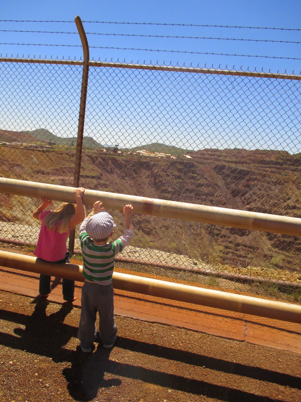
Occasionally we go out to Bisbee. It's a weird little town, built on the side of a canyon 5 miles from Mexico. If you guessed mining town, you nailed it. Bisbee was founded after a rich copper deposit was found, which was then worked and became the Queen Mine. Southeast of downtown Bisbee is the Lavender Pit, an open pit mine that was developed once the high-grade ores played out. The pit and Queen Mine are no longer mined for ore, but you can stop and book a tour and they'll take some of your money and use it to help the place stay open. Last year, there was talk of shutting down the tour. We like to stop at the overlook, get out of the car, and look at the big hole in the ground.
Old town Bisbee is the second most famous town in the county, coming in just after Tombstone. It certainly got the appealing architecture that is hard to find elsewhere in the area. Once the mines shut down, most of the residents boarded up the houses and moved away. Like elsewhere, an artist found out about it and now Bisbee is full of artists, liberals, and other Bohemians. Some of them are a little too weird for me, so if we go we stick to daylight hours only. It's a unique little community. Every fall they have a big race event called the "Bisbee 1000" where racers seek to ascend or descend all of the public staircases in town. The profit from the race is pumped back into the community and used exclusively to help preserve the stairs of Bisbee and fight against the relentless pull of time and gravity.
A few miles west of Bisbee is this small Catholic shrine just off of the north side of the highway. There's a few of them in the area, and since we hadn't stopped before, we said "why not" and stopped for 3 minutes.
One last thing to see in the area is the Mule Pass Tunnel- one of the only highway tunnels in Arizona. It's not that long, but it cuts through the bedrock of Mule Pass at over 5,500 feet elevation. Snowplows park on the west side of the pass- nearly the only place in Cochise County where snowplows are needed, although they are only needed sparingly.
Nearest City: Bisbee, AZ
Location: Bisbee, AZ
Time Needed: Varies
Difficulty: Easy
Kid Friendly: Varies
Additional Info:
Wednesday, September 17, 2014
Confederates vs Indians at Dragoon Springs Station
On Labor Day Weekend we headed east to the Chiricahua Mountains for a getaway. On the way we had one important stop to make at Dragoon Springs. I like to think that I'm pretty good at digging up unique and random sites that are worth visiting, so when I heard about Dragoon Springs I just had to visit it. I was just surprised though that it took me a year and a half to learn about it. We turned off of I-10 at the Dragoon Exit, then drove to the small town of Dragoon before turning off to drive a few miles on dirt roads to find the Dragoon Springs Stage Station.
Along the way we saw a few roadrunners. It's beautiful out here in the foothills of the Dragoon Mountains.
We found our turnoff, then parking area, and a short time later we were at the ruins of the Dragoon Springs Stage Station. The ruins themselves are worth a visit just because it's always fun to think about what traveling in the old west was really like. I personally think they way the depict it in movies is actually better than it was in real life. It would be a tough drive over roads that are just barely better than trails, then camping or staying at stage stations that were not much more than a room and a corral for the horses or mules. But, the stage station was not strictly what we came to visit.
Just north of the stage station are several graves. Not just any graves, but the graves of Confederate Soldiers from the Civil War. I was somewhat incredulous when I heard about them at first, but sure enough, they're there with Confederate flags and grave markers to boot! How'd they get here? In 1862 a band of Confederates had a run in with Apache Warriors when the Apaches stole much of their stock. The Indians got the best of round 1 and took most of the Confederate's horses and killed 4 of the Confederates. It's become a small footnote in history as it wasn't a significant engagement of the Civil War. What's fascinating though it that it is one of Arizona's Civil War sites and the furthest west casualties of the Confederate States of America during the Civil War. It's also one of the few skirmishes where Confederates and Indians fought. Round 2 went to the Confederates when they recovered their livestock and killed several Apaches a short time later.
Here's a sign at the site giving more detail to the history. It's a unique location that's well worth visiting.
Nearest City: Dragoon, AZ
Location: Take the road immediately south of the train tracks in "downtown" Dragoon and head west. The dirt road will curve to the south. Turn east on the side road when you see a sign for Jordan Canyon and the Stage Station. Drive 1 mile and park at the sign, then take a short stroll to the northeast to the stage station and graves.
Time Needed: 1 hour
Difficulty: easy. The most difficult part is the drive as the road is better with a little clearance on your vehicle.
Kid Friendly: Yes
Additional Info:
Subscribe to:
Posts (Atom)