About Us

Saturday, May 31, 2014

Petrified Forest National Park

The week before Memorial Day we took a trip to Northern Arizona.  The last time I'd taken a whole week off of work was back in 2012 when we took a long trip to Oregon to visit friends.  Our plan was to visit the Petrified Forest, Grand Canyon, and numerous other points along the way.  We prepared most of what we needed over the course of the week leading up to the trip, did some final packing and loading on Friday after work, and were off!  The plan was to drive for several hours, then find a place to camp somewhere between Globe and Show Low.  A few miles past Globe, we saw the sign for the Jones Water Campground, so we pulled in and found a nice primitive sight, and crashed for the night.  
After breakfast in the morning, we loaded up, drove through Show Low, then on to Petrified Forest National Park!   My wife had been wanting to visit the Petrified Forest for a long time- at least since we lived in Fort Collins, Colorado.  We went in the South Entrance, then stopped at the visitor center to look at the museum and to take a short hike there out among the agatized wood chunks that litter the ground.   The small museum had several exhibits, the best being one of showing the example of several fossils that have been found at Petrified Forest National Park.  My favorite was this flying dinosaur.
The colors in the petrified wood are beautiful.  I've found petrified wood before, but it's mostly been browns and blacks.  The wood here is all sorts of reds, yellows, browns, and other colors. 

The area the park is now used to be slow winding streams and rivers.  As the trees died, they'd fall into the river, then get buried in the silt and sand.  Over the course of 200 million years or so, the cells in the tree would be replaced with stone, leaving the petrified logs.  Initially, the logs mostly start out whole, but as they erode out of the hillside and lose the support beneath them, they fracture into smaller pieces. 
Behind the visitor center as we were hiking around one of the kids noticed this collared lizard on one of the logs.  It made a great picture, so of course we had to try and capture it "on film".  The lizard posed quite nicely, but I'm sure a nicer camera would have captured it a little better than I did. 
We soon drove up the road for 5 miles or so to the Crystal Forest- the most abundant location of petrified wood in the park.  Pieces and logs of petrified wood were scattered across the ground.  There weren't just large pieces, but the dark areas in the picture below are where the ground is covered in smaller pieces of petrified wood.


We thought this log was pretty cool how it has broken into several similar sized pieces.  After the hike at the Crystal Forest, the youngest needed a nap. 
We drove around the Blue Mesa, where the banding in the badlands is really pretty.  The color differences are attributed to differing oxygen levels when the sediment in the different layers settled.

We stopped by Newspaper Rock for a complete disappointment.  The area where the petroglyphs are is fenced off and you can only view them from a long ways away.  If you're planning on visiting Petrified Forest, don't waste your time at Newspaper Rock.  You can't see anything really that good, and the petroglyph of the crane eating the frog is located at the Puerco Pueblo ruins anyway.  I really liked the Puerco Pueblo ruins.  You can see several of the rooms of the pueblo, as well as numerous petroglyphs. 
The heron or crane eating the frog is probably the most famous petroglyph in Petrified Forest National Park.  I thought it was really unique.  Puerco Pueblo is definitely one of the best things to see at the Petrified Forest.
Another nearby petroglyph reminded me of the tlalocs we saw at Hueco Tanks.  I really liked a solar calendar petroglyph that was there at Puerco Pueblo too, but didn't get a good picture of it. 
We finished our visit with stop at Route 66,  a view of the Painted Desert, then a stop at the visitor center on the North end of the park.

As it would happen, the Petrified Forest was one of the many highlights of our Northern Arizona trip.  We spent about a day wandering the park and found it about enough time to see what we wanted to see, but not enough to make us feel rushed. 

Nearest City: Holbrook, AZ
Location: N° W°
Time Needed: At least one day
Difficulty: Easy
Kid Friendly: Yes
Additional Info: Petrified Forest National Park

Thursday, May 15, 2014

Hiking up Carr Peak

I've been wanting to climb a peak in the Huachucas for a while.  Miller Peak was my desired destination, as it is the highest peak in the Huachuca Mountains, but my babysitter fell through, so I changed to Carr Peak so I could haul the kids and family up there with me.  We thought about camping up Carr Canyon, but ultimately decided to stay home so we could get a few things done that have been lingering on the "to do" list for too long.  I worked on building the strongback for my canoe while my wife sewed some adventure vests for the kids.  We also played a little phone tag while some friends deliberated about coming with us.  Ultimately, it would end up being just a family hike.  We got to the trailhead about 9 AM, finished getting everything in order for the hike, then headed up the trail. 
We left Sierra Vista about 8:15 and got to the trailhead about 8:45. At the trailhead at the end of the road, located near the Ramsey Vista Campground, we finished getting everything in order for the hike, then headed up the trail shortly after 9. The Carr Canyon Road on top of the reef is at 7200 ft in elevation, making a nice change from the desert floor below.  The trail starts out through the manzanita, passes a small grove of evergreens, then switchbacks up the brush to a grove of aspen trees.  Along the way I hid some pudding cups under an evergreen to serve as motivation for the kids on the return back down.  It was nice to be back in the aspens!  The trees were still really small, having been affected by the Monument Fire a few years back.  The trail soon turned a corner and started circling around the back side of the peak for the final climb to the summit.
The aspen grove on Carr Peak

Upper slopes of Carr Peak with trees burned in the Monument Fire.
The kids were tired but kept pushing on.  We told stories and played games to keep them going.  The wind was really whipping as we left the crest trail to the final 1/3 mile to the summit, so we hiked quickly in order to get into some sort of shelter from the wind at the top.  We made the peak about 3 1/2 hours after we left.  It's 2 3/4 miles to the peak, with a gain of 2000 feet in elevation.  We'd been hiking at the blistering pace of 0.78 mph, but the amazing thing was that the 4 1/2 year old had done it all on her own. 
Carr Peak summits out at 9236 feet.  It's the second highest peak of the Huachuca Mountains (second only to Miller Peak), and the 3rd highest peak in Cochise County.  We enjoyed our 1/2 hour break at the top and the fantastic view.  After we all were sufficiently rested, we loaded back up and hiked down. Along the way, we passed a dirty hiker heading south toward Mexico at a brisk pace.  While I'm not certain, it easily could have been a coyote (the slang name for a human smuggler).  While illegal immigrants use the Huachuca Mountains as a corridor north, they almost exclusively leave people alone as they'd rather avoid seeing you and know that if they mess with a citizen their chances of getting in are drastically reduced.  The pudding cups were fantastic motivators for the 4 1/2 year old, but more games and stories helped pass the time.  We found our stashed pudding cups and enjoyed the chocolate mess the kids created with them.  More stories and games helped the rest of the way down the trail.  We made it back to the car 6 hours after we left- the 4 1/2 year old having hiked every step of the 5.5 miles.  It was a fantastic hike, and a great lesson in doing hard things for the young hiker.  Now I need to go climb Miller Peak!

Nearest City: Sierra Vista, AZ
Location: N° W°
Time Needed: less than 6 hours
Difficulty: moderate
Kid Friendly: reasonably
Additional Info:

Camping and Soaking at the Hot Well Dunes

A soaking pool at the Hot Well Dunes
The first weekend in May we went camping out at the Hot Well Dunes.  We didn't start packing until I got home from work on Friday, so the late start set us back quite a bit.  We drove up to I-10, then east to Bowie.  We got to Bowie in the late dusk and after a short delay while waiting for a train to cross, the rest of our drive was in the dark.  We drove 19 miles on mostly-dirt roads north of Bowie to the Hot Well Dunes.  The road is well signed, so there's not much risk in getting lost if you follow the signs.   There's regulated primitive camping at the dunes, so we drove in, found a spot, and set up for the night listening to the country music blasting from some campers 1/4 mile away.  I didn't even bother putting on the rainfly, so we fell asleep under the endless stars of the desert sky.  There's an official campground there at the dunes, but all of the roads and sites are just camping in the sand.  Camping is pretty much allowed anywhere, but the BLM encourages the use of a few sites by having tables and fire rings out.  A few pit-toilets are available for use as well. 
The drilling rig used to drill the hot well
We woke up at what felt like the crack of dawn.  The sun was up, it was time for everybody to get up!  Sleeping in while camping is hard.  Sleeping in while camping when you have kids is impossible.  I dragged out of my bag got out of the tent, and started boiling water for oatmeal.  The kids started hollering about going potty, so I dragged them out of the tent to help them "take care of business".   Before long the water was done, and everyone was filling their tummies.  After breakfast, we put everyone back in the tent to put on their swimming suits to go to the hot springs.
We drove 1/2 mile down the road, and parked at the hot well.  Surprisingly, nobody else was there.  The BLM has the well pump on solar panels, so there is only water in the pools in the daylight hours.  As we got there, the pools were just filling. The water is about 106* and is a delightful soak.  The two pools are well kept, and the area is fenced off to keep ATVs out of the immediate area. 
We soaked for nearly an hour, first in the eastern pool, then we moved to the western pool to take advantage of the shade of some big cottonwoods that are between them.  I'm sure in the afternoon, the pools on the east are shaded and probably preferable.  We eventually dragged ourselves out of the pool and toweled off and headed back to camp to change into dry clothes and play in the sand.  On the way we stopped and looked at the drilling rig just west of the fenced off pool area to look at the rig used to drill the well.  The well was drilled in something like 1928 by some folks looking for oil.  1/4 mile down, they struck a pocket of hot water that's been flowing ever since. 

A cardinal at the Hot Well Dunes


Nearest City: Bowie, AZ
Location: N° W°
Time Needed: Several hours
Difficulty: easy
Kid Friendly: yes (no nudity allowed at the hot springs)
Additional Info: http://www.blm.gov/az/st/en/prog/recreation/camping/hot_well.html

Tuesday, May 6, 2014

Reid Park Zoo: Tucson's Zoo

The last Saturday in April we went to the Reid Park Zoo in Tucson.  A cold front was coming in, so it was nice and cool, a pleasant time instead of dealing with the usual Tucson heat.  One of the first stops was to see the anteaters.  The Tucson Zoo is famous for it's anteater breeding program. 
We liked the noisy green parrots.
The lion cubs were a great hit.
The kids really liked the tall giraffes.
 The flamingos were great to see too.
At the Discovery Center we got to pet a hedgehog.
The peacocks were out in full display as well.  Last time we were here, one of the peacocks stole some banana bread from our little guy and made him sad that they took his treat.  We wandered for a few hours until the front got closer and it started getting cold. 

Nearest City: Tucson, AZ
Location: 22nd St & Alvernon, Tucson, AZ
Time Needed: 1/2 day
Difficulty: easy
Kid Friendly: yes
Additional Info: www.reidparkzoo.org

Monday, May 5, 2014

Several short attractions at Guadalupe Mountains National Park

We visited the Frijole Ranch at Guadalupe Mountains National Park after hiking the Devils Hall Trail.  It's a few miles down the road from the visitor center.  The Frijole Ranch was one of the main locations in the Guadalupe Mountains where people settled, primarily due to the reliable spring that still kicks out water at the rate of 6 gallons a minute. The museum was closed when we visited, but we still enjoyed wandering the grounds.  I liked the gas generator that was between the ranch house and the school house which used carbide to produce oxyacetylene gas which was piped into the house and burned to produce light. 
Out behind the house is an orchard, which was used to supplement the income of the families that lived at the Frijole Ranch.  The fruit must have been a welcome change to the diet of beans (where do you think the Frijole Ranch got it's name?), as well as provided supplemental income.   Most of the orchard has been replanted with numerous varieties of apples, pears, and peaches, along with plums.
We drove to McKittrick Canyon, and along the way saw this rattlesnake in the road.  We drove around it and he was gone when we drove back out.  We didn't hike up McKittrick Canyon because everyone was just too tired.  I'll have to put it at the top of the list the next time I make it out here.
The Pine Springs Stage Station was another quick and easy stop.  You can hike to it from the visitor center, or park in the parking area along the highway.  The stage station was on the Butterfield Stage line and was one of the more desirable stations to live at.  Now it's just ruins.  I thought it would be interesting to see Pine Springs, which the nearby campground was named after, but the springs dried up in the 1930's after an earthquake. 
In mid-April the claret cup cactus were in bloom.  I love their brilliant colors!
One final critter we saw at Guadalupe Mountains National Park was this Texas red-headed centipede.  Everything really is bigger in Texas!  For a point of reference, he's crawling along the back of a curb.  They grow to be 6-8 inches long, but they're not poisonous.

Nearest City: Carlsbad, NM
Location: N° W°
Time Needed: Varies
Difficulty: Varies
Kid Friendly: Yes
Additional Info:

Hiking to Devils Hall at Guadalupe National Park

We did one other hike at Guadalupe National Park.  The Devils Hall hike looked interesting, so we loaded up the kids one morning after breakfast, then walked up to the trailhead from our site in the Pine Springs Campground.  The hike is 4.2 miles round trip, which we figured was doable for our 4 year old.  Plus it had a destination at the end that would be a little motivating.  There was a fairly sizable crowd at the trailhead, most of them going to Guadalupe Peak.  We signed in at the register, then held to the right as the trail split 50 yards from the trailhead.  
The trail goes along the lower slopes of a canyon for about half of the hike.  The desert vegetation different than what you'd find out in the open.  We even saw a few maple trees on the way in. 
About midpoint of the hike, the trail drops down to the streambed, which is then followed for the rest of the hike.  There's no real trail, but there's not really much routefinding either- just follow the streambed, going around and climbing over boulders as you do so. 
 A few of the boulders and rocks have fossils in them.  Actually, Guadalupe National Park was created because of the fossils that are in the remnants of a Permian fossilized reef.  This reef was formed during the same geologic time period that the trackways and footprints at Prehistoric Trackways National Monument were put down. 
At about the 2 mile mark, the banded limestone cliffs start to climb above the stream bed, and after a short opening we arrived at the Devils Hall.  It's a short section where the stream runs through a slot canyonlike  gap in the limestone bedding.  I found it somewhat disappointing as it wasn't as cool as the pictures I'd seen of it made it look.  But that's the advantage and drawback of photography I guess- it can make it look a whole lot better than real life, or fail to remotely capture how awesome a place is. 
We had a picnic at the hall, then packed up and hiked back down the trail.  We met several other hikers on their way in.  We made it back to our camp about 4 1/2 hours later, the 4 year old having hiked the entire way, a little tired at the end, but still under her own power.  I thought it was a decent hike, but wasn't that impressed at the same time.  I guess I've been spoiled by having hiked some of those Utah slot canyons!

Nearest City: Carlsbad, NM
Location: N° W°
Time Needed: 4 hours (kids hiking)
Difficulty: moderately easy
Kid Friendly: so-so
Additional Info:

Carlsbad Caverns National Park: Rattlesnake Springs Section

The filter box at Rattlesnake Springs
After wandering the caves at Carlsbad Caverns, we drove back to the Pine Springs Campground, but on the way we stopped at Rattlesnake Springs.  Rattlesnake Springs is a section of Carlsbad National Park that was acquired primarily as a water source for the park.  The springs are still used for water, but the site is primarily used for picnicking and bird watching.  The springs are contained in a large pond with a filter box in the middle of it, and a pump house sitting on near the bank.  It's a great spot for a leisurely picnic. 

We ate a cantaloupe on the grass and wild mint along the bank of the spring.  Numerous fish are visible in the crystal clear water.  The ones above I think are tilapia, but I also saw bass swimming around.  I would have loved to have my fishing pole for a cast or two, but fishing is not allowed at Rattlesnake Springs. 
There's a large picnic area as you drive in with picnic tables under the large cottonwood trees.  It's a great spot for kids to run around.  As we were leaving, a tour bus full of school kids from Lubbock, TX on a field trip pulled in.  We waved goodbye, glad that we'd had it quieter while we were there.

Nearest City: Carlsbad, NM
Location: N° W°
Time Needed: 1/2 hour
Difficulty: easy
Kid Friendly: yes
Additional Info:

Saturday, May 3, 2014

In the Dark at Carlsbad Caverns National Park

The Natural Entrance
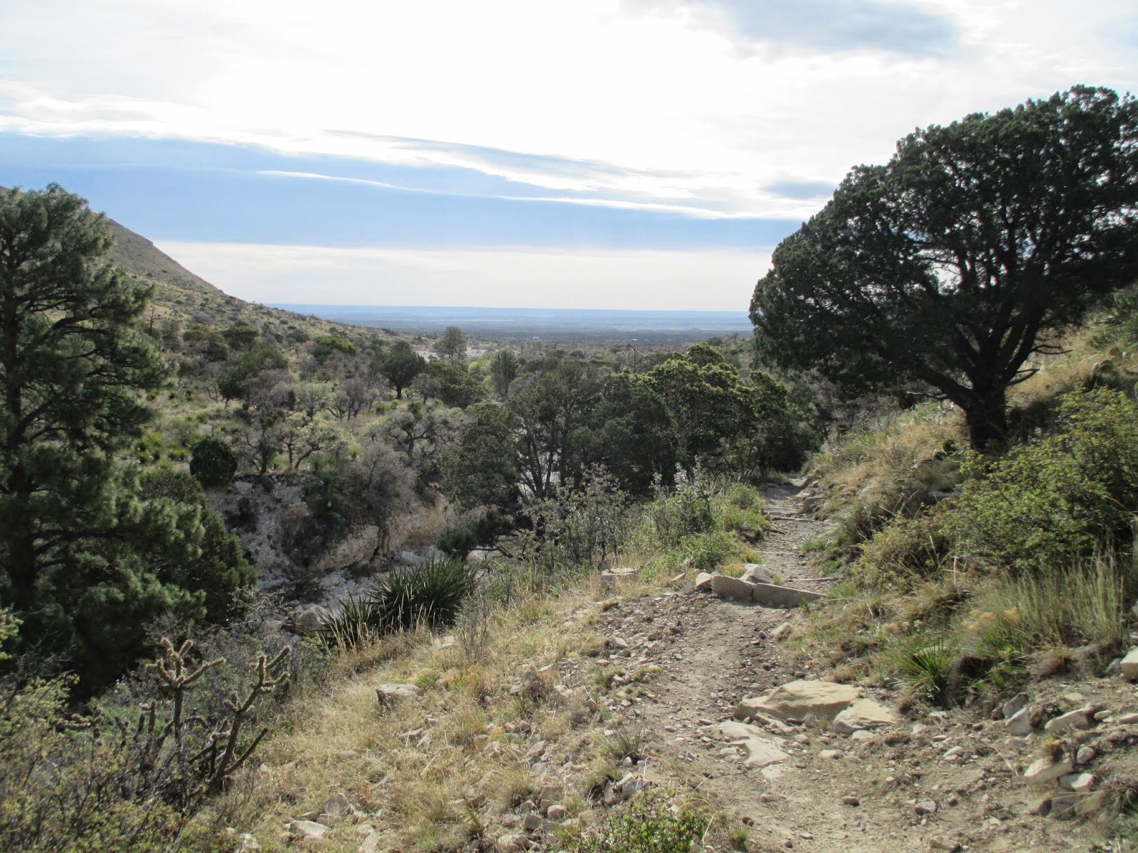
Our Spring Break trip to Carlsbad was pretty awesome.  I can't say it was epic, because nobody died.  But it was a great experience.  After hiking Guadalupe Peak overnight, I was a little bit sore when I awoke, but I still figured I was good enough to go through the caves at Carlsbad.  We drove up from the Pine Springs Campground at Guadalupe National Park, the reasonably closest campground to Carlsbad Caverns, and found the place not that crowded, at least judging from the limited number of cars in the vast parking lot.  I'd heard that Spring Break is a zoo at Carlsbad Caverns, so in searching out a time for the trip, deliberately scheduled it for mid/late April, a week or two after all of the Texas Public Schools have their Spring Breaks.
Pictographs outside the cave entrance at Carlsbad
We picked up our tickets at the ticket counter ($10/adult, or free with a National Parks Pass), then wandered over to the natural entrance.  There are about half a dozen tours at Carlsbad Caverns, but the two most common ways to the cave are through the Natural Entrance or through the elevator.  We took the both ways- more on that later.  After getting a pep-talk from a ranger, along with encouragement to not touch things or spit, or throw things into the pools (and keep your hands inside the ride at all times), we paused at the entrance to look for some pictographs made by Indians before non-Indians discovered the cave.  I found them on the right side of the entrance.  We then proceeded to walk down the switchbacks into the cave.  The steep switchbacks reminded me of Walters Wiggles at Zion National Park.
The Whale's Mouth
The cave is pretty impressive.   The one of the first named features we came to was the Whale's Mouth.  The drapery was pretty impressive.  I had to wonder about what the early explorers saw as they descended into the depths of the cavern.  They had to deal with only the lights on their helmets or torches and must have had a much different experience than the average tourist does today. 
We passed a lot more formations, many of which were just difficult to photograph.  We also saw some wooden stairs that were used for tours before the modern path was installed.  It's a steep, steep path.  No strollers or wheelchairs are allowed down the natural entrance.  I felt like I needed a wheelchair almost.  I gingerly continued onward- my knees complaining for most of the way.  We passed a few intrepid individuals climbing out the natural entrance. 
Overall it's a 750 foot descent to the bottom.  The cave is deeper than that, but they don't do tours there.   The elevator ride takes over a minute, and is guaranteed to make your ears pop from the pressure differential.  We finally made it to the end of the descent.  The kids were tired and needed a break, so we took the elevator up to the top for a snack and some daylight. 
 After lunch, we went back inside and showed our tickets to the ranger operating the elevator and she let us back in via an elevator ride back down to the bottom.  Keep your ticket!  Don't throw it away if you want to take the elevator up and down!  If you've got young kids, definitely keep your tickets! 
Back down at the bottom, we left the elevator lobby, snack bar, and restrooms for a walk through the highly decorated cave. 
The cave is amazing!  There are decorations everywhere!  Most of them are dry/dormant/dead.  But the cave scientists are hopeful, so dead ones are not completely dead and are just dormant. 
I tried taking good pictures, and got a few that are decent, but they are all completely inadequate for conveying how awesome the cave is.  One of the rangers said that the least crowded time at Carlsbad Caverns National Park is between New Years and mid-February.  I think it would be a bit easier to take some stellar shots when there aren't as many people around. 
 One of the most photographed features in the cave is the Totem Pole. 
We also saw an old rope ladder descending into the pit leading to the lowest levels of the cave.  Nearby in the big room there was another rope- this one hanging from the ceiling.  The single rope hanging from the ceiling was used to discover new passages located at a previously inaccessible area of the cave.
More stalactites and columns.  Amazing stuff.  The cave is pretty temperature stable, so a light jacket is desirable for some people.  I did fine without one though. 
These draperies are not lit by the tour lights, but they caught my eye.  It is amazing that these are stone instead of cloth!  Overall, I thought the lighting at Carlsbad was very tastefully done.   The early explorers must have had a very different experience then we did.  I felt a little envious of them, but at the same time thought that I probably got a better overall view of the cave since they only had the light from their carbide lamps to go off of.  As we neared the end of loop the kids were again tired, so even  though I could have stayed until we got kicked out, we trudged to the elevators and the 1 minute ride to daylight.
The Visitor Center has a model showing the cave and the route of the tours.  The visitor center is shown at the top, and the elevators are shown with a clear plastic tube.  Tour routes are shown by the black lines. 

I was blown away by Carlsbad Caverns.  They are absolutely worth visiting.  We spent just over half a day and could have spent longer.  But half a day is about all that a 4 year old could take (walking the whole way on her own), so I was content with that.  If you're contemplating visiting Carlsbad Caverns- make it happen.  Do it. 

Nearest City: Carlsbad, NM
Location: N° W°
Time Needed: 1/2 day plus!
Difficulty: varies.  Natural entrance- strenuous.  Elevator route- easy
Kid Friendly: Yes
Additional Info: