We visited the Frijole Ranch at Guadalupe Mountains National Park after hiking the Devils Hall Trail. It's a few miles down the road from the visitor center. The Frijole Ranch was one of the main locations in the Guadalupe Mountains where people settled, primarily due to the reliable spring that still kicks out water at the rate of 6 gallons a minute. The museum was closed when we visited, but we still enjoyed wandering the grounds. I liked the gas generator that was between the ranch house and the school house which used carbide to produce oxyacetylene gas which was piped into the house and burned to produce light.
Out behind the house is an orchard, which was used to supplement the income of the families that lived at the Frijole Ranch. The fruit must have been a welcome change to the diet of beans (where do you think the Frijole Ranch got it's name?), as well as provided supplemental income. Most of the orchard has been replanted with numerous varieties of apples, pears, and peaches, along with plums.
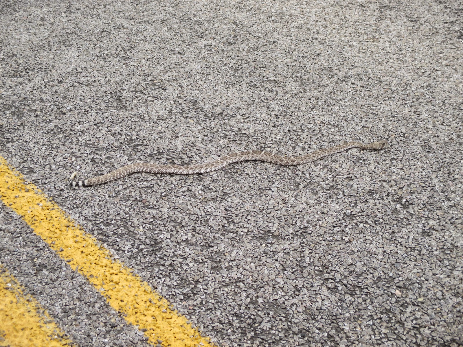
We drove to McKittrick Canyon, and along the way saw this rattlesnake in the road. We drove around it and he was gone when we drove back out. We didn't hike up McKittrick Canyon because everyone was just too tired. I'll have to put it at the top of the list the next time I make it out here.
The Pine Springs Stage Station was another quick and easy stop. You can hike to it from the visitor center, or park in the parking area along the highway. The stage station was on the Butterfield Stage line and was one of the more desirable stations to live at. Now it's just ruins. I thought it would be interesting to see Pine Springs, which the nearby campground was named after, but the springs dried up in the 1930's after an earthquake.
In mid-April the claret cup cactus were in bloom. I love their brilliant colors!
One final critter we saw at Guadalupe Mountains National Park was this Texas red-headed centipede. Everything really is bigger in Texas! For a point of reference, he's crawling along the back of a curb. They grow to be 6-8 inches long, but they're not poisonous.
Nearest City:
Carlsbad, NM
Location: N° W°
Time Needed:
Varies
Difficulty:
Varies
Kid Friendly:
Yes
Additional Info:
Our random, yet highly entertaining, romp through the highly visited and less explored parts of life. Comments with additional information are also welcomed, as are questions looking for more information. If you like my blog or it was useful to you, please comment!
Showing posts with label Texas. Show all posts
Monday, May 5, 2014
Hiking to Devils Hall at Guadalupe National Park
We did one other hike at Guadalupe National Park. The Devils Hall hike looked interesting, so we loaded up the kids one morning after breakfast, then walked up to the trailhead from our site in the Pine Springs Campground. The hike is 4.2 miles round trip, which we figured was doable for our 4 year old. Plus it had a destination at the end that would be a little motivating. There was a fairly sizable crowd at the trailhead, most of them going to Guadalupe Peak. We signed in at the register, then held to the right as the trail split 50 yards from the trailhead.
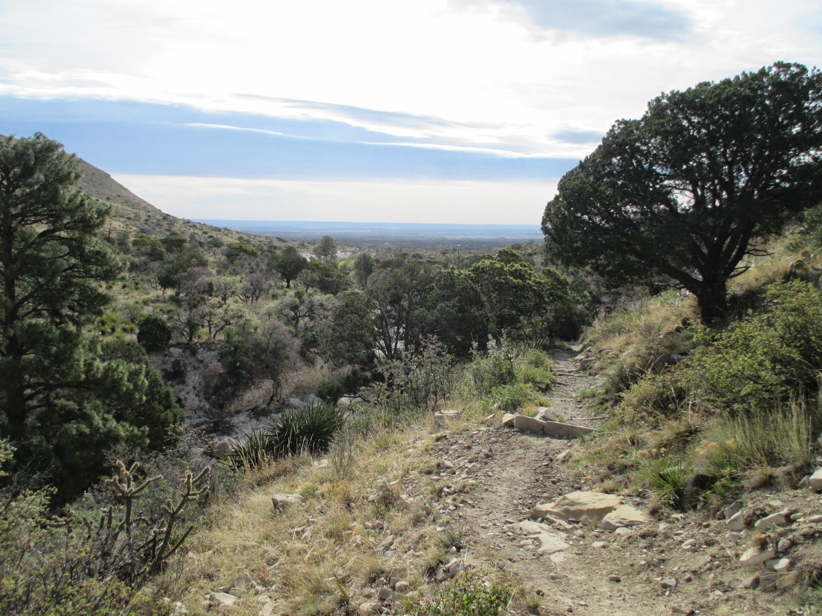
The trail goes along the lower slopes of a canyon for about half of the hike. The desert vegetation different than what you'd find out in the open. We even saw a few maple trees on the way in.
About midpoint of the hike, the trail drops down to the streambed, which is then followed for the rest of the hike. There's no real trail, but there's not really much routefinding either- just follow the streambed, going around and climbing over boulders as you do so.
A few of the boulders and rocks have fossils in them. Actually, Guadalupe National Park was created because of the fossils that are in the remnants of a Permian fossilized reef. This reef was formed during the same geologic time period that the trackways and footprints at Prehistoric Trackways National Monument were put down.
At about the 2 mile mark, the banded limestone cliffs start to climb above the stream bed, and after a short opening we arrived at the Devils Hall. It's a short section where the stream runs through a slot canyonlike gap in the limestone bedding. I found it somewhat disappointing as it wasn't as cool as the pictures I'd seen of it made it look. But that's the advantage and drawback of photography I guess- it can make it look a whole lot better than real life, or fail to remotely capture how awesome a place is.
We had a picnic at the hall, then packed up and hiked back down the trail. We met several other hikers on their way in. We made it back to our camp about 4 1/2 hours later, the 4 year old having hiked the entire way, a little tired at the end, but still under her own power. I thought it was a decent hike, but wasn't that impressed at the same time. I guess I've been spoiled by having hiked some of those Utah slot canyons!
Nearest City: Carlsbad, NM
Location: N° W°
Time Needed: 4 hours (kids hiking)
Difficulty: moderately easy
Kid Friendly: so-so
Additional Info:
The trail goes along the lower slopes of a canyon for about half of the hike. The desert vegetation different than what you'd find out in the open. We even saw a few maple trees on the way in.
About midpoint of the hike, the trail drops down to the streambed, which is then followed for the rest of the hike. There's no real trail, but there's not really much routefinding either- just follow the streambed, going around and climbing over boulders as you do so.
A few of the boulders and rocks have fossils in them. Actually, Guadalupe National Park was created because of the fossils that are in the remnants of a Permian fossilized reef. This reef was formed during the same geologic time period that the trackways and footprints at Prehistoric Trackways National Monument were put down.
At about the 2 mile mark, the banded limestone cliffs start to climb above the stream bed, and after a short opening we arrived at the Devils Hall. It's a short section where the stream runs through a slot canyonlike gap in the limestone bedding. I found it somewhat disappointing as it wasn't as cool as the pictures I'd seen of it made it look. But that's the advantage and drawback of photography I guess- it can make it look a whole lot better than real life, or fail to remotely capture how awesome a place is.
We had a picnic at the hall, then packed up and hiked back down the trail. We met several other hikers on their way in. We made it back to our camp about 4 1/2 hours later, the 4 year old having hiked the entire way, a little tired at the end, but still under her own power. I thought it was a decent hike, but wasn't that impressed at the same time. I guess I've been spoiled by having hiked some of those Utah slot canyons!
Nearest City: Carlsbad, NM
Location: N° W°
Time Needed: 4 hours (kids hiking)
Difficulty: moderately easy
Kid Friendly: so-so
Additional Info:
Wednesday, April 23, 2014
Guadalupe Peak: Night Hike to the Top of Texas
| East Face Switchbacks from the Pine Springs Campground |
We dragged into the Pine Springs Campground about 4:30 on a Thursday afternoon. The drive between Hueco Tanks and Guadalupe National Park being the right time and duration for the kids to get a good nap in on the way. Surprisingly, the campground was about 75% full. We found a site that required a short walk of about 100 yards to get to, paid our $8/night fee, and started hauling in gear. We set up camp, ate dinner, and wandered around a little bit. I got everything ready for the hike then it was time for bed. I set an alarm for midnight then dozed off. I ended up waking up before the alarm due to some other campers wandering around outside. I knew that getting back to sleep was not an option since I was ramped up and eager to go, so I kissed my wife then crawled out of the tent- taking care to not wake the kids. A short hike to the trailhead, then I was on my way!
I hiked for a short while only guided by the light of the moon, but then thoughts about cougars and a friend who almost stepped on a rattlesnake while hiking at night convinced me to pull it out and turn it on. Mentally, I had divided the hike into 4 sections: The east face, the south side of the canyon, on top of the ridge to the campground turnoff, then the final push to the peak. The first 1/4 mile was brutal. It always is on every hike as I seek to establish a good hiking pace. Along the way small bits of light along the trail blinked at me- the spiders were out doing their hunting. I felt good other than burning lungs, and after a while reached the point where the east switchbacks were done as I rounded the bend to the south side of the canyon wall. Hiking at night has some great advantages. It's quiet, it's not crowded, and you avoid the heat of hiking during the day. It also has some drawbacks, namely being that you miss out on the fantastic views that you have in the daytime. Pretty much all of my hike looked like the picture above- a small area illuminated by my headlamp, surrounded by darkness.
The north side of the shoulder of Guadalupe Peak doesn't have the switchbacks that the east face does and also has some pines and evergreens. I pressed on, occasionally pulling out my camelbak for a quick swallow of water. I could rest when I was done, but I wanted to hurry on. I kept wondering about when I would make it to the top of the shoulder and finish the second part of my hike, but the trail never crested the ridge, and before too long I was at the turnoff to the campground. I had estimated wrongly- the trail would be best divided into three sections. I didn't mind because it meant that I only had a mile left to go. Shortly after the campground turnoff, I crossed the famous bridge. The bridge spans a small dropoff along a cliff, and happens to be the highest bridge in Texas. I pulled out the camera for a quick picture and quickened my pace. The trail soon zigzagged before me, steadily climbing to the top.
I finally reached the summit of Guadalupe Peak an hour and 40 minutes after I started hiking. 4.2 miles and 3000 feet in elevation. It was a brutal pace, but it sure was nice to get to the top! The top is 8,749 feet above sea level. It's marked by a unique monument placed by American Airlines. I sat down, signed the summit register, and had a quick handful or two of dried fruit. It was amazing looking off in the distance at the lights, but the pictures didn't turn out. I thought about the last long solo hike I had done to an airplane crash site in Utah.
Looking at the monument, it was pretty self promoting. American Airlines placed it to commemorate the stagecoach drivers who helped open the west and made a comparison to themselves. The wind was blowing pretty steadily, so rather then ponder the plaque at the top, I strapped my backpack back on and started back down the trail. The elevation dropped rapidly as I passed familiar landmark after familiar landmark. My knees were pretty tired by the time I turned the corner onto the east face, but by then the lights in the campground below beckoned me onward. As I decended, the spiders once again started to appear here and there along the trail. I hadn't noticed their lights blinking as I was higher up. I staggered to the trailhead and checked the time. It took me 3 hours and 5 minutes to hike Guadalupe Peak round trip. It was a blistering pace, but I made it! I stopped by the water spigot and dumped some cold water on my feet to cool off the hot spots. It felt great finally taking a break. I pulled my wet socks back on, didn't bother tying my shoes, then staggered down to the campground and my tent. I checked in with my wife with a hug and a cuddle and was out until morning.
Nearest City:
Location: N° W°
Time Needed: The National Park Service says to plan on 6-8 hours roundtrip.
Difficulty: Strenuous
Kid Friendly: No
Additional Info:
Saturday, April 19, 2014
Tours and relics at Hueco Tanks
Ah, Spring Break, the much anticipated delight of school children everywhere! We planned a Spring Break trip for ourselves on April 9-13, purposefully avoiding everyone else's spring break. We wanted to visit Carlsbad Caverns, climb Guadalupe Peak (the highest point in Texas), and visit Hueco Tanks. Eric at The Continuing Adventures of Eric and Noelle used to be a ranger at Carlsbad and said to avoid Spring Break if we could, so we took him up on his advice and had a near-perfect trip. We took off after work on Wednesday, drove to Las Cruces for the night, then continued on to Hueco Tanks. We had called ahead to reserve spots on a guided tour of the pictographs, and arrived about 10:15 for a 10:30 tour. The tour we went on was I believe Tour #2 around the West section of the park. We met at the small interpretive center / museum just after the guard station. There are a few ruins nearby of an old Butterfield Stage Station. After everyone was ready to go, we drove over to a parking area near a dam on the west side and began our hike.
We walked over the dam, placed there to hold water for a golf course which fortunately never materialized and took a quick detour to the "puking horse" pictograph. I've never seen a horse puke, but the pictograph was interesting.
Our next stop was at the largest of the mask pictographs at Hueco Tanks. Hueco Tanks is famous for it's rock art and it's rock climbing. There are mostly pictographs, paintings on rocks, here but there are a few petroglyphs, carving into rocks, here as well. After a few pictures, our tour guide continued on to the most famous pictograph at Hueco Tanks- the Starry Eyed Man.
The Starry Eyed Man is famous for it's green pigments. Most pictographs that you'll see are either red, brown, or black. The Starry Eyed Man is the only known pictograph in Texas with green pigment. Utah also has a few pictographs with green pigment in Grand Gulch, but they are uncommon. The Starry Eyed Man is located on a slanted ceiling, about 8 feet off of the ground. It's amazing how well preserved it is.
We then hiked through Tlalac Pass and detoured into a small alcove hidden by an oak tree. The alcove has been well used- grinding holes and mutates cover about half of the floor, and on the ceiling is a large tlalac, or Rain God Pictograph. All of the tlalacs have the zigzag motif, and many of them have heads. We would end up seeing 3-4 more tlalacs on our tour.
Across the trail we scrambled up to another enclosure among the boulders. This one was bigger, but not as protected and was a low class-4 scramble to get to. Again, pictographs adorned the ceiling.
I was struck by the desert beauty of Hueco Tanks. It's a beautiful spot! Hueco means hollow, so Hollow Tanks. These hollow tanks scattered throughout the area were a reliable source of water that have drawn people to the area for centuries.
Our tour guide at this point took a vote- go back and see another spot or two, or continue on to the Cave of the Masks and a couple other pictographs. No contest- we all determined to continue on! Along the way the kids started to drag, so I had to be "as strong as an ox" and carry them for about half of it. On the way to Cave of the Masks, we passed a crew of local inmates working on trail improvements. The law enforcement brings out some supervised inmates to work on trails and improve other areas of the park. We waved hello and kept hiking. The decision to continue to Cave of the Masks was worth it. There several more outstanding pictographs in the hollow in the rock, including the smallest known mask at Hueco Tanks. Again cameras came out.
The Cave of the Masks was the last scheduled stop on our tour, but ended up not being the last surprise. As we were walking along the side of the dirt road back to the vehicles, I glanced down and saw a small piece of turquoise in the sand. As I stopped to pick it up, I noticed a small hole drilled in it. Sweet! The turquoise, about half the size of a dime was once part of a necklace worn by perhaps one of the pictograph creators. We took pictures, and documented where it was, perhaps to be collected later by Hueco Tanks Park Rangers and added to the on-site museum. Hopefully something cool is done with it! The turquoise sparked a conversation with the tour guide about artifacts and how sad it is how many of them are filed away for the professionals and never really seen again. Many years ago a team of archeologists from the University of Texas came to Hueco Tanks and did some excavations of pit houses and found a few graves. The items they collected now in Austin "in a cardboard box" to quote the guide. A few years ago someone from the University of Texas said they'd bring some back to Hueco Tanks to put on display, but they still haven't acted on it. Hueco Tanks is an amazing place. I concur with the guide and wish the on-site museum did have more of an archeology exhibit to show a glimpse of what went on here.
Nearest City: El Paso, TX
Location: N° W°
Time Needed: we spent 5 hours and it was not nearly enough time. Maybe next time we'll have to camp here.
Difficulty: Easy- Moderate
Kid Friendly: Yes
Additional Info: A gentleman on the tour mentioned an abundance of petroglyphs at Alamo Mountain, someplace nearby. I haven't heard of Alamo Mountain, but it sounds like a pretty cool place.
We walked over the dam, placed there to hold water for a golf course which fortunately never materialized and took a quick detour to the "puking horse" pictograph. I've never seen a horse puke, but the pictograph was interesting.
Our next stop was at the largest of the mask pictographs at Hueco Tanks. Hueco Tanks is famous for it's rock art and it's rock climbing. There are mostly pictographs, paintings on rocks, here but there are a few petroglyphs, carving into rocks, here as well. After a few pictures, our tour guide continued on to the most famous pictograph at Hueco Tanks- the Starry Eyed Man.
The Starry Eyed Man is famous for it's green pigments. Most pictographs that you'll see are either red, brown, or black. The Starry Eyed Man is the only known pictograph in Texas with green pigment. Utah also has a few pictographs with green pigment in Grand Gulch, but they are uncommon. The Starry Eyed Man is located on a slanted ceiling, about 8 feet off of the ground. It's amazing how well preserved it is.
We then hiked through Tlalac Pass and detoured into a small alcove hidden by an oak tree. The alcove has been well used- grinding holes and mutates cover about half of the floor, and on the ceiling is a large tlalac, or Rain God Pictograph. All of the tlalacs have the zigzag motif, and many of them have heads. We would end up seeing 3-4 more tlalacs on our tour.
Across the trail we scrambled up to another enclosure among the boulders. This one was bigger, but not as protected and was a low class-4 scramble to get to. Again, pictographs adorned the ceiling.
I was struck by the desert beauty of Hueco Tanks. It's a beautiful spot! Hueco means hollow, so Hollow Tanks. These hollow tanks scattered throughout the area were a reliable source of water that have drawn people to the area for centuries.
Our tour guide at this point took a vote- go back and see another spot or two, or continue on to the Cave of the Masks and a couple other pictographs. No contest- we all determined to continue on! Along the way the kids started to drag, so I had to be "as strong as an ox" and carry them for about half of it. On the way to Cave of the Masks, we passed a crew of local inmates working on trail improvements. The law enforcement brings out some supervised inmates to work on trails and improve other areas of the park. We waved hello and kept hiking. The decision to continue to Cave of the Masks was worth it. There several more outstanding pictographs in the hollow in the rock, including the smallest known mask at Hueco Tanks. Again cameras came out.
The Cave of the Masks was the last scheduled stop on our tour, but ended up not being the last surprise. As we were walking along the side of the dirt road back to the vehicles, I glanced down and saw a small piece of turquoise in the sand. As I stopped to pick it up, I noticed a small hole drilled in it. Sweet! The turquoise, about half the size of a dime was once part of a necklace worn by perhaps one of the pictograph creators. We took pictures, and documented where it was, perhaps to be collected later by Hueco Tanks Park Rangers and added to the on-site museum. Hopefully something cool is done with it! The turquoise sparked a conversation with the tour guide about artifacts and how sad it is how many of them are filed away for the professionals and never really seen again. Many years ago a team of archeologists from the University of Texas came to Hueco Tanks and did some excavations of pit houses and found a few graves. The items they collected now in Austin "in a cardboard box" to quote the guide. A few years ago someone from the University of Texas said they'd bring some back to Hueco Tanks to put on display, but they still haven't acted on it. Hueco Tanks is an amazing place. I concur with the guide and wish the on-site museum did have more of an archeology exhibit to show a glimpse of what went on here.
Nearest City: El Paso, TX
Location: N° W°
Time Needed: we spent 5 hours and it was not nearly enough time. Maybe next time we'll have to camp here.
Difficulty: Easy- Moderate
Kid Friendly: Yes
Additional Info: A gentleman on the tour mentioned an abundance of petroglyphs at Alamo Mountain, someplace nearby. I haven't heard of Alamo Mountain, but it sounds like a pretty cool place.
Thursday, December 16, 2010
San Antonio: The Alamo
My second touristy stop in San Antonio was to the Alamo. I'd heard tales about it all my life, and had seen a few movies as well about Davey Crockett, Jim Bowie, and Col. Travis blockading themselves in the old church before facing off against Santa Anna and his forces.
It was closed the first time I went. The second time, I had 10 minutes to walk around and grab a few pictures before being asked to leave because they were closing for the night.
What a pretty spot!

It was closed the first time I went. The second time, I had 10 minutes to walk around and grab a few pictures before being asked to leave because they were closing for the night.
What a pretty spot! 

Out in front is a bronze line in the plaza, supposedly where Colonel Travis unsheathed his sword, drew a line in the sand, then asked all who wished to join him to come over to his side and left the remainder to go free.
I definitely want to come back and spend more time!
Nearest City:San Antonio, TX
GPS Coordinates:
Time Needed: 60-90 minutes
Difficulty: Easy
Kid Friendly: Yes
Additional Info: The Alamo closes at 5:30 PM.
San Antonio: The Riverwalk
I had a business trip to Texas the early part of the week, so in the evening I was able to do a little sight-seeing. The first stop was the Riverwalk to see the Christmas lights. The whole area is a very well done "riverfront" on the San Antonio River. Walking paths extend along both sides of the river, with countless nooks, crannys, bridges, and things to see. Here are a few pictures:


Subscribe to:
Posts (Atom)