While doing some preliminary research on our trip to Arkansas, I found a tasty little spot we had to experience for ourselves. In Northern Arkansas on Bull Shoals Lake, there is a ferry. A free ferry. Yes please! We cut our visit to the Buffalo National River a tad bit short so we could make it to the ferry before it did its last run for the day. The road between the Tyler Bend visitor center and the Peel ferry was just about as crooked as could be. The bends this way and that way got to be rather taxing, and we were fortunate that nobody got car sick. A time or two I had to slow way down though or I'm sure bad things would have happened.
Finally, after a bajillion bends and turns, we reached the end of the road. Beyond the ferry dock was the blue open water of Bull Shoals Lake. A sign told us to put the car in park and wait for the ferry, so we did. The Peel Ferry is the last free ferry in the Arkansas State Highway system. It's somewhat out in the boonies, and the decision had been made at one point or another to keep the ferry instead of build a bridge. I guess for the (limited) amount of traffic the highway gets, it's more economical to operate a ferry then it is to build and maintain a bridge. This Arkansas Highways article does a great job of telling more about the ferry. We just watched it as it came closer and closer, until it was our turn for a ride.
We drove on to the ferry, put the car in park, and after they'd left the dock we were free to get out and wander around for the 20 minute ride. We looked over the edge, talked with one of the ferry operators, and asked him a few questions. He patiently listened to the kids questions and answered them at a level they would understand. Then it was my turn for my only question. Before we knew it, it was time to get back in the car and continue on into Missouri. If you're wondering what my question was, I'll tell you the answer. No, they can't fish while they are working.
Nearest City:
Peel, AR
Location: Highway 125 by Peel, Arkansas
Time Needed: 20 minutes to cross
Difficulty:
easy
Kid Friendly:
yes
Additional Info: Arkansas.com page on the Peel Ferry
Our random, yet highly entertaining, romp through the highly visited and less explored parts of life. Comments with additional information are also welcomed, as are questions looking for more information. If you like my blog or it was useful to you, please comment!
Showing posts with label Arkansas. Show all posts
Friday, July 24, 2015
Having a great time at the Buffalo National River
After leaving Little Rock late, we drove north for the Buffalo River. In Marshall, we turned off Highway 65 and on to Highway 27. We had reviewed the map and planned to camp at the Woolum primitive campsite and river access, but since it was late, I didn't pay that much attention, and after driving for a lot longer than we intended to, we pulled out the map again. I should have continued up Highway 65 to get where I wanted to go, but since we'd doglegged east, the Spring Creek river access and primitive camp area looked pretty appealing to me. We turned off the highway and on to a dirt road, passed a few cabins, then slowly descended for 3 miles or so to the Spring Creek camp area. I shined my headlights around briefly, saw a spot that looked good enough, put the Subaru in park then turned off the ignition. The tent went up quickly, and I was asleep.
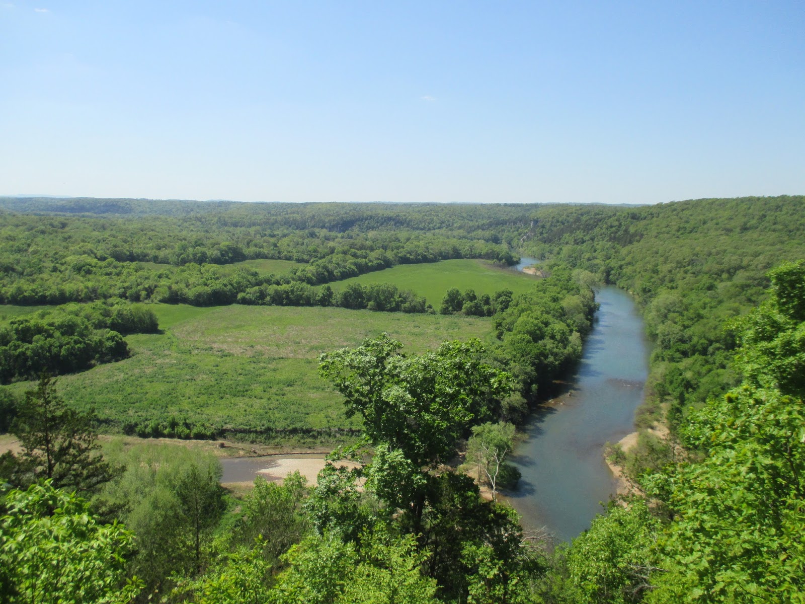
I woke up early, like usual, and couldn't resist leaving the tent. I've always liked maps, and on more than one occasion I had eyed the Buffalo National River and wondered what it would be like. Since I was finally there I couldn't stay inside any longer. I needed to see what the Buffalo River was all about. I padded quietly down the road to the misty river. Wow! The Buffalo River at first glance is amazing! The cool blue-tinged water rushes eastward through tall hills with an occasional cliff or rock outcropping. Long blue pools separated by choppy fast water runs repeat until the river disappears in the morning fog behind a distant bend.
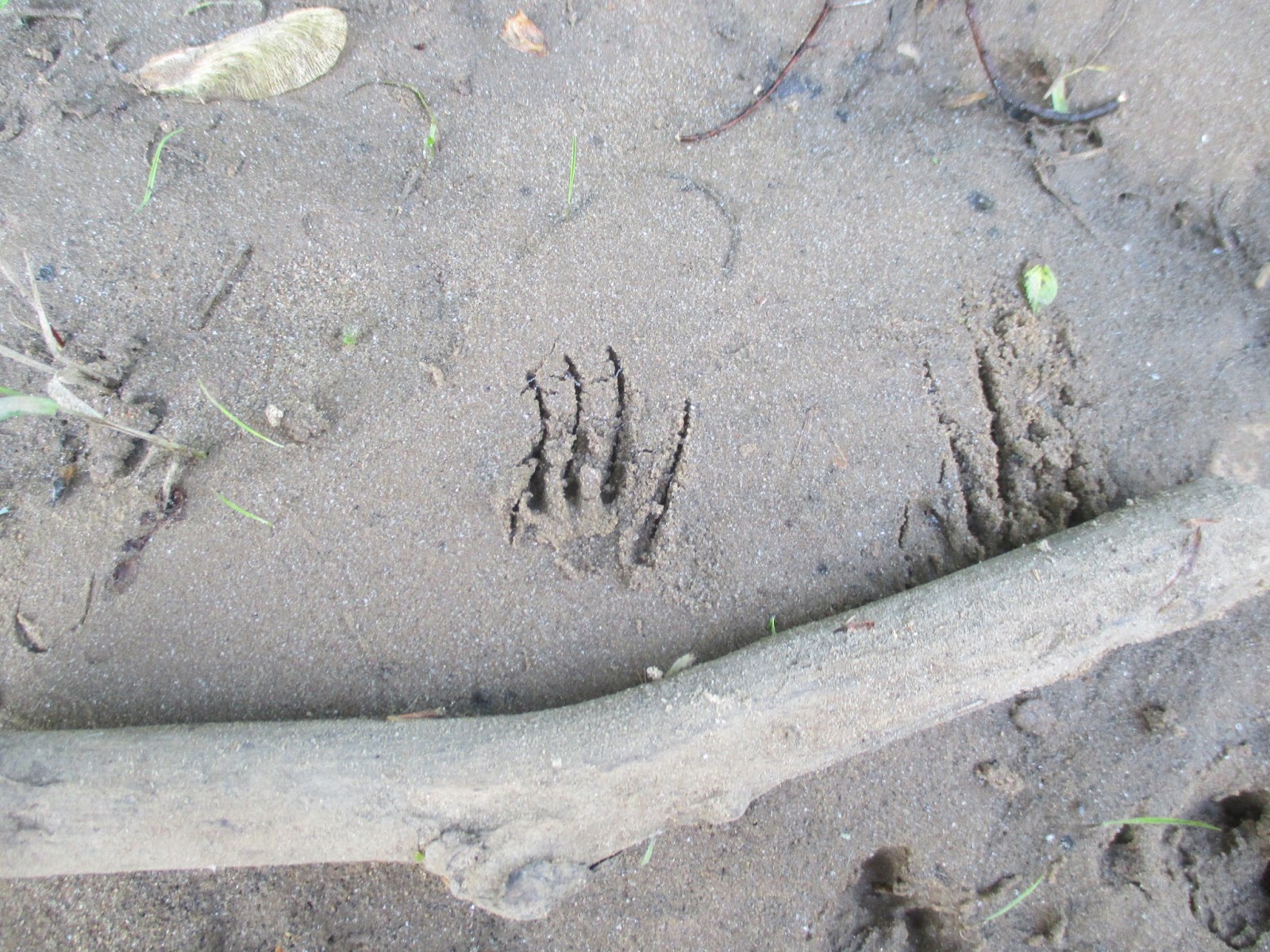
I couldn't resist wandering the banks, so I headed west, upstream, ducking under and over branches and trees along the bank, but occasionally wading into the water to get past the woody obstacles. I spotted footprints from several animal species in the mud, but most of them were familiar to me. Birds, deer, and squirrels made most of them. Then I spotted an unfamiliar one. An animal with small feet, with long claws had passed this way. I'm certain it was an armadillo. I crossed a gravel bar, more undergrowth, a sandy beach, and another gravel bar. I finally decided to turn around. As I made my way back to camp, I decided that the Buffalo River was way more amazing then I thought it would be. I need to come back to float it to really understand more about it. The biggest unexpected discovery though was that it flowed backwards. In the maps I had looked at, I had always imagined that it flowed from east to west. Nope! It flows from the highlands in northwestern Arkansas before it joins the White River a ways downstream.
Back at camp I made some breakfast, then quickly convinced four other adventurers to join me down at the river. We hiked and explored along the bank and discovered animal footprints and mussel shells. At a few sand and gravel bars we skipped rocks in the river, had competitions to make the biggest splash, tried to catch little minnows with our hands, and had a great time. We wandered back to our camp. At the boat ramp, there was a metal post firmly imbedded in the bank. It had red paint at the top, yellow paint in the middle, and green paint near the ground. It was a simple, yet effective stream flow meter to show paddlers the river level and amount of risk relative to the stream flow.
We drove over to the Tyler Bend Visitor Center to see what was there and to stamp the kids' passport books. There was a small visitor center with rangers working on installing a new deck. We drove up to the Collier Homestead for a short hike.
Less than a quarter mile past the homestead is a pretty good overlook over the Buffalo River. We gazed off into the distance at the river, the forests, and the fields. Wow it is beautiful here! We took another trail back and quickly discovered that it was lined with poison ivy. We carefully kept on going and made it back to the Collier Homestead without getting itchy.
The forest trail sure was pretty, but the poison ivy did add some peril to it. The stop at the Tyler Bend visitor center had left me wishing we had gone to Buffalo Point instead. Buffalo Point would have been closer to where we camped, but it also has two other points of interest nearby- the Indian Rockhouse, a primitive cave dwelling, and an old mining town- the ghost town of Rush. I'll have to come back to float the Buffalo River, and when I do I'll visit the other spots. The small part I saw of the Buffalo River left me wanting more and beckons me to return.
Nearest City: Marshall, AR
Location: North central Arkansas
Time Needed: varies
Difficulty: varies
Kid Friendly: yes
Additional Info: Buffalo National River Website
I woke up early, like usual, and couldn't resist leaving the tent. I've always liked maps, and on more than one occasion I had eyed the Buffalo National River and wondered what it would be like. Since I was finally there I couldn't stay inside any longer. I needed to see what the Buffalo River was all about. I padded quietly down the road to the misty river. Wow! The Buffalo River at first glance is amazing! The cool blue-tinged water rushes eastward through tall hills with an occasional cliff or rock outcropping. Long blue pools separated by choppy fast water runs repeat until the river disappears in the morning fog behind a distant bend.
I couldn't resist wandering the banks, so I headed west, upstream, ducking under and over branches and trees along the bank, but occasionally wading into the water to get past the woody obstacles. I spotted footprints from several animal species in the mud, but most of them were familiar to me. Birds, deer, and squirrels made most of them. Then I spotted an unfamiliar one. An animal with small feet, with long claws had passed this way. I'm certain it was an armadillo. I crossed a gravel bar, more undergrowth, a sandy beach, and another gravel bar. I finally decided to turn around. As I made my way back to camp, I decided that the Buffalo River was way more amazing then I thought it would be. I need to come back to float it to really understand more about it. The biggest unexpected discovery though was that it flowed backwards. In the maps I had looked at, I had always imagined that it flowed from east to west. Nope! It flows from the highlands in northwestern Arkansas before it joins the White River a ways downstream.
Back at camp I made some breakfast, then quickly convinced four other adventurers to join me down at the river. We hiked and explored along the bank and discovered animal footprints and mussel shells. At a few sand and gravel bars we skipped rocks in the river, had competitions to make the biggest splash, tried to catch little minnows with our hands, and had a great time. We wandered back to our camp. At the boat ramp, there was a metal post firmly imbedded in the bank. It had red paint at the top, yellow paint in the middle, and green paint near the ground. It was a simple, yet effective stream flow meter to show paddlers the river level and amount of risk relative to the stream flow.
We drove over to the Tyler Bend Visitor Center to see what was there and to stamp the kids' passport books. There was a small visitor center with rangers working on installing a new deck. We drove up to the Collier Homestead for a short hike.
Less than a quarter mile past the homestead is a pretty good overlook over the Buffalo River. We gazed off into the distance at the river, the forests, and the fields. Wow it is beautiful here! We took another trail back and quickly discovered that it was lined with poison ivy. We carefully kept on going and made it back to the Collier Homestead without getting itchy.
The forest trail sure was pretty, but the poison ivy did add some peril to it. The stop at the Tyler Bend visitor center had left me wishing we had gone to Buffalo Point instead. Buffalo Point would have been closer to where we camped, but it also has two other points of interest nearby- the Indian Rockhouse, a primitive cave dwelling, and an old mining town- the ghost town of Rush. I'll have to come back to float the Buffalo River, and when I do I'll visit the other spots. The small part I saw of the Buffalo River left me wanting more and beckons me to return.
Nearest City: Marshall, AR
Location: North central Arkansas
Time Needed: varies
Difficulty: varies
Kid Friendly: yes
Additional Info: Buffalo National River Website
An Evening Along the River in Little Rock
| The Little Rock Skyline from the Clinton Presidential Park Bridge |
We followed Rock Street north to the river, paid $5 for parking, then walked along the Arkansas River Trail a short distance to the Witt Stephens Jr Central Arkansas Nature Center. The Nature Center was a good stop. We learned about a lot of different things in Arkansas, including that alligators are native to parts of the state.
There were lots of displays, including some live fish and reptiles. I thought this albino gar was really awesome. We enjoyed the nature center for about 30 minutes or so until they had to close. They're open almost every day of the year and close about 5 pm. It's worth a visit if you're ever in downtown Little Rock.
We decided to spend a little more time and strolled on the Arkansas River Trail to the Presidential Park Wetlands, a short distance east of the nature center. The wetlands trail had a boardwalk over some wetlands along the Arkansas River. We saw fish, turtles, a snake, and ducks. The kids kept trying to out do each other on the animals they spotted.
Just up the hill from the wetlands is the Clinton Presidential Library. We walked up to it, but the large animatronic dinosaurs out front were a quite intimidating to the kids. We were there a little too late in the evening to go inside.
We concluded that since we'd walked a little ways down the river trail, it would be great to make the rest of the loop as a way to tire the kids out before we drove north. We crossed the Clinton Presidential Park Bridge, turned west on the north bank of the river, then took the Junction Bridge back to our car. It was a great little loop, but and we succeeded in wearing the kids out. The loop has some fantastic views of the Arkansas River and the Little Rock skyline. There were a number of people walking, jogging, or biking- clearly it's a popular urban trail.
On the Junction Bridge, we were able to look down at a submarine, part of the Arkansas Inland Maritime Museum. It was closed for the night, but was fun to look down on a submarine in a river. It might be a fun stop too if we're ever back in Little Rock
Nearest City: Little Rock, AR
Location: 602 President Clinton Avenue, Little Rock, AR 72201
Time Needed: varies
Difficulty: easy- moderate
Kid Friendly: yes
Additional Info:
Thursday, July 23, 2015
Little Rock High School NHS and a rant
We stopped by Little Rock High School to learn a little bit more about racial integration and our nation's history. We thought it would be a good introduction to our kids to learn that people are different. The visit definitely hammered that point home! Little Rock Central High is still a public school, but there is a National Historic Site associated with it, complete with a visitor center located kitty-corner to the school. When the high school opened in 1927, it was listed by the American Institute of Architects as the most beautiful high school in America. Thirty years later, in 1957 it became more famous for its role in the desegregation of public schools in America.
The visitor center has a lot of exhibits, most of which are written for and geared toward teenagers and adults. We read about half of them, but then the kids were antsy, so we breezed through the remainder of them. The exhibits talk about the events that lead up to desegregation, the Little Rock Nine, and the aftermath.
A quick summary is that several court cases throughout the country led up to the Supreme Court declaring that the "separate but equal" policy of sending different races to different schools was not fair and did not treat everybody equally. The states were moving toward integration gradually, but had found different reasons to delay combining the white and black schools. Finally, a judge ordered integration to begin without delay. The Little Rock Nine, nine black students who had been carefully picked, would be the first to attend Little Rock High. The governor of Arkansas ordered the Arkansas National Guard to prevent black students from entering. A federal judge ordered the National Guard removed. The black students went to class, but then the Little Rock Police removed them from class. President Eisenhower then ordered the Army to escort them to class and ensure their safety. The next three years become a see-saw battle between those for and against integration. Finally it is accepted as the way it would be. Interestingly enough, Little Rock Central High school today is attended predominantly by black students.
I found much of the visit interesting and informative. I was always taught to try and evaluate people by their actions instead of their appearance. If someone does good things they're a good person. I was put off by one of the smaller series of exhibits which focused on several other civil rights movements. Each section of the civil rights exhibit had the slant of "white males are bad". To me it sounded rather hypocritical, saying in effect "Judge people by their skin color (but only if they are white)". It definitely deflated the remainder of what could have been an excellent overall visitor. I felt that up to that point the visitor center had done a good time building up toward the ideal that Martin Luther King Jr so eloquently said in his famous I Have a Dream speech that others should "not be judged by the color of their skin but by the content of their character", but then at the end erased it all. Can we get rid of hyphenated Americans already? I'm sick of hearing about White-Americans, African-Americans, Mexican-Americans, Asian-Americans, Women-Americans, Male-Americans, and all of the other subclassifications of Americans out there. Can't we all just be Americans? Lets be Americans first. And be proud of it!
Nearest City: Little Rock, AR
Location: 2120 Daisy L Gatson Bates Dr. Little Rock, AR 72202
Time Needed: 1 hour
Difficulty: easy
Kid Friendly: not really for young children (boredom)
Additional Info: Little Rock Central High School National Historic Site website
The visitor center has a lot of exhibits, most of which are written for and geared toward teenagers and adults. We read about half of them, but then the kids were antsy, so we breezed through the remainder of them. The exhibits talk about the events that lead up to desegregation, the Little Rock Nine, and the aftermath.
A quick summary is that several court cases throughout the country led up to the Supreme Court declaring that the "separate but equal" policy of sending different races to different schools was not fair and did not treat everybody equally. The states were moving toward integration gradually, but had found different reasons to delay combining the white and black schools. Finally, a judge ordered integration to begin without delay. The Little Rock Nine, nine black students who had been carefully picked, would be the first to attend Little Rock High. The governor of Arkansas ordered the Arkansas National Guard to prevent black students from entering. A federal judge ordered the National Guard removed. The black students went to class, but then the Little Rock Police removed them from class. President Eisenhower then ordered the Army to escort them to class and ensure their safety. The next three years become a see-saw battle between those for and against integration. Finally it is accepted as the way it would be. Interestingly enough, Little Rock Central High school today is attended predominantly by black students.
I found much of the visit interesting and informative. I was always taught to try and evaluate people by their actions instead of their appearance. If someone does good things they're a good person. I was put off by one of the smaller series of exhibits which focused on several other civil rights movements. Each section of the civil rights exhibit had the slant of "white males are bad". To me it sounded rather hypocritical, saying in effect "Judge people by their skin color (but only if they are white)". It definitely deflated the remainder of what could have been an excellent overall visitor. I felt that up to that point the visitor center had done a good time building up toward the ideal that Martin Luther King Jr so eloquently said in his famous I Have a Dream speech that others should "not be judged by the color of their skin but by the content of their character", but then at the end erased it all. Can we get rid of hyphenated Americans already? I'm sick of hearing about White-Americans, African-Americans, Mexican-Americans, Asian-Americans, Women-Americans, Male-Americans, and all of the other subclassifications of Americans out there. Can't we all just be Americans? Lets be Americans first. And be proud of it!
Nearest City: Little Rock, AR
Location: 2120 Daisy L Gatson Bates Dr. Little Rock, AR 72202
Time Needed: 1 hour
Difficulty: easy
Kid Friendly: not really for young children (boredom)
Additional Info: Little Rock Central High School National Historic Site website
Saturday, July 18, 2015
Toltec Mounds State Park, Arkansas
Toltec Mounds. Sounds like a fascinating place. I couldn't help but place it on our trip itinerary. We drove over to Toltec Mounds, located a short drive southeast of Little Rock, as one of our furthest stops from home on or Arkansas trip. Essentially, after our stop here, we would more or less be headed toward home. We got there on a hot morning on Wednesday and surprisingly did not have the park to ourselves. A school group and several others were also visiting. The museum was our first stop. It's small, but it's a great place to learn about Toltec Mounds. Most of the site has not been excavated, although much of the non-mound areas have been plowed and planted with crops by the farmer who used to own the area. There's a great collection of artifacts on display. I also enjoyed the exhibits about the archeoastronomy and the measurements and relationship between the different mounds.
At the back side of the mounds in Mound Lake. There's a small boardwalk that goes along part of the edge of the lake which was the favorite part of the hike for the kids. They liked the trees growing in the water, as well as trying to spy the different turtles either swimming in the water or sunning themselves on logs.
Toltec Mounds is a pretty cool little park. It is very neat to visit if you like learning about prehistoric cultures and the Indians that used to live here. It whetted my appetite to learn more about the mound building.
Nearest City: Scott, AR
Location: 490 Toltec Mounds Rd, Scott, AR 72142
Time Needed: 2-3 hours
Difficulty: easy
Kid Friendly: yes
Additional Info: Toltec Mounds State Park website
Saturday, July 11, 2015
A Visit to Hot Springs National Park
Hot Springs National Park. Another one of those destinations we had in mind on our road trip to Arkansas. We arrived on a rainy afternoon, and stopped by the visitor center to get out of the rain and also get an idea of things to do at Hot Springs.
The Visitor Center is at the Fordyce Bath House on Bath House Row in Hot Springs. The National Park is extremely urban for being a National Park. Essentially, it preserves seven historic bathhouses and an associated hillside of springs. We took a walking tour of the Fordyce Bath House and saw a pretty well preserved snapshot of upper class living in the late 19th, early 20th centuries. There are two bathhouses that are open for soaks and massages and the like, but they're a little pricy, and not really designed for young children, so we didn't visit them.
Behind Bathhouse Row, and across the hillside are lots of green boxes. These are the springs. They've been capped to preserved the water quality. Doing a drive on the east mountain, it was amazing how many of the green boxes one can count just from their vehicle. It must have been quite amazing back in the day before they were capped to see them!
The Promenade is a great little walking area. It's well paved in brick and has a nice view of downtown Hot Springs from along it.
There are a few open springs, just around back from several of the bath houses. I though they were the best part of the visit. Unfortunately, they are closed to soaking. They're still great to look at. There are a few fountains that have fresh spring water that are open to the public. After spending a night at the Guleph Gulch Campground, we drove over one morning and filled a few water bottles and used it to make our oatmeal. The water comes out at 140 degrees!
Overall, I'd have to say that Hot Springs National Park disappointed me. A primitive hot spring to soak in would have been quite fantastic. There were a few hiking trails, but it's definitely not on par with other National Park towns like Mammoth in Yellowstone, Estes Park right outside Rocky Mountain National Park, or Springdale outside of Zion National Park. That and Hot Springs doesn't feel like a vacation destination by itself, in fact it seems kindof shabby and outdated.
Nearest City: Hot Springs, AR
Location: N° W°
Time Needed: varies
Difficulty: easy
Kid Friendly: borderline
Additional Info:
The Visitor Center is at the Fordyce Bath House on Bath House Row in Hot Springs. The National Park is extremely urban for being a National Park. Essentially, it preserves seven historic bathhouses and an associated hillside of springs. We took a walking tour of the Fordyce Bath House and saw a pretty well preserved snapshot of upper class living in the late 19th, early 20th centuries. There are two bathhouses that are open for soaks and massages and the like, but they're a little pricy, and not really designed for young children, so we didn't visit them.
Behind Bathhouse Row, and across the hillside are lots of green boxes. These are the springs. They've been capped to preserved the water quality. Doing a drive on the east mountain, it was amazing how many of the green boxes one can count just from their vehicle. It must have been quite amazing back in the day before they were capped to see them!
The Promenade is a great little walking area. It's well paved in brick and has a nice view of downtown Hot Springs from along it.
There are a few open springs, just around back from several of the bath houses. I though they were the best part of the visit. Unfortunately, they are closed to soaking. They're still great to look at. There are a few fountains that have fresh spring water that are open to the public. After spending a night at the Guleph Gulch Campground, we drove over one morning and filled a few water bottles and used it to make our oatmeal. The water comes out at 140 degrees!
Overall, I'd have to say that Hot Springs National Park disappointed me. A primitive hot spring to soak in would have been quite fantastic. There were a few hiking trails, but it's definitely not on par with other National Park towns like Mammoth in Yellowstone, Estes Park right outside Rocky Mountain National Park, or Springdale outside of Zion National Park. That and Hot Springs doesn't feel like a vacation destination by itself, in fact it seems kindof shabby and outdated.
Nearest City: Hot Springs, AR
Location: N° W°
Time Needed: varies
Difficulty: easy
Kid Friendly: borderline
Additional Info:
Monday, June 15, 2015
Mt Magazine, Arkansas High Point
| Mt Magazine, Arkansas' High Point |
| Mt Magazine Trailhead |
| What a view! |
| Arrowheads at Mt Magazine State Park Museum |
Nearest City: Paris, AR
Location: 16878 AR-309, Paris, AR
Time Needed: 30+ min
Difficulty: easy
Kid Friendly: yes
Additional Info: Arkansas State Park Website
Fort Smith National Historic Site
Our next stop on our Arkansas road trip was at Fort Smith National Historic Site. Fort Smith is located right on the border with Arkansas, which ties directly into why Fort Smith is recognized by the National Park Service. Back in the 1800's, Oklahoma was known as indian territory. Fort Smith was established right on the border of indian territory to help keep the peace between the settlers and the indians.
The historic site does a great job of explaining the relations between keeping the peace in indian territory, and the tensions that arose with issues of jurisdiction, or who legally had the right to try lawbreakers in a court of law. Indian tribes are recognized by the government as sovereign nations, meaning they have the right to make and enforce their own laws. The problems arose when lawbreakers tried to use the different borders to their own advantage, and escape the consequences of their actions by crossing a political border between Arkansas and indian territory. The museum inside has two main focal points of its exhibits: law breakers, and law enforcers. The building used to be a prison, and courtroom, among countless other uses. Some exhibits talk about famous prisoners or life in prison, others talk about frontier justice and Judge Parker, the most famous judge at Fort Smith.
West of the main part of the historic site, there's a some trails that tie into the city of Fort Smith's trails. One of the trails goes and shows the ruins of the original Fort Smith, located on a small rise at the junction of the Arkansas and Poteau Rivers.
We also liked the line painted on the path that showed the old boundary between Arkansas and Indian Territory. The boundary has been slightly amended since 1907, so now Oklahoma is a little further west then the Fort Smith Historic Site, but it's still interesting to see where the border once was.
Nearest City: Ft Smith, Arkansas
Location: 301 Parker Avenue, Ft Smith, AR
Time Needed: 2+ hours
Difficulty: easy
Kid Friendly: yes
Additional Info: Fort Smith National Historic Site Website
The historic site does a great job of explaining the relations between keeping the peace in indian territory, and the tensions that arose with issues of jurisdiction, or who legally had the right to try lawbreakers in a court of law. Indian tribes are recognized by the government as sovereign nations, meaning they have the right to make and enforce their own laws. The problems arose when lawbreakers tried to use the different borders to their own advantage, and escape the consequences of their actions by crossing a political border between Arkansas and indian territory. The museum inside has two main focal points of its exhibits: law breakers, and law enforcers. The building used to be a prison, and courtroom, among countless other uses. Some exhibits talk about famous prisoners or life in prison, others talk about frontier justice and Judge Parker, the most famous judge at Fort Smith.
West of the main part of the historic site, there's a some trails that tie into the city of Fort Smith's trails. One of the trails goes and shows the ruins of the original Fort Smith, located on a small rise at the junction of the Arkansas and Poteau Rivers.
We also liked the line painted on the path that showed the old boundary between Arkansas and Indian Territory. The boundary has been slightly amended since 1907, so now Oklahoma is a little further west then the Fort Smith Historic Site, but it's still interesting to see where the border once was.
Nearest City: Ft Smith, Arkansas
Location: 301 Parker Avenue, Ft Smith, AR
Time Needed: 2+ hours
Difficulty: easy
Kid Friendly: yes
Additional Info: Fort Smith National Historic Site Website
Saturday, June 13, 2015
Prairie Grove Battlefield Arkansas
After our visit to Pea Ridge, we drove south and west to Prairie Grove to visit another Civil War battlefield. Prairie Grove wasn't as large or as notable of a battle as Pea Ridge, but it was still a large battle and has been preserved as an Arkansas State Park. Prairie Grove was the last major Civil War battlefield in Northwest Arkansas. The museum provided a great overview of the battlefield, and is a good place to start your visit. One of the points I picked up at the museum was the way that the infantry, cavalry, and artillery should support each other in a battle, and that having them coordinated and working together leads to success. When one of the elements is missing, it exposes a vulnerability that can lead to defeat if the other side exploits it.
There's a small village of historic buildings at Prairie Grove. Most of them are closed, but by signing up for a tour, one can go and walk through many of them. We walked around a few of them as we did our walking tour of the battlefield. The battle was initiated when the Unions divided their force and extended their lines, creating an opportunity for the Confederates to attach one of the forces and perhaps wipe them out. The battle was going poorly for the Union until the other force arrived later in the day, crossed a ford, and began to press the Confederates back.
This sorghum press was used to press the juice out of sorghum, which was then boiled down to create molasses.
The walking tour provided a good overview of some of the pivotal points of the battle, along with short experiences of several of the participants of the battle. The Battle of Prairie Grove was a draw, the Confederates and Unions fought to a standstill, but the Confederates retreated overnight, leaving the Unions victor.
Nearest City: Prairie Grove, AR
Location: 506 E Douglas Street, Prairie Grove, AR
Time Needed: 2-3 hours
Difficulty: easy
Kid Friendly: yes
Additional Info: Prairie Grove State Park Website
There's a small village of historic buildings at Prairie Grove. Most of them are closed, but by signing up for a tour, one can go and walk through many of them. We walked around a few of them as we did our walking tour of the battlefield. The battle was initiated when the Unions divided their force and extended their lines, creating an opportunity for the Confederates to attach one of the forces and perhaps wipe them out. The battle was going poorly for the Union until the other force arrived later in the day, crossed a ford, and began to press the Confederates back.
This sorghum press was used to press the juice out of sorghum, which was then boiled down to create molasses.
The walking tour provided a good overview of some of the pivotal points of the battle, along with short experiences of several of the participants of the battle. The Battle of Prairie Grove was a draw, the Confederates and Unions fought to a standstill, but the Confederates retreated overnight, leaving the Unions victor.
Nearest City: Prairie Grove, AR
Location: 506 E Douglas Street, Prairie Grove, AR
Time Needed: 2-3 hours
Difficulty: easy
Kid Friendly: yes
Additional Info: Prairie Grove State Park Website
Pea Ridge National Military Park
| The Elkhorn Tavern |
| Artifacts from the Battle of Pea Ridge |
There are several walking paths in the park and a scenic drive. The drive goes by many of the most important skirmishes in the battle. I recommend doing the drive and stopping at all of the turnouts to read the signs. We stopped and walked down the path toward the ruins of Leetown, but didn't see much there other then a few foundation holes.
The highlight from our short hike was the box turtle we saw along the trail. It was still slightly chilly out, and it had crawled around to find a sunny spot to warm up. The kids really liked looking at it and seeing the box turtle. We spoke to a ranger at the visitor center who said that they're the most active before it rains.
It was a sad and inspiring site to see the cannons lined up in the fields at Pea Ridge. It's a great spot to visit to get a better understanding of the Civil War west of the Mississippi River. After Pea Ridge, the fighting in the west was largely over, although there were still a few smaller engagements. The west was secure for the Union, and the war would be determined by what happened in the east.
Nearest City: Pea Ridge, Arkansas
Location: 15930 E Hwy 62, Garfield, Arkansas
Time Needed: 1/2 day
Difficulty: easy
Kid Friendly:
Additional Info: Pea Ridge National Military Park Website
Friday, June 12, 2015
The Tanyard Creek Nature Trail
The Tanyard Creek Nature Trail wasn't on our list of places to see in Arkansas. But when we planned the trip, we left a pretty flexible schedule to allow us to squeeze in a few places as we went along. Tanyard Creek was a place we stumbled on, and since the kids needed a place to stretch, it met our needs. It was a great stop. The trail is a loop. It starts at a parking lot near a golf course, then drops to a small creek and gives the option of turning it into a lollipop loop just over a mile long that goes past a cave and a waterfall. If you keep an eye out, you can spot a small natural arch in a limestone overhang as well.
Along the nature trail there are several signs identifying plant species and what makes each useful or unique. There are several bridges over the creek as well. At the trail junction, we took the trail to the right which leads to the cave. The cave had a small building built over the top of it, which has since collapsed. The metal panels are bent and crumpled around the cave entrance. We went to the entrance and felt a cool breeze coming out and could hear water dripping in the back. A small stream trickled out of the entrance and dumped into the larger creek at a pool with a school of fish gently swimming at the bottom of the current.
The trail led as along the creek and next to several limestone ledges and overhangs. One or two of them had small waterfalls coming off of them. The water had forced its way through cracks in the rock after a dam was built to create Lake Windsor. I liked the way these ferns found a great place to grow in one of the small cracks.
After crossing the base of the dam, the trail ascends along a larger creek (Tanyard Creek) to the waterfall outlet from Lake Windsor. The waterfall is manmade, from the outflow from the lake. It's a pretty waterfall. This part of the hike is different then the other half. It's a lot more of a southern forest, and numerous signs identify trees such as hickory and sassafras. We enjoyed the waterfall for a while, then turned around and finished the lollipop back to the trailhead. It's an easy hike and completely enjoyable.
Nearest City: Bella Vista, AR
Location: Nature Trail Lane, Bella Vista, AR
Time Needed: 1-2 hours, less if you don't have young kids.
Difficulty: easy-moderate
Kid Friendly:yes
Additional Info: Tanyard Creek Trail
Along the nature trail there are several signs identifying plant species and what makes each useful or unique. There are several bridges over the creek as well. At the trail junction, we took the trail to the right which leads to the cave. The cave had a small building built over the top of it, which has since collapsed. The metal panels are bent and crumpled around the cave entrance. We went to the entrance and felt a cool breeze coming out and could hear water dripping in the back. A small stream trickled out of the entrance and dumped into the larger creek at a pool with a school of fish gently swimming at the bottom of the current.
The trail led as along the creek and next to several limestone ledges and overhangs. One or two of them had small waterfalls coming off of them. The water had forced its way through cracks in the rock after a dam was built to create Lake Windsor. I liked the way these ferns found a great place to grow in one of the small cracks.
After crossing the base of the dam, the trail ascends along a larger creek (Tanyard Creek) to the waterfall outlet from Lake Windsor. The waterfall is manmade, from the outflow from the lake. It's a pretty waterfall. This part of the hike is different then the other half. It's a lot more of a southern forest, and numerous signs identify trees such as hickory and sassafras. We enjoyed the waterfall for a while, then turned around and finished the lollipop back to the trailhead. It's an easy hike and completely enjoyable.
Nearest City: Bella Vista, AR
Location: Nature Trail Lane, Bella Vista, AR
Time Needed: 1-2 hours, less if you don't have young kids.
Difficulty: easy-moderate
Kid Friendly:yes
Additional Info: Tanyard Creek Trail
Camping at Beaver Lake, Arkansas
On to Arkansas! True story. When I was finishing up grad school, my wife and I were discussing about future career opportunities and where we could find work. The economy wasn't so hot in 2010 and we realized that we may not get our first choice of locations, but a job was better than no job. During this discussion, she remarked that she was good with just about anywhere- except Arkansas. Fast forward a few years, and this same woman is now insisting that we must go and visit The Natural State. We arrived in Arkansas later in the day then we'd intended to, so with the day rapidly fading and no pre-determined campsite, we pulled out our map and rapidly concluded that Beaver Lake was our best shot at camping near Bentonville/Rogers in Northwest Arkansas. We pulled in to the Corps of Engineers operated campground, then decided splurge. $20/night is a bit more than the free we usually like to spend when we're camping, but with no other options apparent, we did it.


The campground is next to Beaver Lake, but most of the sites are not directly on the water, nor is the water accessible directly from them because of steep hillsides. We did drive down to the marina and saw that it is huge with tons of boats and parking. Beaver Lake must be really popular in the summer. While we were there, I woke up early in the morning to what sounded like a radio playing the Star Spangled Banner. I was initially pretty displeased, thinking that some other camper was being pretty rude at 6 AM, but as I listened longer, I concluded that it was the opening ceremony for a bass tournament that was going on that weekend. The campground was pretty nice as far as campgrounds go. Lots of sites, many with electricity or sewer hookups, and flush toilets in the bathrooms. There even was a shower for those who really like the amenities of home!
The campground overlooks Beaver Lake, an immensely popular recreation lake. Fortunately for us April was a little bit early in the year for most people, so we had a pretty decent pick of locations. We picked a site that was away from other campers, and had a great time. Even though it was late April, we still saw a few fireflies on our evening walks.
The campground is next to Beaver Lake, but most of the sites are not directly on the water, nor is the water accessible directly from them because of steep hillsides. We did drive down to the marina and saw that it is huge with tons of boats and parking. Beaver Lake must be really popular in the summer. While we were there, I woke up early in the morning to what sounded like a radio playing the Star Spangled Banner. I was initially pretty displeased, thinking that some other camper was being pretty rude at 6 AM, but as I listened longer, I concluded that it was the opening ceremony for a bass tournament that was going on that weekend. The campground was pretty nice as far as campgrounds go. Lots of sites, many with electricity or sewer hookups, and flush toilets in the bathrooms. There even was a shower for those who really like the amenities of home!
Nearest City:
Eureka Springs, Arkansas
Location: Beaver Lake, Arkansas
Time Needed:
varies
Difficulty: varies
Kid Friendly:
varies
Additional Info: Arkansas tourism website
Subscribe to:
Posts (Atom)