We left Chase County Fishing Lake, stopped in the cute little town of Cottonwood Falls, then continued up the Flint Hills Scenic Byway to Tallgrass Prairie. The heart of the location is the old ranch, with headquarters on site. They have hikes and a ranger-driven bus ride as options that you can do. We missed the bus tour because of a discrepancy between the time posted on the website and times posted at the visitor center.
We went on a short hike out among the prairie grasses. The NPS only owns 35 acres of the preserve, with the Nature Conservancy owning the difference. I heard 10,000 acres as a number, but I'm not sure how accurate that is. Lets just say it's a lot of land and wide open sky out here.
The Flint Hills are prime grazing land. The shallow soil isn't good for farming, which led to much of the prairie grass not being plowed under and replanted in corn or soybeans like much of eastern Kansas is.
Lots of grass out here. If you miss the bus tour like we did, your only option is to explore on foot. They do have a pasture with a buffalo herd that the bus tour drives through the middle of (the pasture, not necessarily the herd). The bus fills up fast, at least the weekend we were here. We were surprised how many people were out here. Like anywhere else, call ahead for your best options.
Nearest City: Strong City,KS
Location: 2 miles north of Strong City
Time Needed: varies
Difficulty: easy
Kid Friendly:
Additional Info:
Our random, yet highly entertaining, romp through the highly visited and less explored parts of life. Comments with additional information are also welcomed, as are questions looking for more information. If you like my blog or it was useful to you, please comment!
Showing posts with label Scenic Drive. Show all posts
Sunday, September 27, 2015
Friday, July 24, 2015
Having a great time at the Buffalo National River
After leaving Little Rock late, we drove north for the Buffalo River. In Marshall, we turned off Highway 65 and on to Highway 27. We had reviewed the map and planned to camp at the Woolum primitive campsite and river access, but since it was late, I didn't pay that much attention, and after driving for a lot longer than we intended to, we pulled out the map again. I should have continued up Highway 65 to get where I wanted to go, but since we'd doglegged east, the Spring Creek river access and primitive camp area looked pretty appealing to me. We turned off the highway and on to a dirt road, passed a few cabins, then slowly descended for 3 miles or so to the Spring Creek camp area. I shined my headlights around briefly, saw a spot that looked good enough, put the Subaru in park then turned off the ignition. The tent went up quickly, and I was asleep.
I woke up early, like usual, and couldn't resist leaving the tent. I've always liked maps, and on more than one occasion I had eyed the Buffalo National River and wondered what it would be like. Since I was finally there I couldn't stay inside any longer. I needed to see what the Buffalo River was all about. I padded quietly down the road to the misty river. Wow! The Buffalo River at first glance is amazing! The cool blue-tinged water rushes eastward through tall hills with an occasional cliff or rock outcropping. Long blue pools separated by choppy fast water runs repeat until the river disappears in the morning fog behind a distant bend.
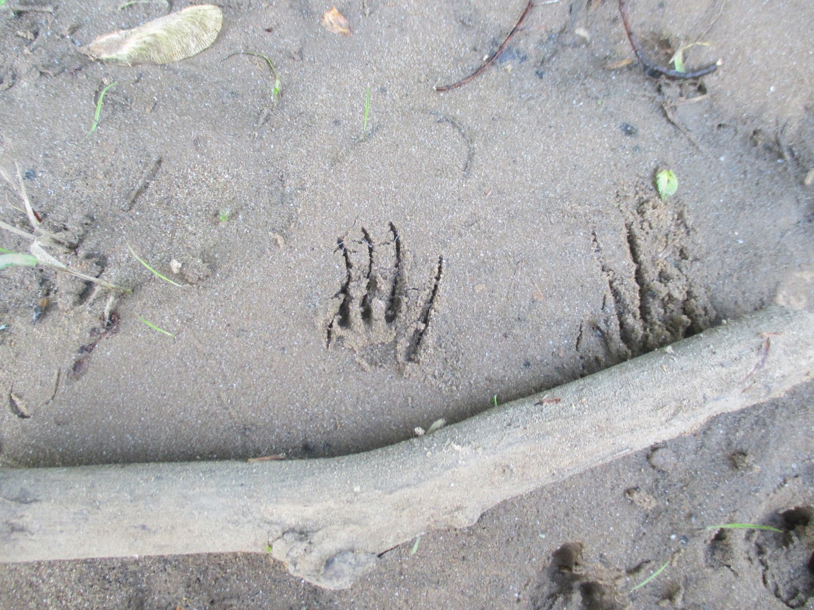
I couldn't resist wandering the banks, so I headed west, upstream, ducking under and over branches and trees along the bank, but occasionally wading into the water to get past the woody obstacles. I spotted footprints from several animal species in the mud, but most of them were familiar to me. Birds, deer, and squirrels made most of them. Then I spotted an unfamiliar one. An animal with small feet, with long claws had passed this way. I'm certain it was an armadillo. I crossed a gravel bar, more undergrowth, a sandy beach, and another gravel bar. I finally decided to turn around. As I made my way back to camp, I decided that the Buffalo River was way more amazing then I thought it would be. I need to come back to float it to really understand more about it. The biggest unexpected discovery though was that it flowed backwards. In the maps I had looked at, I had always imagined that it flowed from east to west. Nope! It flows from the highlands in northwestern Arkansas before it joins the White River a ways downstream.
Back at camp I made some breakfast, then quickly convinced four other adventurers to join me down at the river. We hiked and explored along the bank and discovered animal footprints and mussel shells. At a few sand and gravel bars we skipped rocks in the river, had competitions to make the biggest splash, tried to catch little minnows with our hands, and had a great time. We wandered back to our camp. At the boat ramp, there was a metal post firmly imbedded in the bank. It had red paint at the top, yellow paint in the middle, and green paint near the ground. It was a simple, yet effective stream flow meter to show paddlers the river level and amount of risk relative to the stream flow.
We drove over to the Tyler Bend Visitor Center to see what was there and to stamp the kids' passport books. There was a small visitor center with rangers working on installing a new deck. We drove up to the Collier Homestead for a short hike.
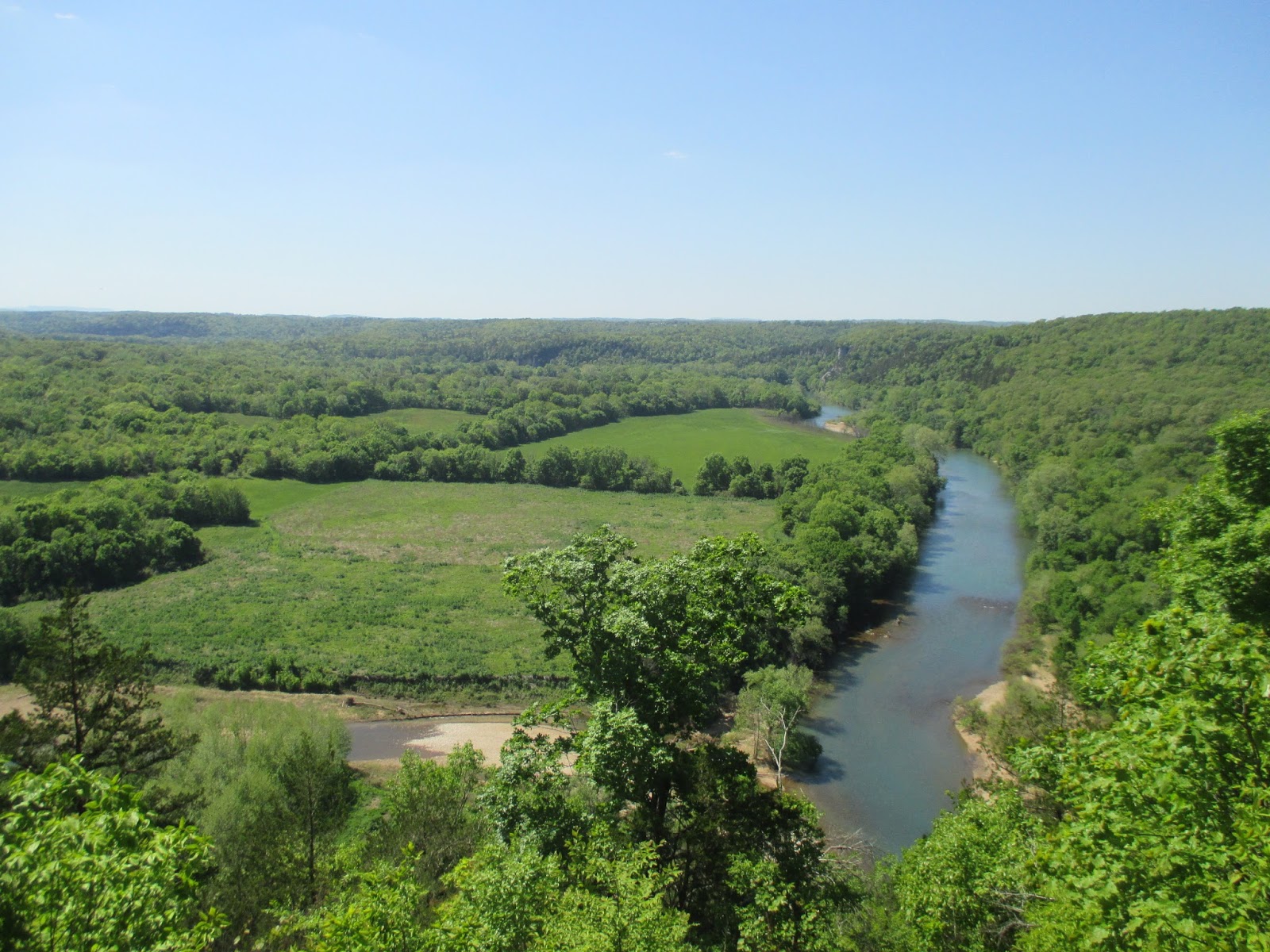
Less than a quarter mile past the homestead is a pretty good overlook over the Buffalo River. We gazed off into the distance at the river, the forests, and the fields. Wow it is beautiful here! We took another trail back and quickly discovered that it was lined with poison ivy. We carefully kept on going and made it back to the Collier Homestead without getting itchy.
The forest trail sure was pretty, but the poison ivy did add some peril to it. The stop at the Tyler Bend visitor center had left me wishing we had gone to Buffalo Point instead. Buffalo Point would have been closer to where we camped, but it also has two other points of interest nearby- the Indian Rockhouse, a primitive cave dwelling, and an old mining town- the ghost town of Rush. I'll have to come back to float the Buffalo River, and when I do I'll visit the other spots. The small part I saw of the Buffalo River left me wanting more and beckons me to return.
Nearest City: Marshall, AR
Location: North central Arkansas
Time Needed: varies
Difficulty: varies
Kid Friendly: yes
Additional Info: Buffalo National River Website
I woke up early, like usual, and couldn't resist leaving the tent. I've always liked maps, and on more than one occasion I had eyed the Buffalo National River and wondered what it would be like. Since I was finally there I couldn't stay inside any longer. I needed to see what the Buffalo River was all about. I padded quietly down the road to the misty river. Wow! The Buffalo River at first glance is amazing! The cool blue-tinged water rushes eastward through tall hills with an occasional cliff or rock outcropping. Long blue pools separated by choppy fast water runs repeat until the river disappears in the morning fog behind a distant bend.
I couldn't resist wandering the banks, so I headed west, upstream, ducking under and over branches and trees along the bank, but occasionally wading into the water to get past the woody obstacles. I spotted footprints from several animal species in the mud, but most of them were familiar to me. Birds, deer, and squirrels made most of them. Then I spotted an unfamiliar one. An animal with small feet, with long claws had passed this way. I'm certain it was an armadillo. I crossed a gravel bar, more undergrowth, a sandy beach, and another gravel bar. I finally decided to turn around. As I made my way back to camp, I decided that the Buffalo River was way more amazing then I thought it would be. I need to come back to float it to really understand more about it. The biggest unexpected discovery though was that it flowed backwards. In the maps I had looked at, I had always imagined that it flowed from east to west. Nope! It flows from the highlands in northwestern Arkansas before it joins the White River a ways downstream.
Back at camp I made some breakfast, then quickly convinced four other adventurers to join me down at the river. We hiked and explored along the bank and discovered animal footprints and mussel shells. At a few sand and gravel bars we skipped rocks in the river, had competitions to make the biggest splash, tried to catch little minnows with our hands, and had a great time. We wandered back to our camp. At the boat ramp, there was a metal post firmly imbedded in the bank. It had red paint at the top, yellow paint in the middle, and green paint near the ground. It was a simple, yet effective stream flow meter to show paddlers the river level and amount of risk relative to the stream flow.
We drove over to the Tyler Bend Visitor Center to see what was there and to stamp the kids' passport books. There was a small visitor center with rangers working on installing a new deck. We drove up to the Collier Homestead for a short hike.
Less than a quarter mile past the homestead is a pretty good overlook over the Buffalo River. We gazed off into the distance at the river, the forests, and the fields. Wow it is beautiful here! We took another trail back and quickly discovered that it was lined with poison ivy. We carefully kept on going and made it back to the Collier Homestead without getting itchy.
The forest trail sure was pretty, but the poison ivy did add some peril to it. The stop at the Tyler Bend visitor center had left me wishing we had gone to Buffalo Point instead. Buffalo Point would have been closer to where we camped, but it also has two other points of interest nearby- the Indian Rockhouse, a primitive cave dwelling, and an old mining town- the ghost town of Rush. I'll have to come back to float the Buffalo River, and when I do I'll visit the other spots. The small part I saw of the Buffalo River left me wanting more and beckons me to return.
Nearest City: Marshall, AR
Location: North central Arkansas
Time Needed: varies
Difficulty: varies
Kid Friendly: yes
Additional Info: Buffalo National River Website
Monday, June 15, 2015
Mt Magazine, Arkansas High Point
| Mt Magazine, Arkansas' High Point |
| Mt Magazine Trailhead |
| What a view! |
| Arrowheads at Mt Magazine State Park Museum |
Nearest City: Paris, AR
Location: 16878 AR-309, Paris, AR
Time Needed: 30+ min
Difficulty: easy
Kid Friendly: yes
Additional Info: Arkansas State Park Website
Saturday, June 13, 2015
Pea Ridge National Military Park
| The Elkhorn Tavern |
| Artifacts from the Battle of Pea Ridge |
There are several walking paths in the park and a scenic drive. The drive goes by many of the most important skirmishes in the battle. I recommend doing the drive and stopping at all of the turnouts to read the signs. We stopped and walked down the path toward the ruins of Leetown, but didn't see much there other then a few foundation holes.
The highlight from our short hike was the box turtle we saw along the trail. It was still slightly chilly out, and it had crawled around to find a sunny spot to warm up. The kids really liked looking at it and seeing the box turtle. We spoke to a ranger at the visitor center who said that they're the most active before it rains.
It was a sad and inspiring site to see the cannons lined up in the fields at Pea Ridge. It's a great spot to visit to get a better understanding of the Civil War west of the Mississippi River. After Pea Ridge, the fighting in the west was largely over, although there were still a few smaller engagements. The west was secure for the Union, and the war would be determined by what happened in the east.
Nearest City: Pea Ridge, Arkansas
Location: 15930 E Hwy 62, Garfield, Arkansas
Time Needed: 1/2 day
Difficulty: easy
Kid Friendly:
Additional Info: Pea Ridge National Military Park Website
Friday, April 17, 2015
Weekend Trip to Indian Cave State Park
In early/mid April we took a weekend camping trip to Indian Cave State Park in Nebraska. Why Indian Cave? Why not! I enjoyed the trip, but was slightly underwhelmed by it. First off, there is no cave. Secondly, I didn't see any Indians either. But, there were some petroglyphs, so that made the visit worthwhile. The alcove is located on the south end of the park, just off of the Missouri River. We parked our car, wandered down to the river, then crossed the road and climbed the boardwalk to the alcove. Most of the pictures you see will make you believe that you hike down to see the petroglyphs. Not so! You start at the bottom, then hike up.
Here's one of the petroglyphs. There are several that are readily visible, although they are surrounded by graffiti that's been inscribed more recently. I could pick out 8-10 pretty easily, although a sign said there were 15 petroglyphs in the alcove. One of the pictographs is a half fish/half man but it isn't visible from the boardwalk. I would have liked to see it, but I can understand why they don't point it out just the same. Most of the petroglyphs, like the one pictured above, were of buffalo.
We also visited the ghost town of St. Deroin there in the park. There are several buildings, but since we visited in the off season, there were only two we could walk around at- the old schoolhouse, and a store. They give broom making demonstrations at the store in the warmer months, but since we visited too early in the year, we just peeked in the windows.
Some of the roads were pretty interesting. I jokingly referred to this one as a Nebraska slot canyon. It was incised so deeply into the hillside that the surrounding oak trees could have fallen over and still left room to drive underneath. The park is 5 square miles along the Missouri River and has some beautiful views and a vast network of trails.
One of the better viewpoints looked eastward into Missouri and over the river. When Lewis and Clark were through here the river was 1 1/2 miles further east than it is today. We enjoyed reading the signs and talked about how Lewis and Clark passed going both up the river and down the river. The kids asked why it took so long for them to go up the river, but so short when they went down the river, so I had them walk from one side of a platform to the other with me pushing them in opposition, then walk back with me pushing them faster and faster. I then compared it to the river pushing against you when you go up it, but pushing you faster when you go with it.
Overall we had a great weekend camping trip. I think my impression of Indian Cave State Park would have been more favorable if more stops were open when we visited. But, since half of the ghost town was closed, as well as the museum, it doesn't get my ringing endorsement. Maybe you'll enjoy it more if you visit in summer. I probably would have.
Nearest City: Shubert, Nebraska
Location: 65296 720 Rd, Shubert, NE 68437
Time Needed: Varies
Difficulty: Easy-moderate
Kid Friendly: yes
Additional Info: Indian Cave State Park website
Here's one of the petroglyphs. There are several that are readily visible, although they are surrounded by graffiti that's been inscribed more recently. I could pick out 8-10 pretty easily, although a sign said there were 15 petroglyphs in the alcove. One of the pictographs is a half fish/half man but it isn't visible from the boardwalk. I would have liked to see it, but I can understand why they don't point it out just the same. Most of the petroglyphs, like the one pictured above, were of buffalo.
We also visited the ghost town of St. Deroin there in the park. There are several buildings, but since we visited in the off season, there were only two we could walk around at- the old schoolhouse, and a store. They give broom making demonstrations at the store in the warmer months, but since we visited too early in the year, we just peeked in the windows.
Some of the roads were pretty interesting. I jokingly referred to this one as a Nebraska slot canyon. It was incised so deeply into the hillside that the surrounding oak trees could have fallen over and still left room to drive underneath. The park is 5 square miles along the Missouri River and has some beautiful views and a vast network of trails.
One of the better viewpoints looked eastward into Missouri and over the river. When Lewis and Clark were through here the river was 1 1/2 miles further east than it is today. We enjoyed reading the signs and talked about how Lewis and Clark passed going both up the river and down the river. The kids asked why it took so long for them to go up the river, but so short when they went down the river, so I had them walk from one side of a platform to the other with me pushing them in opposition, then walk back with me pushing them faster and faster. I then compared it to the river pushing against you when you go up it, but pushing you faster when you go with it.
Overall we had a great weekend camping trip. I think my impression of Indian Cave State Park would have been more favorable if more stops were open when we visited. But, since half of the ghost town was closed, as well as the museum, it doesn't get my ringing endorsement. Maybe you'll enjoy it more if you visit in summer. I probably would have.
Nearest City: Shubert, Nebraska
Location: 65296 720 Rd, Shubert, NE 68437
Time Needed: Varies
Difficulty: Easy-moderate
Kid Friendly: yes
Additional Info: Indian Cave State Park website
Tuesday, November 25, 2014
Lonesome Organ Pipe Cactus National Monument
We drove through the Border Patrol checkpoint and kept on going. A few miles past the checkpoint, we reached Organ Pipe Cactus National Monument. Although it's out in the middle of nowhere, the desert is beautiful down here. The highway gets a lot of traffic as people drive through to got to Puerto Penasco (Rocky Point) in Mexico. We didn't go all the way to Rocky Point, but instead stopped at Organ Pipe Cactus National Monument.
We stopped at the Kris Eggle Visitor Center, named after a park ranger who was gunned down by the drug cartel as he attempted to keep them away. You can read more about Kris here. The kids got some junior ranger books so they could become junior rangers. We took a small walk outside of the visitor center as well. The amazing thing you'll notice right away at Organ Pipe Cactus National Monument is that there are organ pipe cacti and saguaro cacti growing right next to each other. Their range overlaps here in the park.
We also went over to hike the Discovery Trail near the campground. The organ pipe cacti are a lot more plentiful over there then they are by the visitor center.
The Organ Pipe Cactus is named because the dead cactus turns white and looks like the organ pipes that you'd see in a church. It's not as tall as a saguaro, nor does it have arms. Instead it's a cluster of pillars that come out of the same base- reaching a height of 10-15 feet.
We debated camping for another night then doing a scenic drive to see an arch as well as hiking to the Victoria Mine, an old mine in the park. Most of us were coming down with colds and were kindof cranky, so we decided to reel it in and call it a vacation. After one last potty break, we loaded up and headed for home.
As we drove toward Tucson, we saw the Kitt Peak Observatory off in the distance. It's here because of the clear skies in the desert and there's not much light pollution from nearby cities. It's a stop for you to make if you're out here and have the time to visit.
Nearest City: Lukeville, AZ
Location: N° W°
Time Needed: varies
Difficulty: varies
Kid Friendly:
Additional Info: $8/vehicle entrance fee, payable at the visitor center Organ Pipe Cactus National Monument Website.
We stopped at the Kris Eggle Visitor Center, named after a park ranger who was gunned down by the drug cartel as he attempted to keep them away. You can read more about Kris here. The kids got some junior ranger books so they could become junior rangers. We took a small walk outside of the visitor center as well. The amazing thing you'll notice right away at Organ Pipe Cactus National Monument is that there are organ pipe cacti and saguaro cacti growing right next to each other. Their range overlaps here in the park.
We also went over to hike the Discovery Trail near the campground. The organ pipe cacti are a lot more plentiful over there then they are by the visitor center.
The Organ Pipe Cactus is named because the dead cactus turns white and looks like the organ pipes that you'd see in a church. It's not as tall as a saguaro, nor does it have arms. Instead it's a cluster of pillars that come out of the same base- reaching a height of 10-15 feet.
We debated camping for another night then doing a scenic drive to see an arch as well as hiking to the Victoria Mine, an old mine in the park. Most of us were coming down with colds and were kindof cranky, so we decided to reel it in and call it a vacation. After one last potty break, we loaded up and headed for home.
As we drove toward Tucson, we saw the Kitt Peak Observatory off in the distance. It's here because of the clear skies in the desert and there's not much light pollution from nearby cities. It's a stop for you to make if you're out here and have the time to visit.
Nearest City: Lukeville, AZ
Location: N° W°
Time Needed: varies
Difficulty: varies
Kid Friendly:
Additional Info: $8/vehicle entrance fee, payable at the visitor center Organ Pipe Cactus National Monument Website.
Friday, October 31, 2014
Fall Leaves in the West Fork of Oak Creek
On Columbus Day we woke up, enjoyed breakfast, then headed out to go hike the West Fork of Oak Creek. We stopped by there a few days earlier and went and visited Pumphouse Wash instead because of the crowds. We thought that a Monday would be a better option, since getting there early would mean we could park at the trailhead.
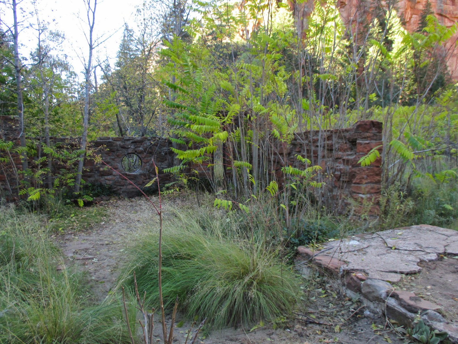
We arrived about 8 and found the parking lot about 1/4 full. We paid our $10 parking fee (or $2 for walk-ins), parked, then loaded up. A bridge crossed Oak Creek, and we could see a few trout swimming in the pools below. Thick blackberry brambles along the bank would make for a tasty treat earlier in the year, but now they were all bare. At the mouth of the canyon, we found the ruins of an old lodge. I can't remember much about the lodge other then it being just about the first building in Oak Creek Canyon.
We explored the nearby chicken coops and "cave", a room cut into the sandstone cliff. Then we ducked into the canyon.
The trail goes a little over 3 miles, and 13 stream crossings up the West Fork of Oak Creek. We brought sandals and water shoes but didn't need them because the stream was shallow enough to hop across and keep dry feet.
Most of the way we found the canyon pretty quiet. It's a narrow canyon, but it never really gets to be as narrow as a true slot canyon is. The water and the sandstone sure are a pretty combination though!
Does this remind anyone of another famous picture spot? The log propped up against the overhanging canyon wall reminded me of the numerous pictures I've seen of "The Subway" in Zion National Park.
There aren't any waterfalls in Oak Creek Canyon, but a there's a few spots, like this one, where the stream has cut into the sandstone bedrock, forming small plunge pools.
More sandstone, water, and fall leaves. We were a little bit early for peak color.
At the end of the trail, there's a large ledge overlooking the creek. It's a very popular spot to stop, eat a snack or lunch, then turn around and hike back down the trail. People aren't the only ones that like the spot. This crow was entertaining the crowds when I got there. He evidently has learned that there is food where there are people sitting down.
The maples were starting to change color, but were far from being ideal. It was still a beautiful little hike.
Nearest City: Sedona, AZ
Location: N° W°
Time Needed: 1/2 day
Difficulty: easy-moderate
Kid Friendly: yes
Additional Info: watch out for poison ivy. It's there in abundance, but none of the signs at the trailhead warn you about it.
We arrived about 8 and found the parking lot about 1/4 full. We paid our $10 parking fee (or $2 for walk-ins), parked, then loaded up. A bridge crossed Oak Creek, and we could see a few trout swimming in the pools below. Thick blackberry brambles along the bank would make for a tasty treat earlier in the year, but now they were all bare. At the mouth of the canyon, we found the ruins of an old lodge. I can't remember much about the lodge other then it being just about the first building in Oak Creek Canyon.
We explored the nearby chicken coops and "cave", a room cut into the sandstone cliff. Then we ducked into the canyon.
The trail goes a little over 3 miles, and 13 stream crossings up the West Fork of Oak Creek. We brought sandals and water shoes but didn't need them because the stream was shallow enough to hop across and keep dry feet.
Most of the way we found the canyon pretty quiet. It's a narrow canyon, but it never really gets to be as narrow as a true slot canyon is. The water and the sandstone sure are a pretty combination though!
Does this remind anyone of another famous picture spot? The log propped up against the overhanging canyon wall reminded me of the numerous pictures I've seen of "The Subway" in Zion National Park.
There aren't any waterfalls in Oak Creek Canyon, but a there's a few spots, like this one, where the stream has cut into the sandstone bedrock, forming small plunge pools.
More sandstone, water, and fall leaves. We were a little bit early for peak color.
At the end of the trail, there's a large ledge overlooking the creek. It's a very popular spot to stop, eat a snack or lunch, then turn around and hike back down the trail. People aren't the only ones that like the spot. This crow was entertaining the crowds when I got there. He evidently has learned that there is food where there are people sitting down.
The maples were starting to change color, but were far from being ideal. It was still a beautiful little hike.
Nearest City: Sedona, AZ
Location: N° W°
Time Needed: 1/2 day
Difficulty: easy-moderate
Kid Friendly: yes
Additional Info: watch out for poison ivy. It's there in abundance, but none of the signs at the trailhead warn you about it.
Boulder hopping up Pumphouse Wash
After watching the airplanes fly around with the model airplane club, we headed north to Oak Creek Canyon. A few of the places we'd had on our list were Slide Rock State Park, and the West Fork of Oak Creek. We planned on hitting Slide Rock in the afternoon after it had warmed up a little bit, so made Oak Creek Canyon the first stop on our list. The place was a zoo. Literally. The parking lot was full and cars were backed up onto the highway. Scratch that. Plan B- Pumphouse Wash.
Pumphouse Wash is located toward the top of Oak Creek Canyon, off to the east of the highway literally at the base of the switchbacks. There's a parking spot for 2-3 cars just above the Pumphouse Wash bridge, so we parked there, then scrambled down the hill to get to the wash. No crowds- just the way I like it!
We crossed under the bridge, and headed upstream. Most of the way was boulder hopping. The kids did great at it, but they insisted that it wasn't a hike. They didn't want to go on a hike, but they were ok with going on an "adventure walk". It's all about the semantics. I'm ok with adventure walks. Since it was the Columbus Day weekend, the leaves were changing and the air was a little bit crisp. We didn't get the prime time for colorful leaves, but it was still really pretty.
The kids almost immediately began to have glorious finds. A few small lizards were still too lethargic to escape the inquisitive fingers of a 3 year old. The lizards would be fairly still and content until the body heat radiating from the small hands warmed up the smaller ectothermic (ectothermic means cold blooded) lizard and he'd run away to hide in the rocks.
Pretty soon, more little discoveries were made. Baby frogs! The frogs were really little, and the kids were determined to bring one home. I'm pretty sure one was hauled a solid 1/4 mile in a little hand. It took quite a lot of persuasion, but we finally talked the 3 year old into letting the frog go at a small pool in the canyon.
We made our way upstream until we finally found our way blocked by a deep pool in a narrow spot of the canyon. Now Pumphouse Wash isn't what I'd call a slot canyon by any means. It's a narrow canyon, with a few places where it's narrow. We were about 1/2 mile or so up from the bridge and this was the end of the trail for us.
We turned around and boulder hopped our way down the canyon. The fall leaves on the maples and cottonwoods were beautiful as we went. Pumphouse Wash was a good little hike, adventure walk, boulder hop, or whatever else you might call it. I wouldn't recommend it for everybody, but if you're looking for something else to do and you're not in a hurry to go anywhere fast, you might give it a try.
Nearest City: Sedona, AZ
Location: Upper end of Oak Creek Canyon, at the base of the switchbacks
Time Needed: varies- several hours at least
Difficulty: moderate-strenuous because of boulder hopping
Kid Friendly: it depends
Additional Info:
We crossed under the bridge, and headed upstream. Most of the way was boulder hopping. The kids did great at it, but they insisted that it wasn't a hike. They didn't want to go on a hike, but they were ok with going on an "adventure walk". It's all about the semantics. I'm ok with adventure walks. Since it was the Columbus Day weekend, the leaves were changing and the air was a little bit crisp. We didn't get the prime time for colorful leaves, but it was still really pretty.
The kids almost immediately began to have glorious finds. A few small lizards were still too lethargic to escape the inquisitive fingers of a 3 year old. The lizards would be fairly still and content until the body heat radiating from the small hands warmed up the smaller ectothermic (ectothermic means cold blooded) lizard and he'd run away to hide in the rocks.
Pretty soon, more little discoveries were made. Baby frogs! The frogs were really little, and the kids were determined to bring one home. I'm pretty sure one was hauled a solid 1/4 mile in a little hand. It took quite a lot of persuasion, but we finally talked the 3 year old into letting the frog go at a small pool in the canyon.
We made our way upstream until we finally found our way blocked by a deep pool in a narrow spot of the canyon. Now Pumphouse Wash isn't what I'd call a slot canyon by any means. It's a narrow canyon, with a few places where it's narrow. We were about 1/2 mile or so up from the bridge and this was the end of the trail for us.
We turned around and boulder hopped our way down the canyon. The fall leaves on the maples and cottonwoods were beautiful as we went. Pumphouse Wash was a good little hike, adventure walk, boulder hop, or whatever else you might call it. I wouldn't recommend it for everybody, but if you're looking for something else to do and you're not in a hurry to go anywhere fast, you might give it a try.
Nearest City: Sedona, AZ
Location: Upper end of Oak Creek Canyon, at the base of the switchbacks
Time Needed: varies- several hours at least
Difficulty: moderate-strenuous because of boulder hopping
Kid Friendly: it depends
Additional Info:
Friday, June 13, 2014
Sunset Crater National Monument
After leaving Wupatki, we continued south on the loop road to Sunset Crater National Monument. As we climbed back toward the mountains, the geology took a rapid change from sandstone to volcanic cinders and basalt lava rock. It was an amazing transformation. Sunset Crater Volcano erupted approximately 1200 years ago, but the area still remains mostly desolate as the plants struggle to get a good foothold in the shifting cinders. The National Monument was created in the mid 1900's after intense lobbying to protect the area, spurred on by a film crew wanting to blow the volcano up for a film.
There are only a few hiking trails at Sunset Crater, and hiking to the top of the volcano is prohibited. It was allowed at one time, but the trail ruts got to be 3 feet deep. We stopped at the Cinder Hills Overlook for a view of the area, and looking southeast it was readily apparent that trails don't just go away after a short time of not being used here.
The Lava Flow Trail was a really short hike that we did go on, out among a lava flow. It seriously looked like the area had been bulldozed because of all the broken and piled up rock. The loop is not even 1/4 mile, but even over that short distance it is apparent that you need good footwear if you're going to hike in the lava fields. The lava rock is really jagged and unforgiving, quite eager to catch ahold of a shoe or bare foot to tear it up.
We stopped by the small visitor center museum to learn a little more about Sunset Crater and had the place to ourselves. The museum is really small, basically with exhibits on different types of volcanic rock, ranging from pumice, to obsidian, to volcanic bombs. There's a seismograph where you can jump on the floor and watch on a screen the vibrations caused by your jumping that was a pretty big hit for the kids. My favorite exhibit though was one of some corn imprints in the lava rock. The natives were around when the volcano erupted and had their own mini-migrations due to it. Perhaps to appease the volcano they left corn and other offerings at smaller vents where the offerings were splashed with lava and burned. The natives would then bring the imprints back to their pueblos in the region for some sort of religious ceremony.
After leaving Sunset Crater, we found a campsite on the National Forest land right outside of the monument. Camping on the cinders was pretty cool, as was listening to the crunch crunch crunch underfoot as you walked around. We woke up in the morning with ashes on our tent and our car from the Slide Fire burning north of Sedona in Oak Creek Canyon. The fire started a day or two prior, while we were at the Grand Canyon, so we didn't know anything about it. We packed up and drove to Flagstaff to find out about the fire.
Nearest City: Flagstaff, AZ
Location: N° W°
Time Needed: a few hours
Difficulty: easy
Kid Friendly: so-so
Additional Info:
There are only a few hiking trails at Sunset Crater, and hiking to the top of the volcano is prohibited. It was allowed at one time, but the trail ruts got to be 3 feet deep. We stopped at the Cinder Hills Overlook for a view of the area, and looking southeast it was readily apparent that trails don't just go away after a short time of not being used here.
The Lava Flow Trail was a really short hike that we did go on, out among a lava flow. It seriously looked like the area had been bulldozed because of all the broken and piled up rock. The loop is not even 1/4 mile, but even over that short distance it is apparent that you need good footwear if you're going to hike in the lava fields. The lava rock is really jagged and unforgiving, quite eager to catch ahold of a shoe or bare foot to tear it up.
We stopped by the small visitor center museum to learn a little more about Sunset Crater and had the place to ourselves. The museum is really small, basically with exhibits on different types of volcanic rock, ranging from pumice, to obsidian, to volcanic bombs. There's a seismograph where you can jump on the floor and watch on a screen the vibrations caused by your jumping that was a pretty big hit for the kids. My favorite exhibit though was one of some corn imprints in the lava rock. The natives were around when the volcano erupted and had their own mini-migrations due to it. Perhaps to appease the volcano they left corn and other offerings at smaller vents where the offerings were splashed with lava and burned. The natives would then bring the imprints back to their pueblos in the region for some sort of religious ceremony.
After leaving Sunset Crater, we found a campsite on the National Forest land right outside of the monument. Camping on the cinders was pretty cool, as was listening to the crunch crunch crunch underfoot as you walked around. We woke up in the morning with ashes on our tent and our car from the Slide Fire burning north of Sedona in Oak Creek Canyon. The fire started a day or two prior, while we were at the Grand Canyon, so we didn't know anything about it. We packed up and drove to Flagstaff to find out about the fire.
Nearest City: Flagstaff, AZ
Location: N° W°
Time Needed: a few hours
Difficulty: easy
Kid Friendly: so-so
Additional Info:
Subscribe to:
Posts (Atom)