About Us

Monday, June 15, 2015

Mt Magazine, Arkansas High Point

Mt Magazine, Arkansas' High Point
We camped the night somewhere off of a dirt road in the Ouachita National Forest on the lower slopes of Mt. Magazine.  We had driven far on the prior day, and when we saw the dirt road turning of the pavement, we took it.  It was a road just like any of the others, but since night was falling quickly, and it wasn't someone's driveway, it met our needs.  We bumped across the ruts, easing our way onward, as we scouted out a few possible campsites, finally determining that the first one we had passed looked the best.  I pulled the car forward and backward into a 10-15 point turn, finally succeeding in turning around and avoiding getting stuck in the thick undergrowth.  I woke up a few times during the night, once to the soft patter of rain on the tent, another time to the harsh sound of a truck's engine brake is it descended the tight curves on the highway below us.  I drifted back to sleep until the early morning glow of dawn dissipated the last chance for rest. 
Mt Magazine Trailhead
We packed up quickly, my wife and kids to avoid the rain that was once-again threatening, and me to stay warm in the crisp morning air.  I'd successfully packed everything we needed for the trip, but we were several hours from home when I realized that I'd left my jacket on the couch in the living room.  Oh well, I've concluded that you need to forget or leave something on every trip, this time I was the lucky one.  Me without a jacket was much better then the time my brother left his shoes, or the time I forgot the bug spray.  A chilly hour or so every morning was tolerable and I knew I could always be a little more active to ward off the chill.  After we were all loaded, we drove up the road to Mt Magazine State Park, and found a pavilion we could cook breakfast under and stay out of the drizzle.   After a warm bowl of oatmeal, and the happiness that comes from a full stomach, we packed up our cook stove, and went to the small museum at the entrance to Mt Magazine.  It was a small museum with a large gift shop.  We wandered the exhibits, grabbed a few maps and brochures, then drove up the road to find the high point of Arkansas. 
What a view!
There's a scenic drive, campground built by the CCC, an amphitheater, and a lodge and cabins at Mt Magazine, in addition to the hiking trails.  We were out to climb the highest point in Arkansas, so as we drove around, we kept our eye out for the trailhead.  We found the trailhead quite readily, but the parking was a wide spot across the road, along another road that came and t-boned with the main loop through the park.  We drove on, and wound our way around Mt Magazine as we waited for a short break in the weather.  Finally it looked like a clearing in the rain so we pulled in, loaded up, and set off on our hike. 
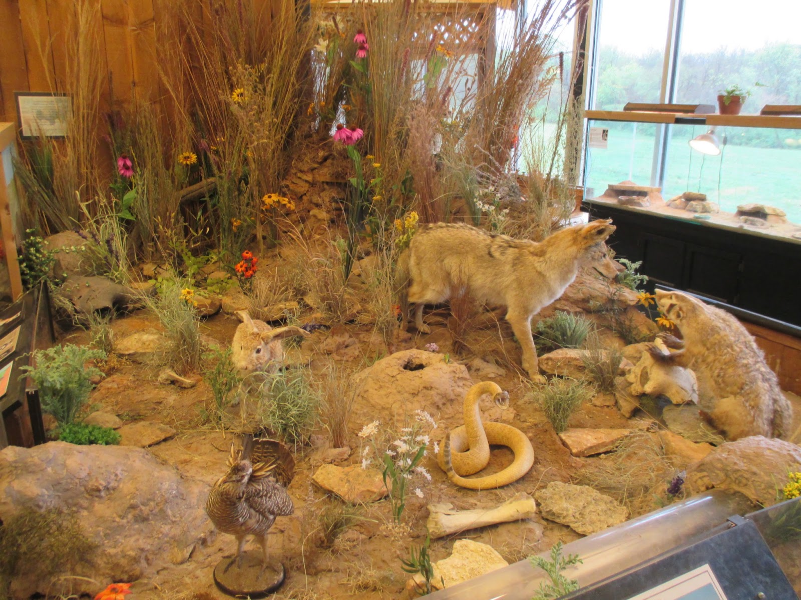
Arrowheads at Mt Magazine State Park Museum
There are three different trails that will lead to the top of Mt Magazine/ Signal Hill.  Most commonly, the hike is completed as a loop hike, going counterclockwise from the trailhead.  We rushed up the trail, noting that spring was several weeks behind the lower elevation trails we had been on earlier in the week.  I thought it was about 2 weeks slower then the lower elevations, approximately one week for every thousand feet of elevation it was over the surrounding hills and valleys.  After 15 minutes of hiking, with the kids hiking the trail under their own power and on their own short legs, we made it to the top.  It's not a hard hike, and it's quite enjoyable.  We'd been at the top for about 3 minutes when a kindergarten class started trooping in, out on a field trip.  We quickly took our pictures, then stepped aside for the 5 year olds to gather into the clearing at the top of Arkansas.  It was fun to see them out having a great time.  Hats off to their teachers for taking them hiking!  We turned around, and hiked back to the car, just a few moments before rain droplets started up again.

Nearest City: Paris, AR
Location: 16878 AR-309, Paris, AR
Time Needed: 30+ min
Difficulty: easy
Kid Friendly: yes
Additional Info: Arkansas State Park Website

Fort Smith National Historic Site

Our next stop on our Arkansas road trip was at Fort Smith National Historic Site.  Fort Smith is located right on the border with Arkansas, which ties directly into why Fort Smith is recognized by the National Park Service.  Back in the 1800's, Oklahoma was known as indian territory.  Fort Smith was established right on the border of indian territory to help keep the peace between the settlers and the indians. 
The historic site does a great job of explaining the relations between keeping the peace in indian territory, and the tensions that arose with issues of jurisdiction, or who legally had the right to try lawbreakers in a court of law.  Indian tribes are recognized by the government as sovereign nations, meaning they have the right to make and enforce their own laws.  The problems arose when lawbreakers tried to use the different borders to their own advantage, and escape the consequences of their actions by crossing a political border between Arkansas and indian territory.  The museum inside has two main focal points of its exhibits: law breakers, and law enforcers.  The building used to be a prison, and courtroom, among countless other uses.  Some exhibits talk about famous prisoners or life in prison, others talk about frontier justice and Judge Parker, the most famous judge at Fort Smith.
West of the main part of the historic site, there's a some trails that tie into  the city of Fort Smith's trails.  One of the trails goes and shows the ruins of the original Fort Smith, located on a small rise at the junction of the Arkansas and Poteau Rivers. 
We also liked the line painted on the path that showed the old boundary between Arkansas and Indian Territory.  The boundary has been slightly amended since 1907, so now Oklahoma is a little further west then the Fort Smith Historic Site, but it's still interesting to see where the border once was. 

Nearest City: Ft Smith, Arkansas
Location: 301 Parker Avenue, Ft Smith, AR
Time Needed: 2+ hours
Difficulty: easy
Kid Friendly: yes
Additional Info: Fort Smith National Historic Site Website

Saturday, June 13, 2015

Prairie Grove Battlefield Arkansas

After our visit to Pea Ridge, we drove south and west to Prairie Grove to visit another Civil War battlefield.  Prairie Grove wasn't as large or as notable of a battle as Pea Ridge, but it was still a large battle and has been preserved as an Arkansas State Park.  Prairie Grove was the last major Civil War battlefield in Northwest Arkansas.  The museum provided a great overview of the battlefield, and is a good place to start your visit.  One of the points I picked up at the museum was the way that the infantry, cavalry, and artillery should support each other in a battle, and that having them coordinated and working together leads to success.  When one of the elements is missing, it exposes a vulnerability that can lead to defeat if the other side exploits it. 
There's a small village of historic buildings at Prairie Grove.  Most of them are closed, but by signing up for a tour, one can go and walk through many of them.  We walked around a few of them as we did our walking tour of the battlefield.   The battle was initiated when the Unions divided their force and extended their lines, creating an opportunity for the Confederates to attach one of the forces and perhaps wipe them out.  The battle was going poorly for the Union until the other force arrived later in the day, crossed a ford, and began to press the Confederates back. 
This sorghum press was used to press the juice out of sorghum, which was then boiled down to create molasses. 
 The walking tour provided a good overview of some of the pivotal points of the battle, along with short experiences of several of the participants of the battle.  The Battle of Prairie Grove was a draw, the Confederates and Unions fought to a standstill, but the Confederates retreated overnight, leaving the Unions victor.

Nearest City: Prairie Grove, AR
Location: 506 E Douglas Street, Prairie Grove, AR
Time Needed: 2-3 hours
Difficulty: easy
Kid Friendly: yes
Additional Info: Prairie Grove State Park Website

Pea Ridge National Military Park

The Elkhorn Tavern
When we planned our trip to Arkansas, high on the list of things to do was visiting Civil War sites.  Most of the Civil War sites in Arkansas are in Northwest Arkansas, including the Pea Ridge Battlefield.  Pea Ridge is the most notable of the Civil War battlefields in Arkansas and is now preserved as part of the National Park Service.  It is was the Union victory at Pea Ridge that preserved Missouri as part of the Union instead of falling under the control of the Confederates. 
Artifacts from the Battle of Pea Ridge
We stopped by on a Monday morning after a few detours and back road diversions.  Don't be stupid like we were- follow the signs to the Pea Ridge Battlefield instead of the those directing you to the town of Pea Ridge.  We arrived eventually!  The visitor center is small but well done.  There are numerous exhibits and artifacts displayed from the battle, and a good explanation of why the battle happened where it did.  Essentially, the battle was fought along the Telegraph Road that lead from St Louis, MO to Ft. Smith, AR.  Control of the road would determine who would be able to control Missouri- the Union or the Confederates. 
There are several walking paths in the park and a scenic drive.  The drive goes by many of the most important skirmishes in the battle.  I recommend doing the drive and stopping at all of the turnouts to read the signs.  We stopped and walked down the path toward the ruins of Leetown, but didn't see much there other then a few foundation holes. 
The highlight from our short hike was the box turtle we saw along the trail.  It was still slightly chilly out, and it had crawled around to find a sunny spot to warm up.  The kids really liked looking at it and seeing the box turtle.  We spoke to a ranger at the visitor center who said that they're the most active before it rains. 
It was a sad and inspiring site to see the cannons lined up in the fields at Pea Ridge.  It's a great spot to visit to get a better understanding of the Civil War west of the Mississippi River.  After Pea Ridge, the fighting in the west was largely over, although there were still a few smaller engagements.  The west was secure for the Union, and the war would be determined by what happened in the east.

Nearest City: Pea Ridge, Arkansas
Location: 15930 E Hwy 62, Garfield, Arkansas
Time Needed: 1/2 day
Difficulty: easy
Kid Friendly:
Additional Info: Pea Ridge National Military Park Website

Friday, June 12, 2015

The Tanyard Creek Nature Trail

The Tanyard Creek Nature Trail wasn't on our list of places to see in Arkansas.  But when we planned the trip, we left a pretty flexible schedule to allow us to squeeze in a few places as we went along.  Tanyard Creek was a place we stumbled on, and since the kids needed a place to stretch, it met our needs.  It was a great stop.  The trail is a loop.  It starts at a parking lot near a golf course, then drops to a small creek and gives the option of turning it into a lollipop loop just over a mile long that goes past a cave and a waterfall.  If you keep an eye out, you can spot a small natural arch in a limestone overhang as well.
Along the nature trail there are several signs identifying plant species and what makes each useful or unique.  There are several bridges over the creek as well.  At the trail junction, we took the trail to the right which leads to the cave.  The cave had a small building built over the top of it, which has since collapsed. The metal panels are bent and crumpled around the cave entrance.  We went to the entrance and felt a cool breeze coming out and could hear water dripping in the back.  A small stream trickled out of the entrance and dumped into the larger creek at a pool with a school of fish gently swimming at the bottom of the current. 
The trail led as along the creek and next to several limestone ledges and overhangs.  One or two of them had small waterfalls coming off of them.  The water had forced its way through cracks in the rock after a dam was built to create Lake Windsor.  I liked the way these ferns found a great place to grow in one of the small cracks. 
After crossing the base of the dam, the trail ascends along a larger creek (Tanyard Creek) to the waterfall outlet from Lake Windsor.  The waterfall is manmade, from the outflow from the lake.  It's a pretty waterfall.  This part of the hike is different then the other half.  It's a lot more of a southern forest, and numerous signs identify trees such as hickory and sassafras.  We enjoyed the waterfall for a while, then turned around and finished the lollipop back to the trailhead.  It's an easy hike and completely enjoyable. 

Nearest City: Bella Vista, AR
Location: Nature Trail Lane, Bella Vista, AR
Time Needed: 1-2 hours, less if you don't have young kids.
Difficulty: easy-moderate
Kid Friendly:yes
Additional Info: Tanyard Creek Trail

Camping at Beaver Lake, Arkansas

On to Arkansas!  True story.  When I was finishing up grad school, my wife and I were discussing about future career opportunities and where we could find work.  The economy wasn't so hot in 2010 and we realized that we may not get our first choice of locations, but a job was better than no job.  During this discussion, she remarked that she was good with just about anywhere- except Arkansas.  Fast forward a few years, and this same woman is now insisting that we must go and visit The Natural State.  We arrived in Arkansas later in the day then we'd intended to, so with the day rapidly fading and no pre-determined campsite, we pulled out our map and rapidly concluded that Beaver Lake was our best shot at camping near Bentonville/Rogers in Northwest Arkansas.  We pulled in to the Corps of Engineers operated campground, then decided splurge.  $20/night is a bit more than the free we usually like to spend when we're camping, but with no other options apparent, we did it. 


The campground overlooks Beaver Lake, an immensely popular recreation lake.  Fortunately for us April was a little bit early in the year for most people, so we had a pretty decent pick of locations.  We picked a site that was away from other campers, and had a great time.  Even though it was late April, we still saw a few fireflies on our evening walks. 

The campground is next to Beaver Lake, but most of the sites are not directly on the water, nor is the water accessible directly from them because of steep hillsides.  We did drive down to the marina and saw that it is huge with tons of boats and parking.  Beaver Lake must be really popular in the summer.  While we were there, I woke up early in the morning to what sounded like a radio playing the Star Spangled Banner.  I was initially pretty displeased, thinking that some other camper was being pretty rude at 6 AM, but as I listened longer, I concluded that it was the opening ceremony for a bass tournament that was going on that weekend.  The campground was pretty nice as far as campgrounds go.  Lots of sites, many with electricity or sewer hookups, and flush toilets in the bathrooms. There even was a shower for those who really like the amenities of home!

Nearest City: Eureka Springs, Arkansas
Location: Beaver Lake, Arkansas
Time Needed: varies
Difficulty: varies
Kid Friendly: varies
Additional Info: Arkansas tourism website

Checking out the Sturgeons at Neosho National Fish Hatchery

The Neosho National Fish Hatchery was a "must visit" location for us.  I love fish, and visiting fish-raising facilities is a side show of that.  When researching for the trip, I found that we could go and see the sturgeon raising facility at the fish hatchery if we called ahead.  We called and basically got told that since we'd be visiting on a Saturday,  the sturgeon center would be closed since they'd be understaffed. 
The main building is beautiful.  It's the oldest operating federal fish hatchery, and is a very picturesque building.  There's administrative offices and a small welcome desk and museum inside.  We had a great time inside, seeing several exhibits and a  few large pallid sturgeons.  The sturgeons reminded me of the visit we had a few years ago to the fish hatcheries near the Bonneville Dam in Oregon, and near Hagerman, Idaho where they raise white sturgeon.  Even though they're a different species, it's still amazing to se a huge prehistoric fish swimming around. 
Outside the door there was a feed bucket full of hatchery food for the rainbow trout in the ponds.  At the Neosho fish hatchery, they raise rainbow trout, pallid sturgeons, freshwater drum, and fat mucket mussels.  The water supply comes from a spring in the side of the hill that comes out of a cave system.  They haven't discovered an entrance to the cave, but a few endangered Ozark cavefish have come out of the spring, so the hatchery protects their habitat as well.  The trout are raised as a sport fish.  The pallid sturgeons are endangered, so they are raised at the hatchery to help sustain their numbers.  The mussels are also endangered, while the freshwater drum are not.  The only reason the drum are raised is because they have a symbiotic relationship with the mussels.   The female mussel will actually lure the drum up close, then spray its eggs into the fish's face.  Some of the eggs attach to the gills of the drum, where they grow for a while then drop off at another location to finish growing.  It doesn't hurt the fish, but it does make it necessary to raise the drum in order to raise the mussels. 
We ended up getting to take a tour of the sturgeon facility.  The biologist who we had talked with earlier in the week was on duty and remembered our calls.  When we visited with him at the information desk, he said that he could take us over to the sturgeon building for a few minutes just at closing time.  SCORE!  I love the things that I get to do sometimes when I ask!  The baby sturgeons were about 8 inches long.  He told us about how they do not keep adult sturgeons, but instead catch/trap them then keep them for a few weeks to collect the eggs, then turn them loose.  The females are more rare than the males are.  The eggs are fertilized, then conditions are monitored and adjusted to make ideal growing conditions for the baby sturgeons.  When they get to be about a foot long they are then released into the Missouri and Mississippi Rivers. 

I definitely enjoyed visiting the Neosho Fish Hatchery.  It's a place that has something for everybody!

Nearest City: Neosho, MO
Location: 520 E. Park St.  Neosho, MO  64850
Time Needed: 1+ hours
Difficulty: easy
Kid Friendly: yes
Additional Info: Neosho National Fish Hatchery Website

Thursday, June 11, 2015

Art in the Park at George Washington Carver National Monument

After our two earlier stops in the Joplin area, we drove south a few miles to George Washington Carver National Monument.  It ended up being the most crowded of any of our stops that day.   It wasn't just another day at GWCNM, it was Art in the Park weekend! There were lots of tents and sunshades set up outside, with 6-8 different activities to participate in that helped in a hands-on way teach about George Washington Carver. Painting, card making, and dying fabric pieces with natural dye were some of the favorite activities.  We enjoyed learning the basics of the different techniques and collecting a few self-made souvenirs in the process. 
Inside there was an extensive museum on George Washington Carver and his contributions to science.  He was a pretty amazing man.  He lived a way that showed that science and religion are not mutually exclusive activities.  He was determined that everyone has the ability to rise above their circumstances if they are willing to put in the work and make the needed sacrifices. 

Nearest City: Diamond, MO
Location: follow the signs east of Diamond to the monument
Time Needed: 1-2 hours
Difficulty: easy
Kid Friendly: yes
Additional Info: George Washington Carver National Monument Website

The Battle of Carthage State Historic Site, Missouri

We made a quick stop at the Battle of Carthage State Historic Site.   It was quick because there's not much there, just a small pavilion with signs and descriptions of the battle.  I was expecting there to be a lot more to see and explore, but ended up being quite underwhelmed.  The battle itself was one of the first battles of the Civil War (fought before the first Battle of Bull Run), and was fought in part on the site.  Like many of the Civil War Battlefields, the entire battlefield stretched over several miles, and is impossible to preserve completely.  The Wikipedia article on the Battle of Carthage does a great job of explaining what happened.
The site is now a large grassy field, with a spring and a stream flowing along one edge of it.  It's a great spot for a picnic.
There was also a cave on the site, but a sign near the parking lot indicated that entry was prohibited. 

Overall, it's worth stopping by if you're in Carthage or if you're a big fan of the Civil War.  Otherwise, it's not worth driving for several miles out of your way to find since it's an anticlimactic place to visit.

Nearest City: Carthage, MO
Location: Chestnut Street, Carthage, MO
Time Needed: 10 minutes
Difficulty: easy
Kid Friendly:
Additional Info: Battle of Carthage SHS Website

Shoal Creek Cave and the Wildcat Glade Nature Center

In April we took a family trip to southern Missouri and Arkansas.  Since we left after work on a Friday, we stopped north of Joplin to camp for the night at one of the Missouri Conservation Areas.  We picked up in the morning and drove in to Joplin.  Our first stop was the Wildcat Glade Nature Center.  We took a short hike along Shoal Creek to Shoal Creek Cave.  The cave is gated, so there is no access to it.  The sign out front said it only goes in about 150 feet or so, and was mined for lead at one point.  It would have been fun to crawl in, but that's how gated caves go sometimes. 
Back at the Nature Center, we looked around at their exhibits and displays.  The aquarium was an enjoyable stop, as were the exhibits on songbirds, frogs, and furbearers.  Wildcat Glade is one of the few remaining flint glades left in the world.  There's only about 60 acres that are actually the flint glade at the nature center, but there's a small pond and several miles of walking trails. 
We enjoyed walking along Shoal Creek.  Southern Missouri is beautiful!  Shoal Creek looks like a great spot to go canoeing, in fact the nature center sponsors a canoeing basics float down the creek, as well as a creek cleanup periodically.  The Wildcat Glade Nature Center is a great stop for kids and families in the Joplin area. 

Nearest City: Joplin, MO
Location: N° W°
Time Needed: 2 hours
Difficulty: easy
Kid Friendly: yes
Additional Info: Wildcat Glade Website

Sunday, June 7, 2015

Prairie Park Nature Center

We visited the Prairie Park Nature Center in Lawrence.  It's a fantastic little nature center.  Kids enjoyed most of the visit, but they had one small and noisy problem- the macaw.  The macaw likes to shriek at visitors and can be quite loud and startling.  A few of the kids started crying after they were startled by the macaw's shrieks.  They got over it quickly though and had a very enjoyable visit. 
I liked this turtle.  When it was younger it got caught in some fishing line or other trash that restricted it around the middle.  It continued to grow, but was unable to do so where it was encircled.  Now the shell is misshapen and looks like a figure 8.  Take care of your trash and throw it away properly!
The caiman on display was a nice bonus!  It looks like a small crocodile.  It was fun to watch him soak up the warmth from the heat lamp.
There were various other displays as well, some showing the different animals that are native to Kansas.  Some had bugs and spiders. 
Outside there are some birds that have been injured and are unable to be released back into the wild, like these two bald eagles.  The Prairie Park Nature Center is a great place to visit, especially on a rainy Saturday!

Nearest City: Lawrence, KS
Location: 2730 Harper St, Lawrence, Kansas
Time Needed: 1+ hours
Difficulty: easy
Kid Friendly: yes
Additional Info: Prairie Park Nature Center Website

University of Kansas Natural History Museum

While we were in Lawrence, we visited the University of Kansas Natural History Museum.  It's a great museum!  There's lots there to see, but of course I thought the hall with the fossils was the best. 
The kids liked all of the fossils too.  We saw lots of fossil fish, bones from prehistoric mammals, and numerous other fossils.
One of the prized exhibits at the museum is Comanche, the only survivor of the Battle of the Little Bighorn.  In the battle, George Custer and his command were wiped out by the Sioux Indians in Montana.  The Indians took the horses or other animals that were still useful, leaving Comanche, who was greatly injured.  Comanche was brought to Ft. Riley, where he peacefully lived out the remainder of his days.  When he died several years later, they skinned him, then mounted his skin to preserve him for the future.  He's now standing in an exhibit just to the right of the main entrance to the museum.
There were lots of other interesting things on display.  This "horned rabbit" was rather interesting.  It doesn't actually have horns, but instead had parasites that infected it, which caused it to grow the masses and tumors. 

We really enjoyed the museum.  We spent most of the afternoon browsing its halls.  There's a small fee/donation asked to visit the museum, but we spent about the same for parking.  Parking is limited, and in fact restricted on the University of Kansas Campus to those with parking passes.  We parked in the parking structure a block or two north of the museum and walked over to it.

Nearest City: Lawrence, Kansas
Location: 1345 Jayhawk Blvd. Lawrence, Kansas
Time Needed: 1/2 day
Difficulty: easy
Kid Friendly: yes
Additional Info: http://naturalhistory.ku.edu/